Physiographic California: Thoughts on California’s Geomorphic and Tectonic Evolution
Throughout California’s coastal provinces we see the geomorphological evidence of landforms shaped by tectonics, volcanism, wind, water, biogenic processes, and coastal forces. More so than any other, tectonics was, is, and will be the dominant designer and architect of California’s landscapes. The geological building blocks of California’s geomorphic provinces and landscapes are among the most varied and spectacular mineral structures and assemblages in the world.
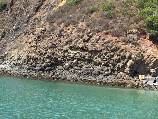
Their mineralogical origins derived from ancient sea floors delivered on a tectonic conveyor belt easterly to collide with and meld and dive under the prehistoric west coast. The geologic components then docking as new landmass, rising up as volcanoes, expelled from or trapped in their igneous chambers, flowing or crumbling back to the ancient seas to be reformed as sedimentary rocks, again delivered to the coastline, and then ground, crumpled, compressed and scraped off to chemically metamorphose in one of at least three prehistoric subduction trenches that formed the border between the massive Farallon and North American tectonic plates.


The early stages of tectonic building and reshaping of California occurred along these prehistoric subduction zones, over a 100 million year period until the Farallon Plate was mostly consumed under the North American plate and into the earth’s mantle. Becoming more boyant as it grew shorter, the millions of years long subduction of the massive Farallon Plate contributed to the formation of the Western North American Cordillera, the seemingly endless rugged landcape of multitudes of mountain ranges, basins, and plateaus running from the Rockies in the east to the Coast Ranges on the west coast, and north to south from Alaska to Central America. The Cordilleran Orogeny continues today, as the remnant wing tips of the ancestral Farallon Plate dive under Mexico and Central America, and under the northwest coast of the United States. These remnants of the once mighty Farallon Plate are the Juan de Fuca, Gorda, Rivera and Cocos tectonic plates.
Once the back end of the Farallon Plate finally reached the North American Plate, the mid ocean ridge spreading center producing the dense basaltic seafloor plate which was dragging behind, collided with the dying subduction trench and the prehistoric West Coast. This convergence marked the eastern border of the newly arrived Pacific Plate, and set in motion a multitudinous chain of events so immense and kinetic that it’s hard to fathom the physical actions and reactions that these three great plates produced over millennia. Due to these collisions, reverberations, and epic tugs a new directional flow was established by the colliding Pacific Plate. At its border, the strike-slip action of the transform San Andreas Fault system was set in motion somewhere around 15-30 million years ago: A tectonic setting that now dominates an approximately 700-800 mile northwestern to southeastern stretch of California, and is still growing.
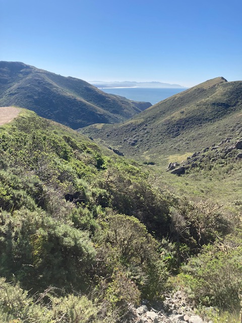
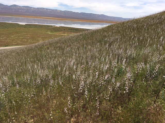
As a result of all this, and a whole lot more, California is actually a young landscape. We have the privilege to live on an active coastal margin, continuously building and reshaping as it grinds along, rises, and collapses in all its glory. Despite California’s distinction as a relaxed, sun drenched locale, our sprawling homeland is inexorably and undeniably rugged and wild. With geomorphological evidence everywhere around us and under us, these structural origins and influences often go unrecognized. As kids, we grew up in one of the most dramatic and dynamic tectonic landscapes in California at the southern tip of the Point Reyes Peninsula, but aside from the occasional uncomfortable earthquake it was unbeknownst to us that the earth beneath our feet held a record of an unimaginable geologic odyssey.

– R. Forest
In time, the ridges that defined our peninsula and separated our rural community from the rest of the bustling San Francisco Bay Area came to be revealed as massive pressure ridges, squeezed and uplifted by a fractured landscape. The smaller picturesque rolling hills that defined local ranchlands and neighborhoods were revealed as a chain of smaller pressure ridges squeezed squarely from the center of the trough of the San Andreas Fault. The idyllic country valley that nestled our school, as well as 150 year old churches, organic farms, and a meandering riparian corridor in time came to be revealed as the immense topographic scar of the mighty San Gregorio Fault, a close neighbor and parallel to the San Andreas and Golden Gate Faults. This tectonic triumvirate merging in a spear point to cut the Bolinas Lagoon and the Olema Valley – a distinct arm of the San Andreas Rift Zone.
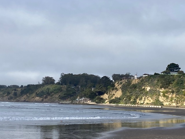
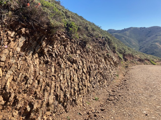
On one side of the main road in and out of town that we rode our bikes and horses along, the geologic unit known as the Merced Formation comprises the landscape, and the hills and mesas rolling out from the other side of the road are formed by the Monterey Formation. Each landscape slice being carried past the other on dueling fault blocks, traversing along their own geologic time frames. The chemistry and sediments and fossils within these two formations hold the secrets to their journeys. Shedding off the cliffs to the marine platforms below, the sediments become beach sands that we played in and brought home between our toes in our sneakers, then pulling bits of fossil sand dollars and clams out of our jean pockets to deposit on deck benches and window sills.
The primary fact that we rarely considered, if ever, was the reality that our entire peninsula was (and is) steadily traveling in a northwesterly trajectory, being carried away from the rest of North America on the Pacific Plate. In fact, my friends who lived downtown, and just across the lagoon on the neighboring sand spit, were not along for the ride, also being left behind on boring old North America, as we headed up the coast on our tectonostratigraphic terrain.
References and Recommended Reading:
Atwater, Tanya M. 1970. “Implications of plate tectonics for the Cenozoic evolution of western North America.” Geological Society of America Bulletin 81: 3513-3536. DOI: 10.1130/0016-7606(1970)81[3513:IOPTFT]2.0.CO;2
Blakey, Ronald, and Wayne Ranney. 2018. Ancient Landscapes of Western North America. Gewerbestrasse: Springer.
Clark, Joseph, and EE Brabb. 1997. Geology of the Point Reyes National Seashore and Vicinity, California. USGS Publications
Grove, Karen, et al. 2010. “Accelerating and spatially-varying crustal uplift and its geomorphic expression, San Andreas Fault zone north of San Francisco, California.” Tectonophysics 495: 256-268. doi:10.1016/j.tecto.2010.09.034
Harden, Deborah. 2004. California Geology. Upper Saddle River: Pearson.
Sloan, Doris. 2006. Geology of the San Francisco Bay Region. Berkeley: University of California Press.
Discover more from Cal Geographic
Subscribe to get the latest posts sent to your email.
