Geomorphology of California’s Seasonal Freshwater Wetlands
For the purpose of this research, and to get a better understanding of this overwhelming and ecologically vital topic, I have grouped California’s seasonal (vernal, ephemeral) freshwater wetlands into four categories, or associations, based on broad geomorphological distinctions, and differing hydrologic characteristics: coastal seasonal freshwater meadows; valley hardpan vernal pools; backdune/interdunal seasonal freshwater wetlands; and sag ponds. One defining factor all seasonal wetlands have in common is the wet-dry cycle of California’s Mediterranean climate, which has produced the extreme seasonality these ephemeral ecosystems have so beautifully adapted to.
In this summary I am analyzing the geomorphology and physical character of each of these four associations. I investigate the biogeography and natural communities of each of these wetland types in the accompanying summary, Biogeography of California’s Seasonal Freshwater Wetlands. Sag ponds are investigated here solely as a geomorphic feature, as they can support the hydrology and natural communities of all three of the other associations depending on the location of the sag pond.

Coastal Seasonal Freshwater Meadows
Geomorphology:
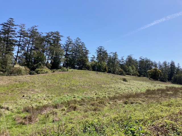
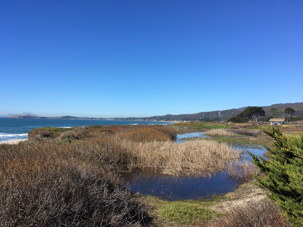
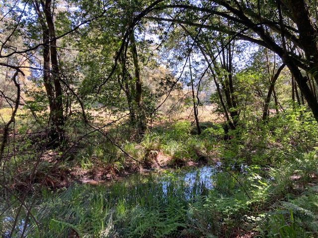
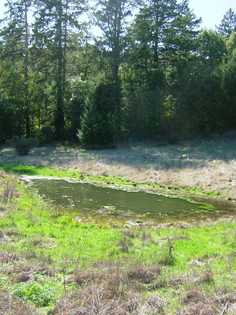
Coastal seasonal freshwater meadows are found along California’s coastline, atop marine terraces, and in the glens, valley bottoms, and meadowscapes of the Coastal Ranges. These deceptive ephemeral wetlands can form in shallow depressions within seasonally moist coastal landscapes, blending in with the surrounding grasslands, prairie, and coastal scrub. The previous season’s herbaceous cover still stands from within the newly flooded wetland, often giving it the appearance of a meadow, and the tell-tale emergent hydrophytic species, such as Juncus, Carex, and Rumex become more robust with inundation.
Some deeper coastal seasonal freshwater wetlands develop soil bottoms due to depth, persistence of inundation, and local climate and geologic factors that affect erosional forces and vegetative cover.
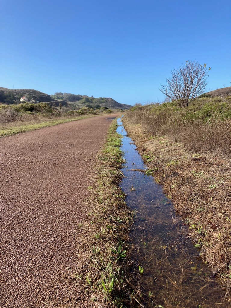
If fragmented and altered, life within a coastal seasonal freshwater meadow can persist for a time, depending on disturbance, pollutants, and water regime – as seen in roadside ditches, and other artificial pools created by drainage projects, road maintenance, and other human disturbances. This persistence is owed to the resilient nature of ephemeral and drought adapted organisms, and to the hidden cyst banks built up in the soil beneath these unrecognized and unprotected wetlands.
Geology:
The landforms and geology of coastal seasonal freshwater meadows has been difficult to research, or to pinpoint clear geomorphic ingredients which might unite these wetlands as a group. The geology of the Coast Ranges, which develops and supports these seasonal wetlands, is the famously complex geologic artifact of an ancestral oceanic subduction zone and accretionary wedge.
Host to coastal seasonal freshwater meadows, marine terraces are uplifted wave cut platforms lining much of the California coast, and most are comprised of Miocene and younger sandstones, mudstones, and marine sedimentary formations such as the Monterey and Purisima Formations. As with the terraces, a large portion of the central and southern Coast Ranges are Miocene sedimentary geologic units, mixed with Mesozoic-aged granitic rock of the Salinian Block. But the majority of the Coast Ranges is composed of the Franciscan Formation, a varied mix of older metamorphic, igneous, and sedimentary rock that originated as oceanic terranes conveyed in by the Farallon Plate to the prehistoric subduction zone, and makes up the coastal portion of the North American Plate in central to northern California.
Soils:
The parent materials of most soils found on marine terraces are the sandstones and mudstones of the Miocene geologic terranes. A soil chronosequence develops on the marine terraces, which can include sandy, course grained, or fine grained marine deposits, along with terrestrial sediments and organic material. The planar geomorphology of marine terraces can inhibit drainage and erosion, thus retaining water levels in the wet months. Marine sedimentary parent materials and sediments overlying a nearly flat slope, combined with poor drainage can result in highly acidic and nutrient poor soils on some terraces.
Flat surfaces and valley bottoms often accumulate greater amounts of eroded parent material and organic matter, which can result in deep, loamy, rich, well-draining soils underlaying the seasonal freshwater wet meadows.
Conversely, coastal seasonal freshwater wetland basins and substrates are also often described to as clayey, or clay-bottomed, as seen in the seasonal wetland monitoring program at UC Santa Barbara’s North Campus Open Space. Parent material may weather to clay-sized particles forming a water-retaining basin layer for some coastal seasonal freshwater meadows and wetlands.
Soils of the Franciscan Complex are as varied as the geology. One striking and infamous geologic unit of the Franciscan Formation, which produces a rare soil type, is serpentinite. The metamorphic serpentinite initially erodes from the forces of water, air, and gravity; and once emplaced as substrate, continues to erode by chemical weathering into a serpentine soil of sandy-gravely consistency.
High in metals and low in nutrients and organic material, serpentine soils host highly specialized, rare, and endemic plant species, which have adapted to these distinct and harsh environments. Serpentine wetlands are similarly unique and beautiful signature California ecosystems. In my field experience I often come across serpentine wetland soils that present as a fine grained clay layer, and appear to be pretty impermeable, contrary to the general understanding of serpentine soils as highly permeable and well-draining. Serpentine geology and habitats will be covered in more depth in later posts on Cal Geographic.

Hydrology:
One defining factor that distinguishes coastal seasonal freshwater meadows and wetlands from the other seasonal wetland types, is their hydrology. Where valley hardpan vernal pools have an impermeable basin, fill by directly accumulating precipitation, and recede mostly by evaporation, coastal seasonal freshwater meadows and wetlands become inundated in wet months quickly when the underlying high water table percolates through and saturates more permeable soils.
Coastal seasonal freshwater meadows are most often adjacent to and associated with swales and high groundwater levels beneath a plain, or at the interface of hill-slopes and uplands which are draining out from the foot of the slope to the adjacent terraces and meadows.
While coastal seasonal freshwater meadows can be exposed to a wetter climate and persist longer than inland vernal pools, these coastal seasonal wetlands are ephemeral nonetheless, receding and drying-out each summer, and have evolved in response to the dry, drought-prone climate of the California coast and Coast Ranges.
As with all seasonal freshwater wetland types, coastal seasonal freshwater meadows have developed a specialized ecosystem of plants, macroinvertebrates, and other animals tolerant of the seasonal extremes, and are highly vulnerable to disturbance and destruction due to human activities.

Valley Hardpan Vernal Pools
Geomorphology:
Valley hardpan vernal pools are defined as ephemeral wetlands with an impervious hardpan or claypan basin, which traps precipitation and is slow-draining. Inundation occurs in the winter months followed by evaporation and desiccation in the late spring through fall. Unique to the Mediterranean climate, these distinctive ephemeral wetland habitats have evolved with and adapted to the extremities and unpredictability of the short-wet, and long-hot-dry seasons of the Central Valley and inland California.
Once dominating the plains, grasslands, and upland rims of the Central Valley, valley hardpan vernal pools can still be found in pockets and small complexes across the state. With the majority still occurring in the Central Valley, hardpan vernal pools also occur in the foothills of the Sierra; valleys of the Transverse and Coast Ranges; southern California coastal mesas; and within the Modoc Plateau.
In the Central Valley, valley hardpan vernal pools form in depressions often atop Pleistocene-aged alluvial fans and riverbank terraces, and within specific soils series. Vernal pools are also found in the shallow hallows of the striking undulating hummock topography of mima mound fields in the Central Valley and California Delta areas. This perplexing mound-and-hallow geomorphological feature is summarized in our Word of the Day post on Mima Mounds.
Another term used to describe a subset of valley hardpan vernal pools geomorphology is potholes, which can refer simply to the depressional landforms described above, or can refer to specific cratered features in rock surfaces which also form seasonal pools by collecting rainwater or snow melt.
Geology and soils:
In the Central Valley, valley hardpan vernal pools are found on alluvial and other geologic formations which range in age from approximately 20,000 years old to 4,000,000 years old. The high terraces and northern Sacramento Valley harbor the oldest vernal pool formations. Vernal pools tend to form on a particular soil series, such as the widespread San Joaquin series.
Through weathering and dissolution, clay particles are washed down through the soils and form a hardpan, or claypan layer below, which acts as an impermeable water retaining basin beneath the pools. In wet months when precipitation inundates the pools and hydrates the clay particles, they expand and form the impermeable subterranean layer. Hardpan refers to the same process, but composed of a more highly cemented and impermeable soil layer.
Hydrology:
The major hydrologic behavior of valley hardpan vernal pools is to become inundated directly from precipitation, and slowly evaporate through the spring and summer until completely desiccated. However, there is some subsurface flow of water between the pools in a valley hardpan vernal pool complex, facilitated by swales, and enhanced in wet years. This allows pools to remain inundated for longer periods than if subjected solely to evaporation.
There is a complex and delicate interplay of shifting components and fluctuating annual cycles of water chemistry and water quality within and between vernal pools. Factors effecting water chemistry, and in turn effecting the flora and fauna of the pools, include temperature; turbidity; mineral content; pH; dissolved substances; nutrients; evaporation; alkalinity; salinity; etc.
Claypan vernal pools on very heavy and saline clay soils lose water mostly through evaporation, and become highly alkaline wetlands knows as playa pools. Playa pools are known for their salt tolerant plant and animal communities.
Backdune/Interdunal Seasonal Freshwater Wetlands
Geomorphology:
Backdune, or interdunal seasonal freshwater wetlands, are found throughout large coastal dune systems from central Oregon to San Luis Obispo/Santa Barbara Counties in the south. Also called coastal dune swales, backdune and interdunal seasonal freshwater wetlands host a unique set of geomorphic and biological components. These wetlands can form in both active and stabilized dune environments.
Well known remnant and protected coastal dune fields in California include Lanphere Dunes of Humboldt Bay National Wildlife Refuge in Humboldt County; the dunes at Fort Ord National Monument and State Park in Monterey County; the Morro Dunes Ecological Reserve in San Luis Obispo County; and Guadalupe-Nipomo Dunes National Wildlife Refuge in San Luis Obispo/Santa Barbara Counties.
Seasonal dune wetlands often form when the base of a dune is close to the groundwater level. Under the forces of wind and gravity, dune movement can scour down to the water table, and/or tap into the flow of surface waters, forming a seasonal dune swales. These wetlands can move over time along with the steady migration of dunes. Dune systems host a plethora of unique and oddly named landforms. A gegenwall is the elongated hummock that forms in front of the migrating wetland. Often a series of these relict solidified sand and mud ridges can be found tracing the historic migration of a dune swale
Backdune seasonal freshwater wetlands can also form atop stabilized dunes, by forming an impermeable clay layer which collects rain water; or can form where the subsurface water table is high and saturates then overflows more permeable soils associated with the stabilized dune. This is seen at Fort Ord National Monument.
Geology and Soils:
Coastal backdune and interdunal seasonal freshwater wetlands are exposed to salt spray from ocean winds and wave emissions, as well as salinity in the sandy soils, encouraging salt tolerant/brackish tolerant plant and animal species to flourish within these unique communities and habitats.
Hydrology:
Dunes and sandy soils are highly permeable, but are usually perched atop/associated with high groundwater levels beneath them. In the wet season groundwater rises to flood the scoured deflation plains within the dune system, and seasonal wetlands form. As the wetlands evaporate and recede, the freshwaters become more brackish as salt concentrates within.
Sag Ponds on San Andreas Fault, R. Forest
Sag Ponds
Geomorphology:
Sag ponds are among the highly visible unique and dramatic tectonic landforms associated with transform fault systems, and are found along the San Andreas rift zone and other transform faults in California. Sag ponds form in depressions that result from transtensional (divergent/pull-apart) forces along an active fault. When strike-slip motion coincides with divergence and extension between the two sides of the fault, transtension occurs and the local landscape and effected geologic materials tend to recede or collapse into the fault trace, forming trenches and basins.
Sag ponds can be as small as a puddle or as large as a lake. Well known complexes of sag ponds along the San Andreas rift zone can be seen in the Carizzo Plain, the Olema Valley, and in urban settings such as in the East Bay (San Francisco Bay Area), and the Los Angeles basin.
Sag ponds can take form as any of the seasonal freshwater wetland alliances proposed in this summary: coastal seasonal freshwater meadows, valley hardpan vernal pools, or backdune/interdunal seasonal freshwater wetlands, if those environments and geomorphologies are present along the rift zones.
Geology and Soils:
Sag ponds can form in any geologic and soil type found along the San Andreas Fault system, and any other transform/strike-slip rift zone.
Hydrology:
The collapse of local landscape and geologic materials, as a result of transtension, can result in ponding of waters either by exposing the water table, or forming an impermeable soil layer that captures and retains rain water. Most small and shallow sag ponds are seasonal/ephemeral freshwater wetlands.

References
Barbour, Michael, T. Keeler-Wolf, and A Schoenherr. 2007. Terrestrial Vegetation of California. Berkeley: University of California Press.
Elam, Diane R., Todd Keeler-Wolf, et al. 1998. State of California Department of Fish and Game California Vernal Pool Assessment Preliminary Report. Natural Diversity Database
Evens, Jules. 2008. “Shifting Sands.” Bay Nature Magazine.
Harden, Deborah. 2004. California Geology. Upper Saddle River: Pearson
Munster, Jennie, and Jennifer W. Harden. 2000. “Physical data of soil profiles formed on late Quaternary marine terraces near Santa Cruz, California
Namm, Ariel. 2014. “Delineating wetlands in serpentinitic soils.” Thesis California Polytechnic State University.
NatureServe. International Terrestrial Ecological System: Mediterranean California Coastal Interdunal Wetland. Element Code: CES206.951. https://explorer.natureserve.org/Taxon/ELEMENT_GLOBAL.2.722730/Mediterranean_California_Coastal_Interdunal_Wetland
Peterson, Michael G. , Kevin B. Lunde, et al. 2017. “Seasonal progression of aquatic organisms in a temporary wetland in northern California.” Western North American Naturalist 77(2): 176–188
Reed, L.K., M. Hatch, et al. 2011. “Reference site characterization and restoration goals for northern coastal scrub and seasonal freshwater wetlands at Younger Lagoon Reserve, Santa Cruz, California.” Report for the California Coastal Commission
San Francisco Bay Hydrologic Region. 2014. “California’s Groundwater: Half Moon Bay Terrace Groundwater Basin Bulletin 118.”
Stoffer, Phillip W., 2005. “The San Andreas Fault in the San Francisco Bay Area, California.”
U.S. Geological Survey Open-File Report 2005-1127
US Fish and Wildlife Service, Department of the Interior. 2003. “Endangered and Threatened Wildlife and Plants; Final Designation of Critical Habitat for Four Vernal Pool Crustaceans and Eleven Vernal Pool Plants in California and Southern Oregon.” Federal Register Rules and Regulations Vol. 68, No. 151: 46684-46866
Widrig, Genevieve M., K.W. Johnson, A. E. Tornincasa. 2010. “A study of soil development on marine and stream terraces of Swanton Pacific Ranch, Davenport, CA.” California Polytechnic State University San Luis Obispo
Witham, Carol and Kate Mawdsley, editors. 2012. Jepson Prairie Preserve Handbook, 3rd Edition. Fairfield: Solano Land Trust.
Discover more from Cal Geographic
Subscribe to get the latest posts sent to your email.
