Tectonic Geomorphology
Southern California’s Transverse Ranges are composed of a series of geologic units of divergent age and origin. Together they are captured and transported to the northwest in an east-west trending rotation by the oblique grind, pull, and squeeze of the fractured and tempestuous boundary between the North American and Pacific Plates.
The Transverse Ranges embody California’s quintessentially convoluted geologic environment. From the plutonic and metamorphic lithologies of the Mesozoic era subduction complex in the eastern range, to more recent Miocene through Pleistocene-aged sedimentary units exhumed as the continental margin shifted from subduction to the transverse mechanics of the San Andreas system, in the western range.
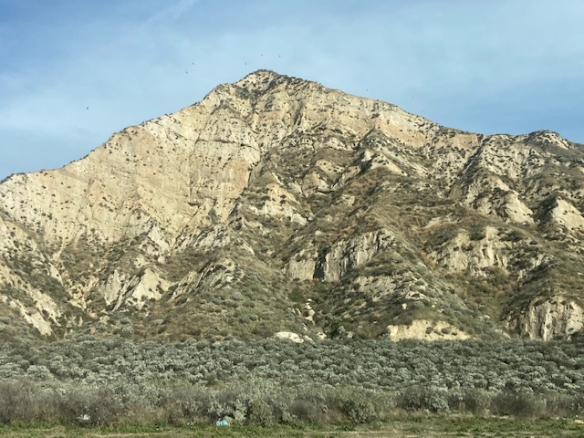
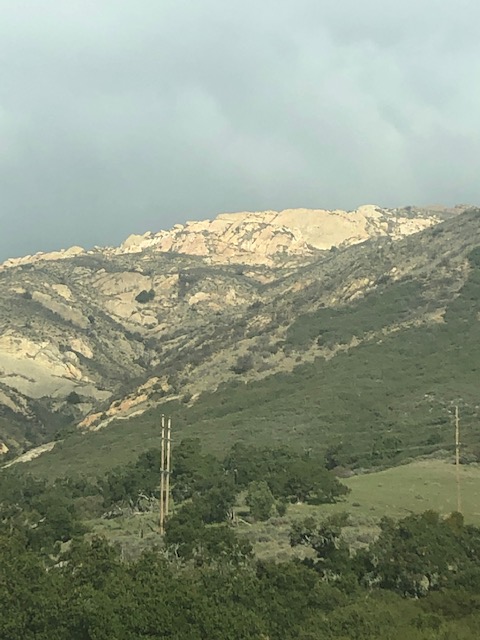
The transpressional squeeze of the San Andreas Fault system is conveying the Transverse Ranges at odds to the dominant northwestward migrations of California’s Coast Ranges, along a massive “Big Bend” in the fault, which slices through several of Southern California’s counties from east to west. This squeeze is also causing intense north-south crustal shortening and uplift of the Transverse Ranges along this highly active fold and thrust belt. In the Western Transverse Ranges this tectonic environment is propagating the fastest uplift rates in North America.
The Transverse Ranges are often grouped into three geographical regions by researchers: the Eastern (the San Gabriel, San Bernardino, and San Jacinto Mountains), the Central (the Central Transverse Ranges and the Sierra Pelona), and the Western (the Northwestern Transverse Ranges and the Santa Ynez Mountains).
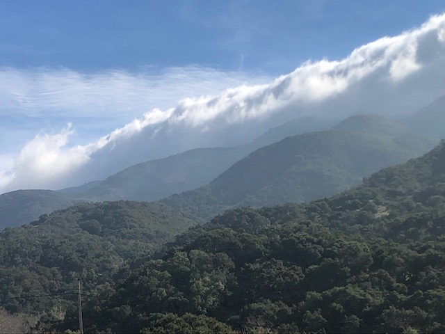
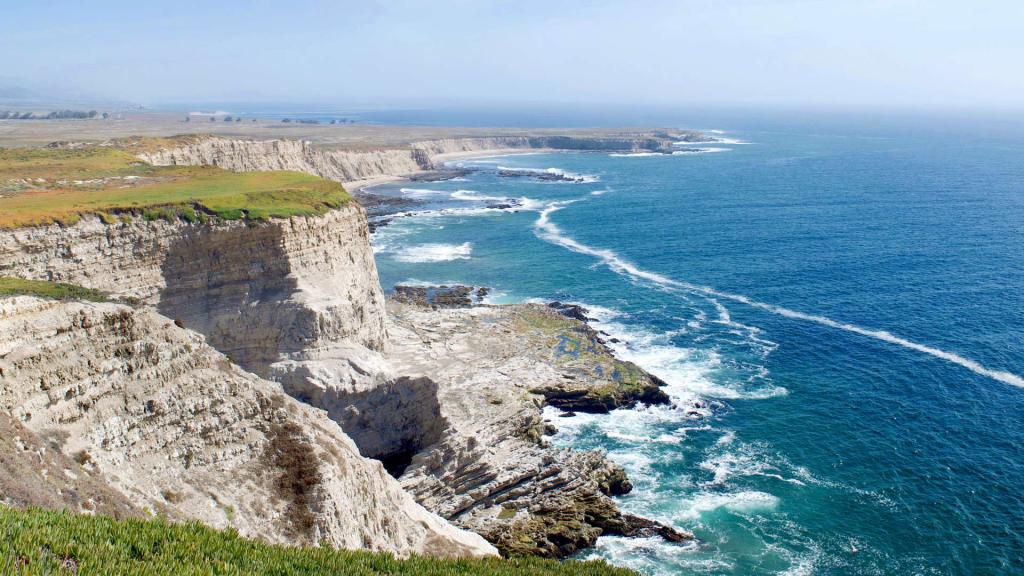
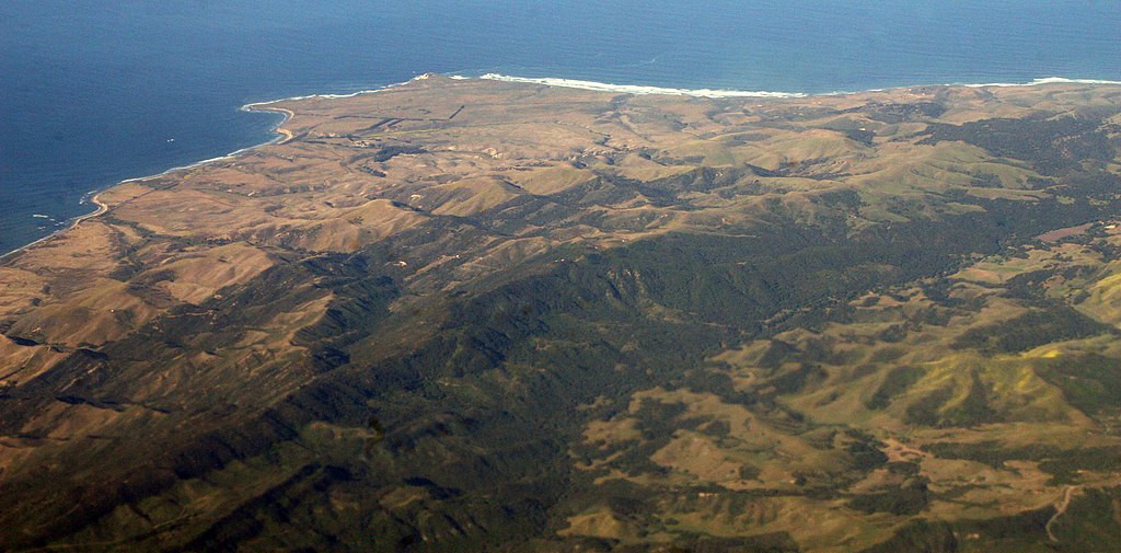
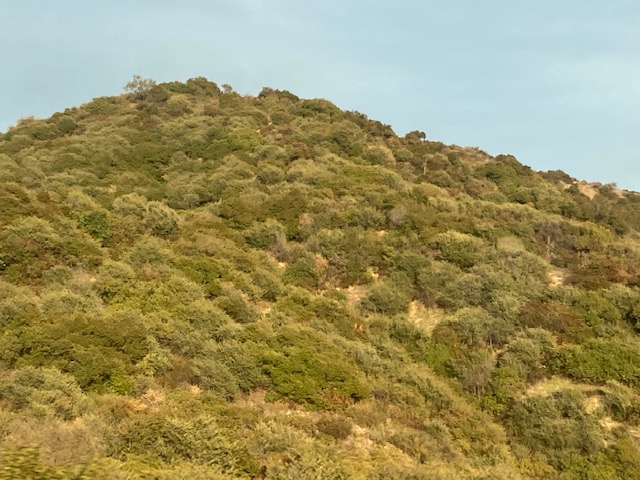
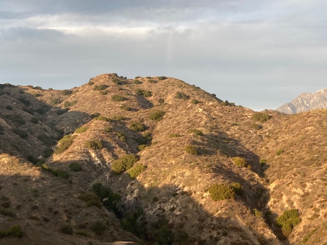
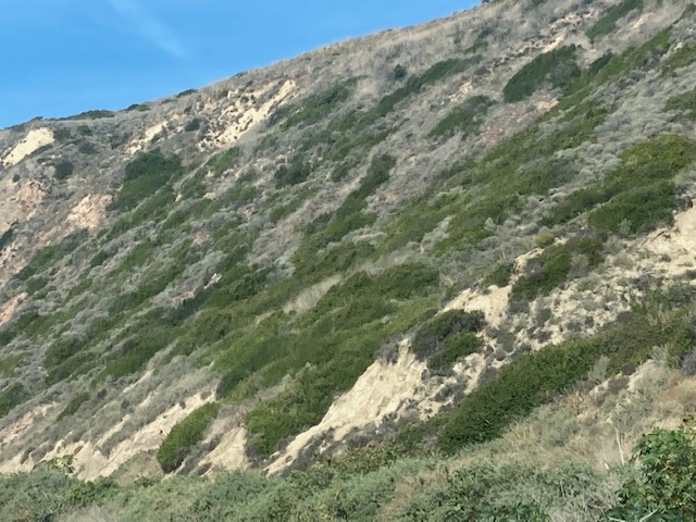
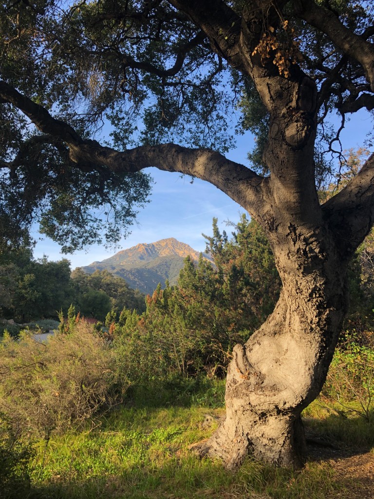
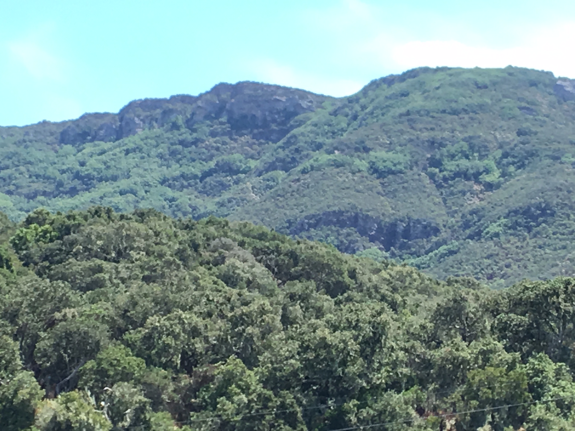
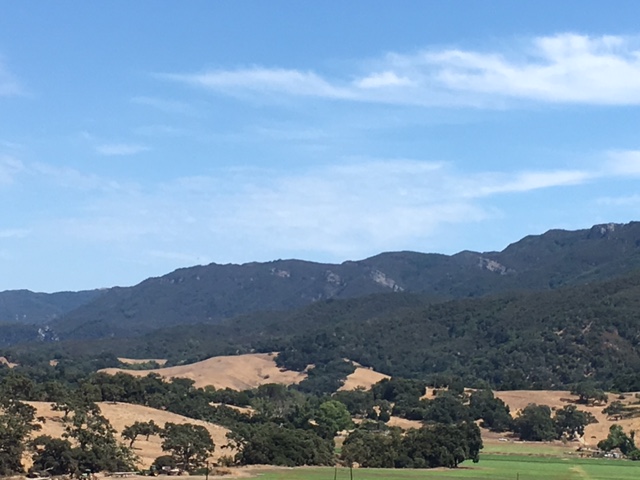
The Western Transverse Ranges geomorphic region holds several prominent tectonic landscape features. These include the spectacularly angular stair-stepped coastline from Point Sal to Point Conception (we will call the Santa Barbara Cape), which is formed by several east-west trending faults and the subsidence basins between them; a chain of uplifting tectonic marine terraces fringing the west and south coasts of the Santa Barbara Cape; the sharp linear rise of the Santa Ynez Mountains squeezed between two thrust faults; and the tectonic Santa Ynez River Valley and fault line defining the northern flank of the Santa Ynez Mountains.
Tectonic Terraces
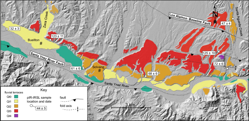
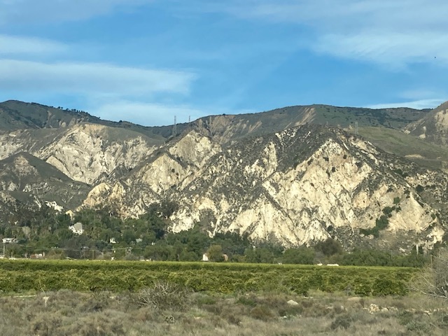
The geomorphic expression of the active tectonics of the Santa Ynez River Valley and its associated faults is seen in a series of uplifted fluvial strath terraces that follow the length of the valley where the river encounters the fault. By mapping, measuring, and dating the terrace profiles along the fault, researchers have been able to infer the prehistoric time frames of episodic tectonic uplift in the region, as well as what local and deeper/regional mechanisms drive contractional uplift and topographic development of the surrounding mountains and structures.
Subsidence
Where there is crustal shortening, contraction, and uplift there is also extension and subsidence. Similar to the topographic expression of the Basin and Range geomorphic province, the shifting and rotating transpressional tectonics of the Transverse Ranges region has also produced a series of fault-bound ridges interspersed with extensional basins between them, collectively referred to as the California Continental Borderland.
As the transverse San Andreas Fault system developed, these shallow marine extensional basins became emergent depositional environments of the Miocene-aged Monterey Formation and other sedimentary formations now composing prominent geologic blocks and terranes along the California coast from San Diego to Point Arena.
The Santa Maria Basin is a major area of subsidence within the Western Transverse Ranges and encompasses multiple tectonic faults and drainages including the Santa Ynez River. The Ventura Basin is another prominent Miocene extensional basin of the Western Transverse Ranges, and is the contiguous with the Santa Barbara Channel extensional basin. A large portion of the California Continental Borderland lies offshore, including the basins of the Santa Barbara channel, and the emergent ranges of the Channel Islands.
Phylogeography
Numerous phylogeographic studies have explored the theory that the Transverse Ranges provide a geographic barrier to the evolutionary tracts of species lineage. While there is no conclusive evidence for a broad north-south phylogeographic divide in California based on the Transverse Ranges, there is evidence for evolutionary divergence within the Transverse Ranges based on the three geographic regions: the Eastern, Central, and Western Transverse Ranges.
Pliocene epoch coastal basins and embayments extending northward from the Ventura Basin (within the region of the present day Santa Clara River Valley) are proposed to be a historic physical barrier that contributed to a phylogeographic break between the eastern and western Transverse Ranges, approximately two to five million years ago.
Burton Mesa
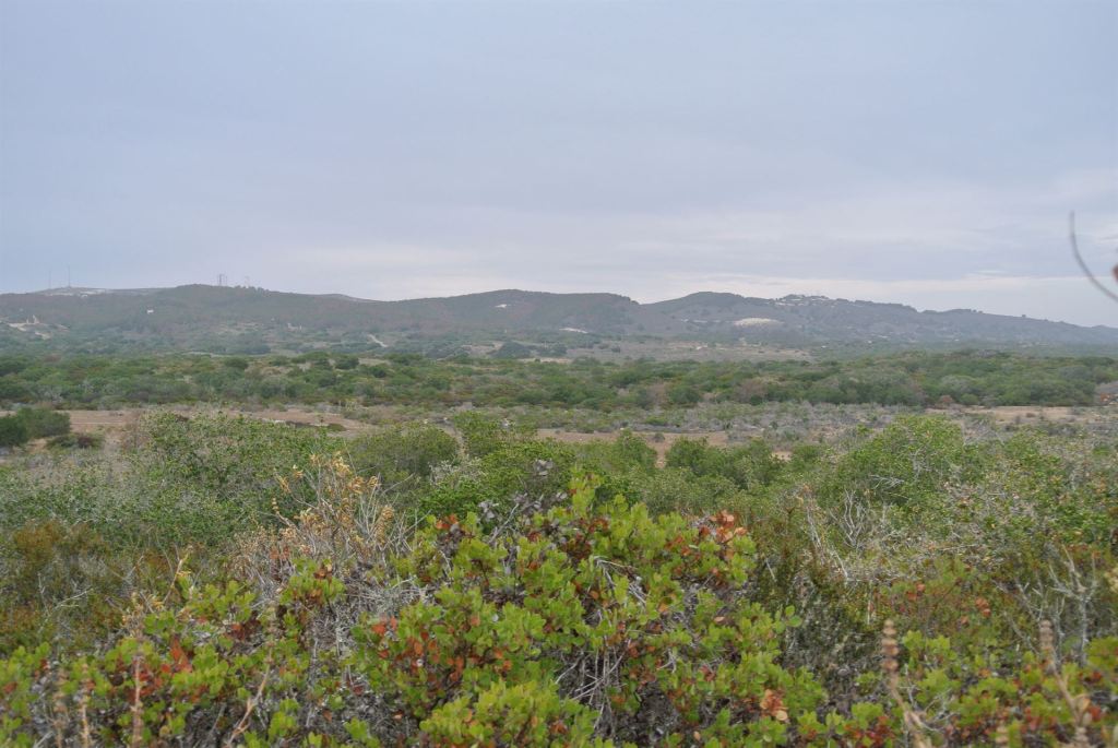
The Burton Mesa is a portion of a fractured series of marine terraces found within the western Santa Maria Basin of the Western Transverse Ranges. Once encompassed by, and to some degree preserved by the 85 year old, very large Vandenberg military installation, the Burton Mesa is a known biogeographic hot spot, sheltering extremely rare and locally endemic species.
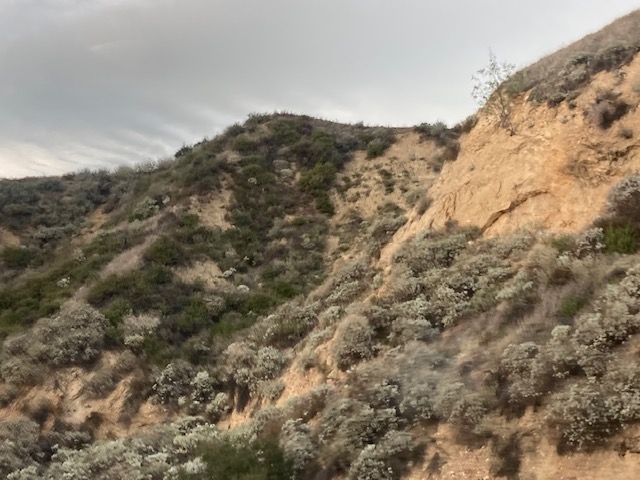
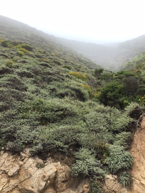
The Burton Mesa Chaparral is a unique remnant of California’s rare and dwindling Maritime chaparral communities – an alliance of varied species composition scattered in tiny pockets up and down the coast on coarse grained thin soils, and adapted to the summer moisture availability of the marine fog belt.
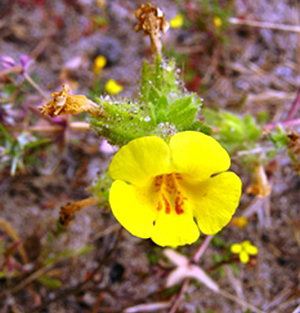
Rare and endemic plants found within the Burton Mesa Chaparral include the Vandenberg monkeyflower (Diplacus vandenbergensis), Purisima manzanita (Arctostaphylos purissima), Sand Mesa manzanita (Arctostaphylos rudis), Lompoc ceanothus (Ceanothus cuneatus var. fascicularis), and Lompoc Yerba Santa (Eriodictyon capitatum).
Since 1991 the Burton Mesa Ecological Reserve has been owned and administered by the State of California, and was designated as an ecological reserve by the State Fish and Game Commission in 2004, expanding protection for the Mesa’s rare and endangered species.
Dune Sheet Geomorphology
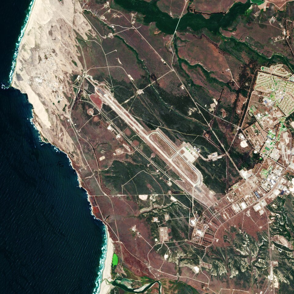
Vast dune systems lay adjacent to and intermingle with the maritime chaparral of Burton Mesa. The Vandenberg and Santa Maria Dune Sheets are some of the largest intact coastal dune fields in the state, and continue eolian sand transport and landward dune migration inland from the coast of the Vandenberg military installation.
Recent studies of these large dune sheets within the tectonically and topographically complex setting of the western Santa Maria Basin reveal the morphological evolution and advance of the dune systems in relation to tectonic uplift and subsidence, historic shoreline orientation, historic wave behavior patterns, coastal sediment supply, and longshore sand transport. Understanding the evolutionary dynamics of dune systems helps to model and predict the morphodynamics of dune evolution into the future.
Dangermond Preserve
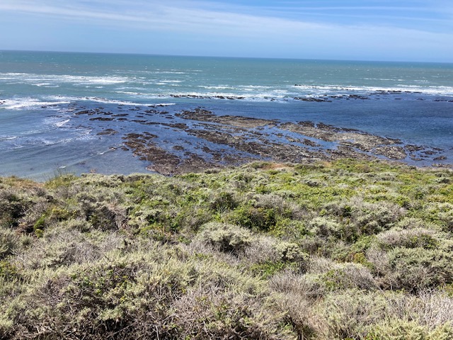
Southwest of the Burton Mesa and adjoining the southeastern boundary of the 100,000 acre Vandenberg military installation, the sprawling Jack and Laura Dangermond Preserve envelopes a significant undeveloped area of California’s south-central coast. Spanning the southwestern flanks of the Santa Ynez Mountains, westernmost marine terraces of the remote Gaviota Coast, and embracing Point Conception itself, this 24,000 acre former ranchland is a remarkable oasis of California’s remaining coastal open space within the Western Transverse Ranges.
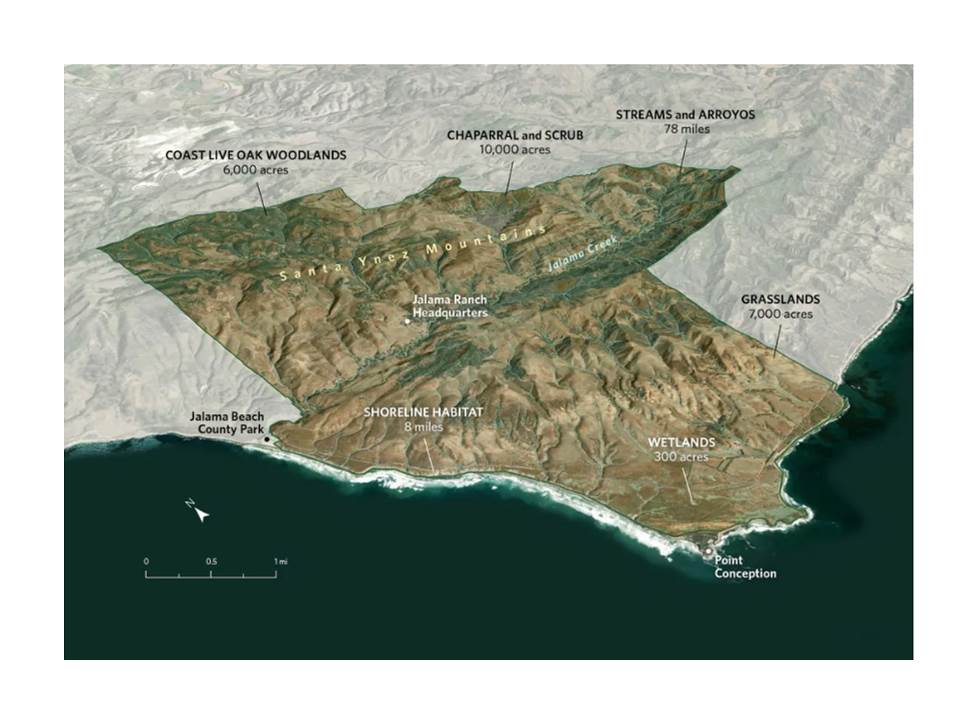
Acquired in 2017 by the Nature Conservancy with a private donation for the purchase, the Dangermond Preserve includes oak woodlands, maritime chaparral, coastal sage scrub, riparian areas, rare seasonal marine terrace wetlands, Bishop pine and Monterey cypress stands, dune system habitats, and coastal prairie ecosystems within the western most tip of the Transverse Ranges. The coastal reaches of the Dangermond Preserve are contiguous with the Point Conception Marine Reserve, extending the conserved areas, zones of ecosystem connectivity, and invaluable wildlife corridors even further.
Field research and surveys are ongoing at the Dangermond Preserve including wildlife monitoring, habitat suitability surveys for species of concern, wetland studies, habitat restoration projects, and vegetation monitoring.
Biogeographies
The Western Transverse Ranges are one of the richest physical and biogeographic regions in California. Standing at the crossroads of geomorphic provinces, physiographic divides, marine and montane environments, colliding oceanic currents, and tectonic regimes, the Western Transverse Ranges feature an abundant mosaic of ecosystems and habitat types. Oak woodlands, maritime chaparral, coastal sage scrub, coastal prairie, riparian corridors, dune system habitats, estuarine environments, and seasonal freshwater wetlands and vernal pools are amongst them.
Coastal Sage Scrub
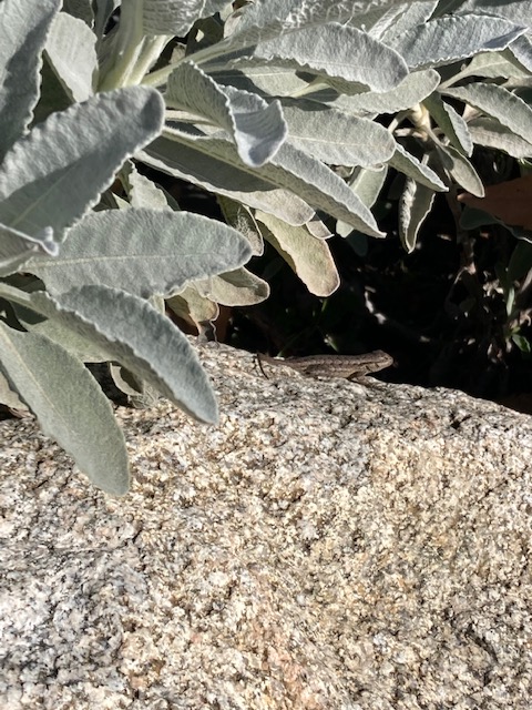
Alliances of the Venturan/Central coastal sage scrub community are found throughout the south facing slopes and valley rims of the Western Transverse Ranges. This fragile and rich scrubland, emblematic of California’s south coast, is dwindling amid the immense pressures and squeeze of coastal development in California. Artemisia californica, Salvia mellifera, and Salvia apiana are the dominant woody keystone species and ecosystem builders of these summer drought adapted scrublands in Southern California. These unassuming woody sage species engineer environments teeming with rare and endemic invertebrates, pollinators, amphibians, reptiles, birds and mammals.
Dominated by flowering woody and drought deciduous shrubs, with species that are both spring and fall bloomers, a highly diverse insect and pollinator population relies on healthy, mature coastal sage scrublands to survive. These insect species and the broad arthropod communities adapted to this ecosystem serve as the nutrient cyclers, pollinators, decomposers, and assistant primary producers of the coastal sage scrublands.
California’s coastal sage scrub mosaic is rapidly disappearing due to coastal development and agriculture, with less than 8% of its original range remaining. While this narrow band of scrub alliances, stretching from Marin County down into Baja, Mexico, had initiated scientific study and conservation focus sporadically from about the 1970’s through the early 2000’s, the status of its declining plant and animal communities as well as conservation trends have been woefully understudied or followed up on, and largely ignored in the past twenty years.
One study of Diegan/Southern coastal sage scrub at one location in the 1990’s inventoried 50 shrub species, over 500 herbaceous understory plants (noting 50% of which are considered rare), and numerous special-status fauna including California gnatcatcher (Polioptila californica californica), Coastal cactus wren (Campylorhynchus brunneicapillus sandiegensis), Orange-throated whiptail lizard (Cnemidophorus hyperythrus beldingi), Coast horned lizard (Phrynosoma coronatus), and Quino checkerspot butterfly (Euphydryas editha quino). This is only a small portion of the known and unknown species adapted to California’s coastal sage scrub alliances.
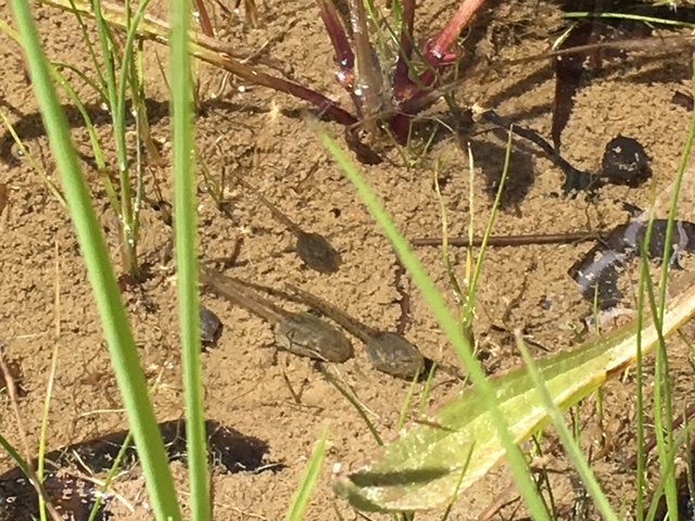
Vernal pools
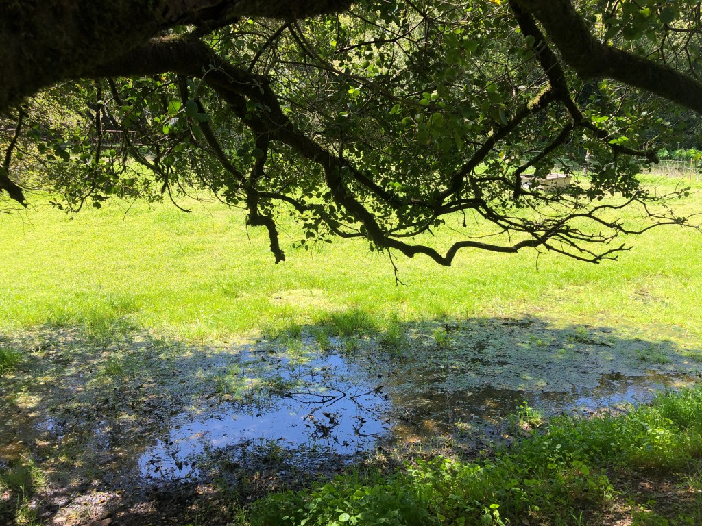
Seasonal freshwater wetlands are ephemeral and rare aquatic ecosystems found throughout the Western Transverse Ranges and Santa Barbara County. Popularly known as vernal pools, these temporary wetlands are replenished and activated by winter precipitation, have an abbreviated submerged period from the start of the fall/winter rainy season through late winter or early spring, and support a condensed growing and breeding season for the emergent plants and animals that are adapted to these intermittent ecosystems.
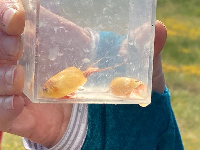
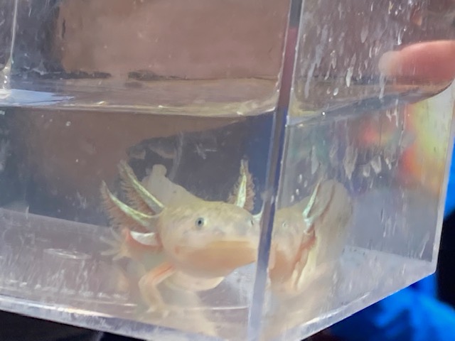
California’s dynamic vernal pool complexes of the Central Valley and select other sites have gained public attention and conservation concern over the decades owing to concerted outreach regarding the importance of these dynamic and disappearing wetlands, which support charismatic endangered species such as Fairy shrimp (Branchinecta spp.), California tiger salamander (Ambystoma californiense), and dozens of colorful rare and endemic vernal pool-specialist flowering plant species.
Read our investigations of the biogeography and geomorphology of California’s seasonal freshwater wetlands
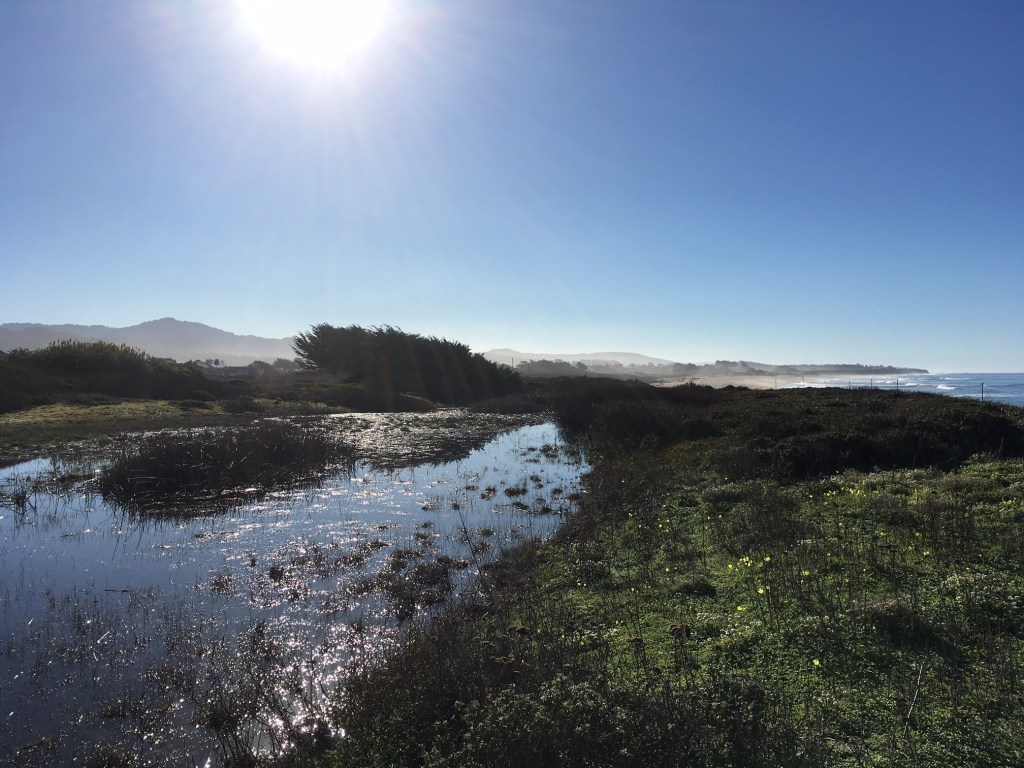
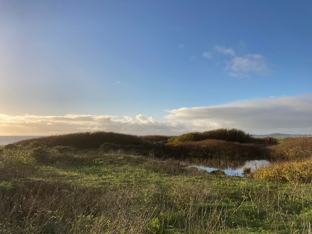
In contrast to the vernal pools of the Central Valley, the seasonal freshwater wetlands along the coast of California have gained little to no scientific study, public attention, or conservation protections. Once found dominating California’s coastal springtime landscape and transforming marine terraces into submerged aquatic landscapes during the rainy season, these wetlands have largely been destroyed by coastal development and agricultural practices. Coastal seasonal freshwater wetlands are inconspicuous but thriving hydrologic ecosystems, and can appear only as puddles, mushy wet meadows, trickling depressional swales, or small pools and ponds on the landscape.
While vegetation surveys within seasonal wetland complexes on California’s coastal public lands and private reserves have frequently been undertaken to identify hydrophytic plant species and communities, no comprehensive surveys, studies, or conservation actions have been undertaken to understand and protect the aquatic invertebrate and arthropod populations of California’s coastal seasonal wetlands. The dire importance of inventories and protections for these little-known invertebrate species and faunal communities of trophic supporters and ecosystem builders cannot be overstated.
As published in the US Fish and Wildlife Service’s 2024 Five Year Review of Vernal Pool Fairy Shrimp habitat, between the years 1994 and 2000, 4,931 acres of vernal pool habitat had been lost in the Santa Barbara Vernal Pool Region alone. And between the year 2000-2001, 15 out of the remaining 27 delineated vernal pool polygons had been destroyed and “converted to other uses,” – a loss of more than half of the wetlands in one year in the Western Transverse Ranges. That was surveyed 25 years ago.
There are some areas of survey and protection of seasonal wetland landscapes within the Western Transverse Ranges, including at the Jack and Laura Dangermond Preserve, Burton Mesa, Vandenberg military installation, Del Sol Vernal Pool Preserve, and North Campus Open Space at UC Santa Barbara – both on the marine terraces of Isla Vista.
At Burton Mesa the two main vernal pool complexes had documented occurrences of Fairy shrimp in 2007, and the understudied vernal pools on Vandenberg military installation have been estimated to cover anywhere from 10-114 acres in total. On the marine terraces of Isla Vista at the southern slope of the Santa Ynez Mountains, there have been concerted restoration efforts and monitoring plans for seasonal wetland sites on the North Campus Open Space Preserve of UC Santa Barbara, as well as the adjacent Del Sol Vernal Pool Preserve, managed by the Isla Vista Recreation and Parks District.
At the Dangermond Preserve seasonal wetlands dotting the expansive Cojo (marine) Terrace at Point Conception have been surveyed and classified in 2012 and again in 2025, which is a huge step in the positive direction for coastal seasonal wetland identification and recognition of their hydrologic and ecosystem function, and ultimately for their wider protections. The wetland surveys at Dangermond Preserve mapped and classified the delineated wetlands on the terrace topographically as flat wetlands, depression wetlands, swales, and spring fed swales. Vegetation surveys, habitat quality assessments, soil surveys, and Branchiopod surveys were also conducted in this delineation process. Continued monitoring and invasive species removal has occurred at these sites on the Dangermond Preserve.
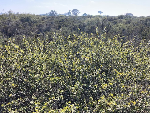
Oak Woodlands
Interspersed amongst the mosaic of chaparral and coastal sage scrub alliances, oak woodlands elegantly drape both the north and south slopes of the Santa Ynez Mountains, defining the Mediterranean climatic character of Santa Barbara and of the Western Transverse Ranges. The Quercus of these Central and Southern coastal oak woodland types are the keystone species of their ecosystems.
One individual oak can supply food, shelter, moisture, soil health, primary production, carbon sequestration, oxygen, trophic exchange and habitat connectivity to hundreds, if not thousands of other species that depend on it, including epiphytic plants, microbes, lichens, fungus, invertebrates, birds, reptiles, amphibians, and mammals.
Southern and Central coastal oak woodlands are highly variable in species composition and structure, depending on the local slope aspect, moisture availability, soil chemistry, etc. These woodlands can form closed canopies and dense forests abundant with lush understory vegetation, or host an open and airy understory of deep leaf litter. Coastal oak woodlands with a sparse canopy cover may have a mixed understory of grasses, forbs, and scattered woody shrubs blended in from adjoining habitats and alliances of the neighboring ecosystem mosaic.
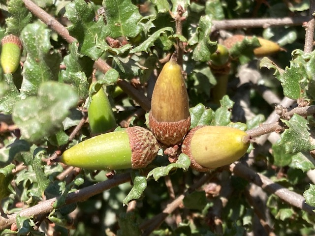
Coast live oak (Quercus agrifolia) is the dominant oak species in the southern and central coastal oak woodlands of the Western Transverse Ranges. Many of California’s other oak species are found here as well, Quercus berberidifolia, chrysolepis, douglasii, dumosa, durata, john-tuckeri, kelogii, lobata, palmeri, parvula, and wislizeni. Other tree species integral to oak woodland assemblages in the Western Transvers Ranges include, California bay (Umbellularia californica), Madrone (Arbutus menzeisii), Tan oak (Notholithocarpus densiflorus), Buckeye (Aesculus californica), California Walnut (Juglans californica), and Big leaf maple (Acer macrophyllum).
The Western Transverse Ranges are home to oak rarities, including Quercus dumosa sensu stricto. The type specimen was collected in the Western Transverse Ranges in the “hills near Santa Barbara,” in 1840 by the early and well known botanist, Thomas Nuttall, traveling aboard a merchant ship with Richard Henry Dana during the voyages of Two Years Before the Mast. Quercus dumosa sensu stricto is one of the most-rare species of oak in California, and is found scattered along the coast from the southwestern Transverse Ranges and down into northern Baja.
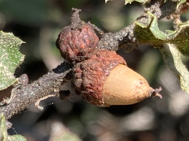
Quercus durata durata is an endemic, and the only serpentine obligate oak species in California. It is found in the Western Transverse Ranges of Santa Barbara County, and northward from there. Quercus parvula parvula is a shrubby form of the Santa Cruz Island oak, and is only found on Santa Cruz Island and in small population pockets in Santa Barbara County within the Western Transverse Ranges.
*If you are going to reference this article or our work, please properly cite this article and website, and give full credit of our authorship and research – See our Copyright and Trademark Statement here *
All photos by Rowena Forest for Cal Geographic unless otherwise noted
References
Alonso, G., et al. 2016. “Plant community patterns in California oak woodlands.” Agro Sur 44(2): 25-34
Barbour, et al.2007. “Classification, ecological characterization, and presence of listed plant taxa of vernal pool associations in California.” US Fish and Wildlife Service and University of California Davis Study NO. 814205G238
Barrineau, P., et al. 2022. “Geomorphology and dynamics of a coastal transgressive dune system, central California.” Physical Geography 43(1): 122–144.
Bartolomeo, E., et al. 2010. “Tectonic history of the Transverse Ranges: Rotation and deformation on the plate boundary.” UC Davis
Burger, J.C. et al. 2003. “Restoring Arthropod Communities in Coastal Sage Scrub.” Conservation Biology 17(2): 460–467
Chatzimanolis, S., et al. 2007. “Toward a better understanding of the Transverse Range Break lineage diversification in Southern California.” Evolution 61(9): 2127–2141
Dartnell, S., et al. 2022. “Flower-Visiting Insect Assemblages on Fall-Blooming Native California Sage Scrub Shrubs.” Diversity 14(11): 958
Desimone, S.A. et al. 1992. “Local variation in floristics and distributional factors in Californian coastal sage scrub.” Madroño 39(3): 170–88
Forest, R. 2023. “Biogeography of California’s Seasonal Freshwater Wetlands.” Cal Geographic.com
Forest, R. 2023 “Geomorphology of California’s Seasonal Freshwater Wetlands.” Cal Geographic.com
Forest, R. 2024. “The Chaparral Mosaic in California.” Cal Geographic.com
Forest, R. 2024 “The Coastal Scrub Mosaic in California.” Cal Geographic.com
Holland, V., Updated by: CWHR Staff 2005.”California Wildlife Habitat Relationships System
California Department of Fish and Game Coastal Oak Woodland.”
Kelty, C., et al., 2022. “Episodic deformation and topographic development along the Santa Ynez River fault: A blind thrust in the western Transverse Ranges of California.” Tectonics 41
King, B. 2025. “Burton Mesa Chaparral.” Flora
Nixon, et al. 2002. “The Oak (Quercus) Biodiversity of California and Adjacent Regions.” USDA Forest Service General Technical Report PSW-GTR-184.
Onderdonk, N., et al. 2022. “Topographic develop‑ment of a compressional mountain range, the western Transverse Ranges of California, USA, resulted from localized uplift along individual structures and regional uplift from deeper shortening.” Geosphere 18(6): 1804-1830
Paterson, L.E., 1996. “Wetlands Inventory of Vandenberg Air Force Base.” Thesis, California Polytechnic University, San Luis Obispo.
Peterson, C. 2017. “Origins of The Santa Maria And Vandenberg Coastal Dune Sheets (~100-0 ka) Under Changing Sea Levels, Shoreline Orientations and Wave Directions: Long-Term Records of Coastal Sand Supply in South-Central California, USA.” Journal of Geography and Geology 9(4): 33-68
Schierenbeck, Kristina. 2014. Phylogeography of California: An Introduction. Berkeley: University of California Press.
Spencer, H.C. 2025. “Evaluating the relative influence of rock strength and uplift rate on the geomorphic expression of a mountain belt: Case study from the Western Transverse Ranges of California – a thesis.” California State University, Long Beach
Wilhelm-Safian, C. et al. 2025. “ Cojo West Terrace Wetland Assessment.” UC Santa Barbara Report
California Department of Fish and Game Burton Mesa Ecological Reserve Land Management Plan 8.1-4 Final EIR – Initial Study 2004
US Fish and Wildlife Service Vernal Pool Shrimp Five Year Review 2024
US Fish and Wildlife Service Endangered and Threatened Wildlife and Plants; Endangered Status for Vandenberg Monkeyflower. 2013. Federal Register/ Vol. 78, No. 209
Further reading
You Can Have It All With a Living Oak Fuel Break – Santa Barbara Botanical Garden
Can Oak Trees Provide a Natural Fuel Break – Santa Barbara Botanical Garden
Threats to Chaparral – California Chaparral Institute
Fire and Chaparral – California Chaparral Institute
Discover more from Cal Geographic
Subscribe to get the latest posts sent to your email.
