Graben:
A depressed segment of the Earth’s crust bounded on at least two sides by faults
Long, narrow trough bounded by one or more parallel normal faults. Down-dropped fault blocks are caused by tensional crustal forces
A block of land bounded by parallel faults in-which the block has been downthrown, producing a distinctive structural valley with a straight, steep-sided fault scarp on either side
Elongate, low-lying surficial structure characterized by a central downthrown block along its axis and uplifted shoulders. Forms by crustal extension. Synonym: rift/rift valley
(Definition references are listed at the bottom of the Geomorphology Word of the Day home page)
Where in California:
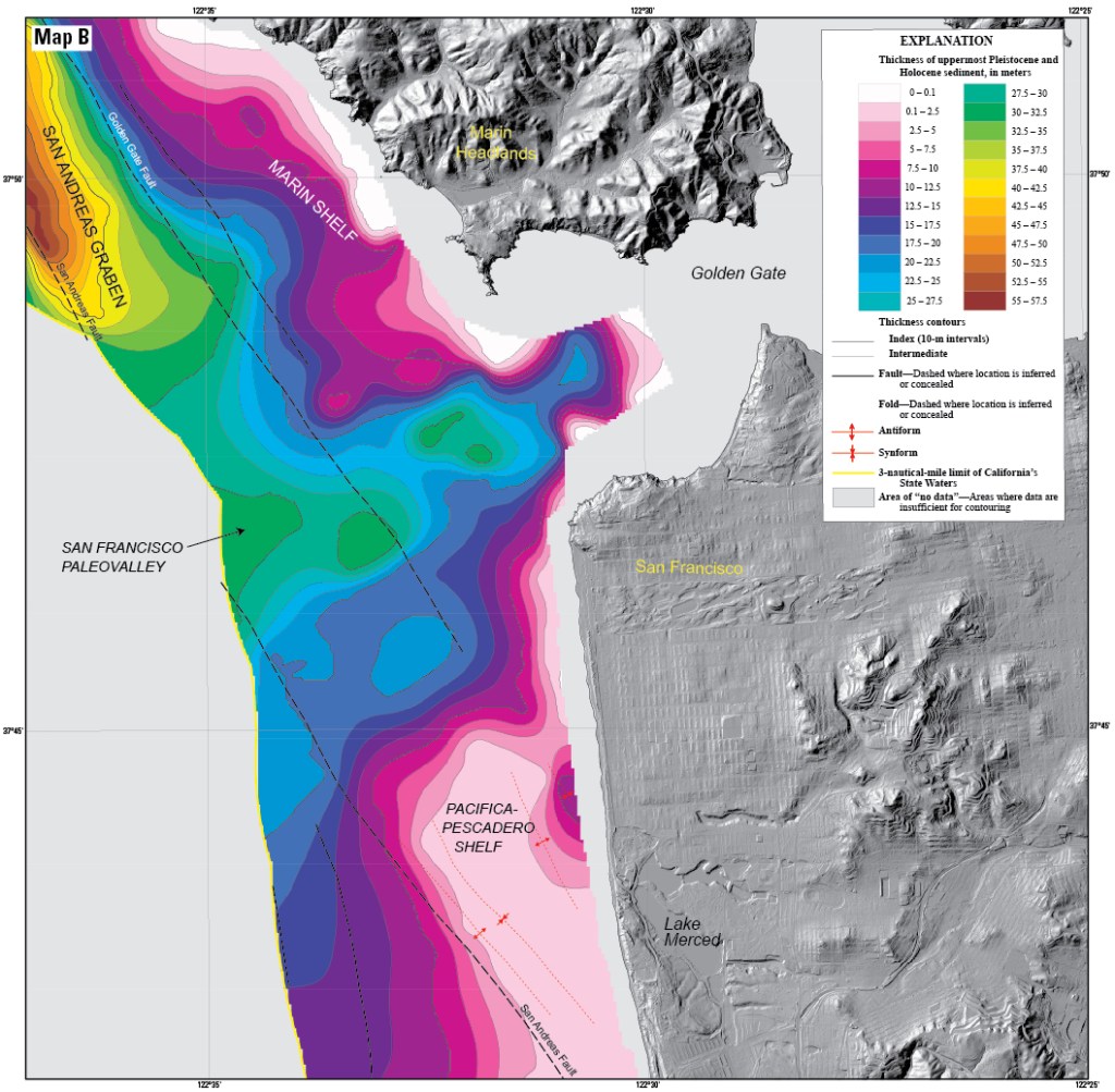
The San Andreas Graben is an offshore transtensional basin, lying northwest of the Golden Gate, in the Gulf of the Farallones, and just south of Bolinas Bay. This region is bisected by several prominent transform and normal faults of the San Andreas tectonic system, including the San Andreas, the San Gregorio, the Golden Gate, the Point Reyes, and the Potato Patch faults. The San Andreas Graben is directly bounded by the San Andreas Fault and the sidestepping Golden Gate Fault, which are actively forming the graben through pull-apart/tensional forces.
The San Andreas Graben lies directly north and adjacent to the epicenter of 1906 San Francisco earthquake. Field studies indicate that initiation and/or acceleration of the subsidence of the San Andreas Graben may have been related to the 1906 great earthquake; although probable, results are not determinant of the cause and age of this submarine graben.
Death Valley is the most famous graben within California’s Basin and Range (graben and horst) geomorphic province. The floor of Death Valley is a pull-apart basin, downfaulting and downdropping so rigorously between two parallel strike-slip faults (the Furnace Creek and the Death Valley Fault), that 550 square miles of valley floor has descended to a depth of -282 feet below sea level; the lowest elevation of earth’s surface in North America.
More precisely, and adding to the complexity and mystique of its extreme geography, Death Valley lies at the geomorphic and biogeographic intersections of the Basin and Range and the Mojave Desert geomorphic provinces; and within the southern region of the Walker Lane Belt/Shear Zone.
