
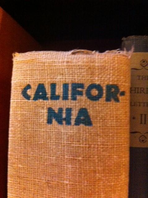
Cal Geographic Maritime Journal
An informal collection of journal posts and photo albums highlighting California’s maritime history
A lighthearted collage of coastal culture and familial connections
And an archive of classic posts from the former Coastal Zone CA blog
Richard Henry Dana’s, Two Years Before the Mast

In 1834, Richard Henry Dana left school and a life of privilege behind in Boston to sign-on as a common sailor aboard the merchant ship, Pilgrim. He sought adventure and physical rigor in an attempt to combat a degenerative illness, but was instantly faced with the brutal reality of the grueling and unending labor, hardships, and hazards of life as a seaman. His intense desire to prove himself a worthy sailor and friend to his crewmates, coupled with meticulous and eloquent daily record keeping of his enfolding two year journey, provided the world with a unique and invaluable record of the true, unromantic realities of life at sea.
Two Years Before the Mast was the first detailed account of the common sailor’s plight, and it served to enlighten young men across the world to the unromantic realities they would face if choosing a life aboard. And for those of us concerned with history and the preservation of the coast, Two Years Before the Mast provides a priceless glimpse into the landscapes and cultures of pre-Gold Rush, early colonial California. At the close of his California voyage, Dana completed his law degree at Harvard and dedicated his life to the advocacy and legal protection of common sailors. Herman Melville was among the many inspired by Dana’s unique literary accomplishment, and in 1841 he too boarded a vessel to research and live the whaling life for himself, and subsequently penned Moby Dick.
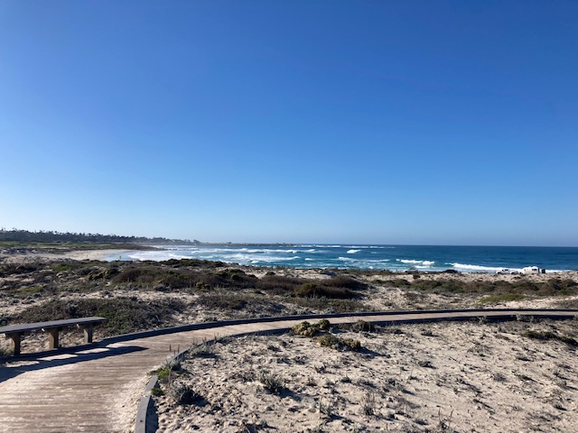
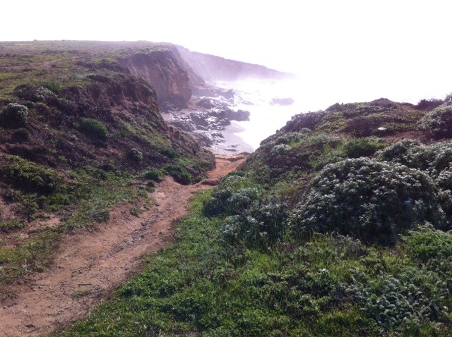
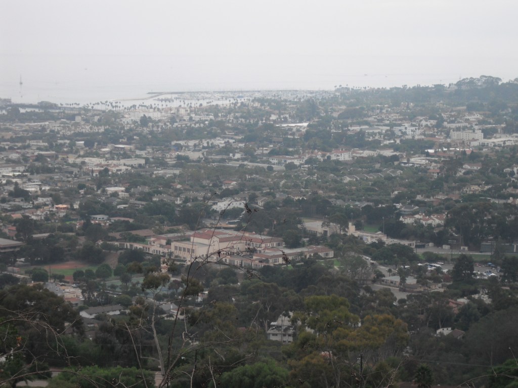
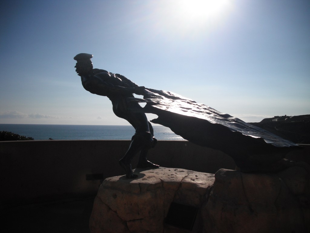
The typical years-long trade route Richard Henry Dana experienced, ping-ponged up and down the California coast, allowing crew to become intimate with the wild California landscape, weather patterns, seasonal indicators, maritime hazards and shortcuts, the nuances of tides, bays, and the myriad techniques of landing every harbor and beach. Working aboard the Pilgrim and then the Alert, acquiring cattle hides from the Spanish missions and settlements up and down the coast, Dana’s undulating longitudinal route took him to: Santa Barbara, Monterey, Santa Barbara, San Pedro (Los Angeles), San Diego, San Pedro, Santa Barbara, San Pedro, San Juan (Capistrano/Dana Point), San Diego, San Pedro, Santa Barbara, San Diego, San Juan, San Pedro, Santa Barbara, San Francisco, Monterey, Santa Barbara, San Pedro, San Diego, Santa Barbara, San Pedro, and finally San Diego before setting sail south for Cape Horn and home.
I researched the exact present day locations of some of Dana’s 188 year old landing sites, and visited and photographed the sites as they appear today. The following are select passages from Two Years Before the Mast, describing Richard Henry Dana’s first encounters, landings, and adventures at some of these now beloved and populous cities, sites, and bays. All header photos taken by Rowena Forest, and correspond with the passage location:


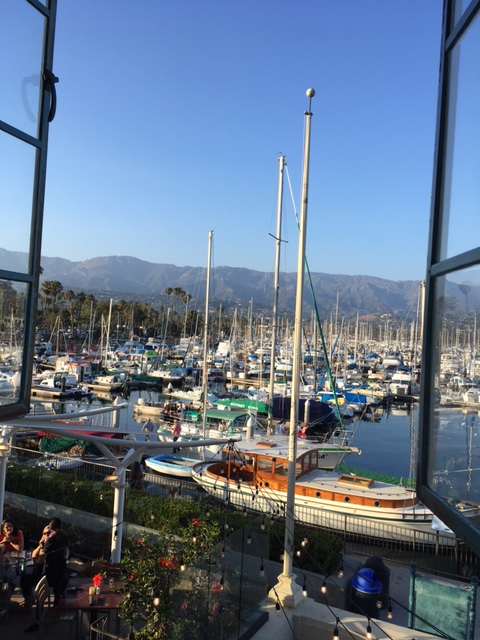
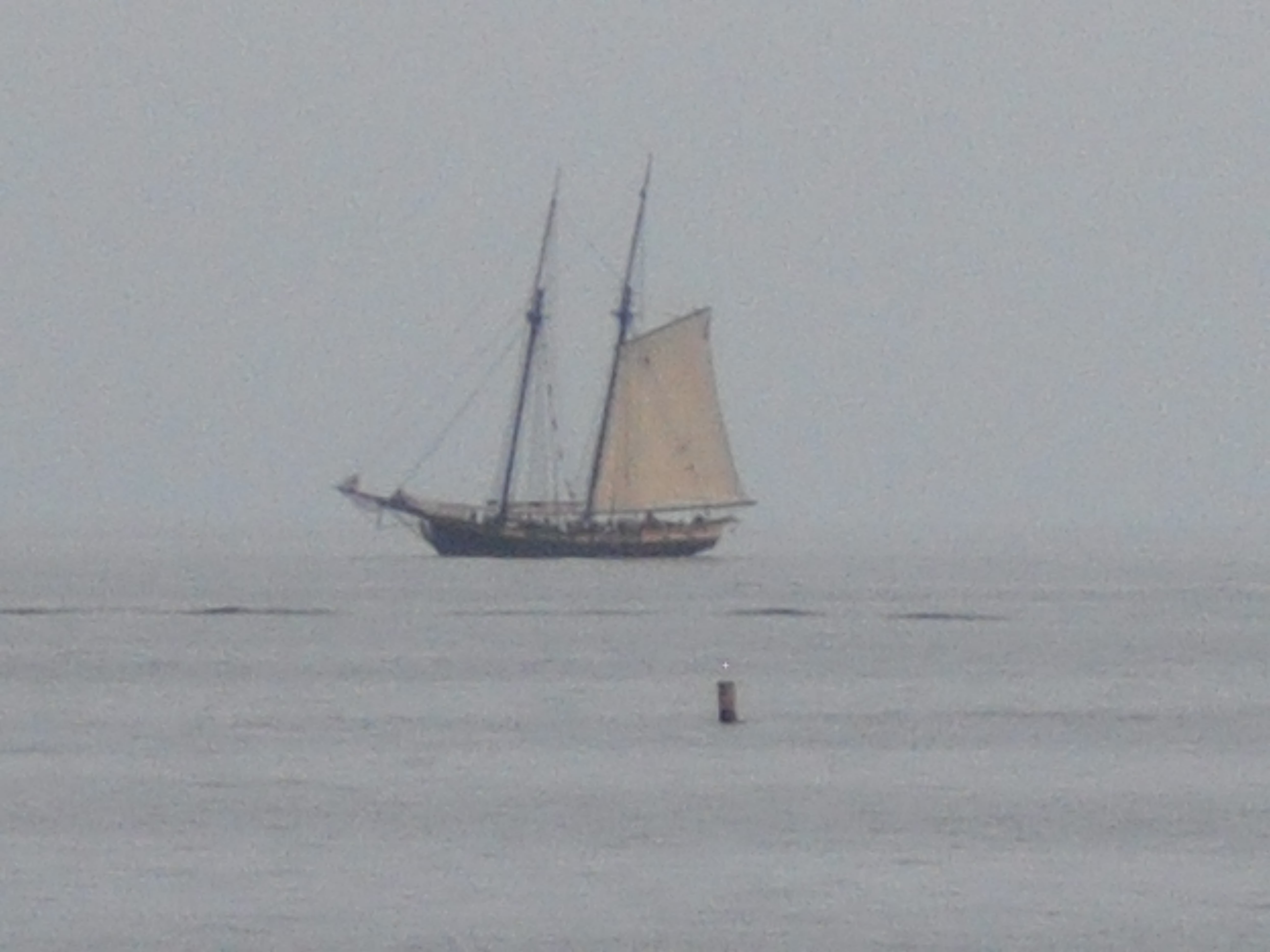
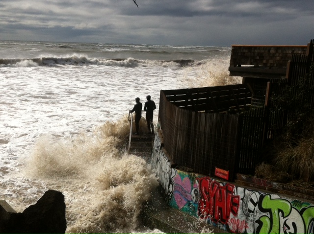
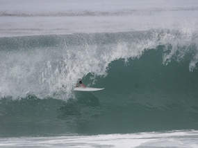
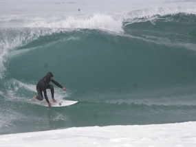
First landing in California, first impressions of Santa Barbara, and the earliest record of surfing in California 188 years ago:
January 14th, 1835 – Santa Barbara
It was a beautiful day, and so warm that we wore straw hats, duck trousers, and all the summer gear. As this was midwinter it spoke well for the climate, and we afterward found that the thermometer never fell to the freezing point throughout the winter, and that there was very little difference between the seasons, except that during a long period of rainy and southeasterly weather, thick clothes were not uncomfortable.
The large bay lay about us, nearly smooth as there was hardly a breath of wind stirring, though the boat’s crew who went ashore told us that the long ground swell broke into ta heavy surf on the beach… In the middle of this crescent, directly opposite the anchoring ground, lie the mission and town of Santa Barbara, on a low plain, but little above the level of the sea, covered with grass, though entirely without trees, and surrounded on three sides by an amphitheater of mountains, which slant off to the distance of fifteen or twenty miles. The mission stands a little back of the town and is a large building, or rather collection of buildings, in the center of which is a high tower, with a belfry of five bells. The whole, being plastered, makes quite a show at a distance and is the mark by which vessels come to anchor… Just before sundown, the mate ordered a boat’s crew ashore, and I was one of the number. We passed under the stern of the English brig, and had a long pull ashore.
I shall never forget the impression which our first landing on the beach of California made upon me. The sun had just gone down; it was getting dusky; the damp night wind was beginning to blow, and the heavy swell of the Pacific was setting in, and breaking in loud and high “combers” upon the beach. We lay on our oars in the swell, just outside the surf, waiting for a good chance to run in, when a boat, which had put off from the Ayacucho, came alongside of us, with a crew of Sandwich Islanders, talking in their tongue. They knew that we were novices in this kind of boating and waited to see us go in. The second mate, however, who steered our boat, determined to have the advantage of their experience, and would not go in first. Finding, at length, how matters stood, they gave a shout, and taking advantage of a greater comber which came swelling in, rearing its head, and lifting up the sterns of our boats nearly perpendicular, and again dropping them in the trough, they gave three or four long and strong pulls, and went in on top of the great wave, throwing their oars overboard, and as far from the boat as they could throw them, and jumping out the instant the boat touched the beach, they seized hold of her by the gunwale, on each side, and ran her up high and dry upon the sand. We saw, at once, how the thing was to be done, and also the necessity of keeping the boat stern out to the sea; for the instant the seas should strike upon her broadside or quarter, she would be driven u broadside on, and capsized…
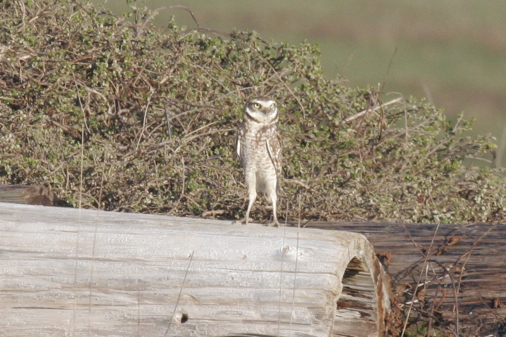
The sand of the beach began to be cold to our bare feet; the frogs set up their croaking in the marshes and one solitary owl, from the end of the distant point, gave out his melancholy note, mellowed by the distance, and we began to think that I was high time for “the old man,” as a shipmaster is commonly called, to come down..

Monterey
The bay of Monterey is wide at the entrance, being about twenty-four miles between the two points, Ano Nuevo at the north, and Pinos at the south, but narrows gradually as you approach the town, which is the whole depth of the bay. The shores are extremely well wooded (the pine abounding upon them), and as it was now the rainy season, everything was as green as nature could make it – the grass, the leaves, and all; the birds were singing in the woods, and great numbers of wild fowl were flying over our heads. Here we could lie safe from the southeasters. We came to anchor within two cable lengths of the shore, and the town lay directly before us, making a very pretty appearance; its houses being of whitewashed adobe, which gives a much better effect than those of Santa Barbara, which are mostly left a mud color. The red tiles too, on the roofs, contrasted well with the white sides, and with the extreme green-ness of the lawn upon which the houses – about a hundred in number – were dotted about, here and there, irregularly. There are in this place, and in every other town which I saw in California, no streets nor fences (except that here and there a small patch might be fenced in for a garden), so that the houses are placed at random upon the green. This, as they are of one story, and of the cottage form, gives them a pretty effect when seen from a little distance.
The Californians are an idle, thriftless people, and can make nothing for themselves, The country abounds in grapes, yet they buy, at a great price, bad wine made in Boston and brought round by us, and retail it among themselves at a real (12 and a half cents) by the small wineglass.

Impressions of the barren and deserted coast between Santa Barbara and Los Angeles (unimaginable), first sight of the mouth of the Los Angeles Basin, and landing at San Pedro/LA Harbor:
Leaving Santa Barbara, we coasted along down, the country appearing level or moderately uneven, and for the most part, sandy and treeless; until doubling a high sandy point, we let go our anchor at a distance of three or three and a half miles from shore. It was like a vessel bound to St John’s, Newfoundland, coming to anchor on the Grand Banks; for the shore, being low, appeared to be at a greater distance than it actually was, and we thought we might as well have stayed at Santa Barbara and sent our boat down for the hides. The land was of a clayey quality, and , as far as the eye could reach, entirely bare of trees and even shrubs; and there was no sign of a town – knot even a house to be seen, What brought us into such a place, we could not conceive, No sooner had we come to anchor, than the slip rope, and the other preparations for southeasters, were got ready; and there was reason enough for it , for we lay exposed to every wind that could blow, except the northerly winds, and they came over a flat country with a rake of more than a league of water, As soon as everything was snug on board, the boat was lowered and we pulled ashore, our new officer, who had been several times in the port before, taking the place of steersman, As we drew in, we found the tide low, and the rocks and stones, covered with kelp and seaweed, lying bare for the distance of nearly an eighth of a mile.
Leaving the boat, and picking our way barefooted over these, we came to what is called the landing place, at high-water mark, The soil was, as it appeared at first, loose and clayey, and except the stalk of the mustard plant, there was no vegetation… I also learned, to my surprise, that the desolate-looking place we were in furnished more hides than any port on the coast. It was the only port for a distance of eighty miles, and about thirty miles in the interior was a fine plane country, filled with herds of cattle, in the center of which was the Pueblo de Los Angeles – the largest town in California – and several of the wealthiest missions; to all of which San Pedro was the seaport.The coyotes (a wild animal of a nature and appearance between that of the fox and the wolf) set up their sharp, quick bark, and two owls, at the end of the distant points running out into the bay, on different sides of the hill where I lay, kept up their alternate dismal notes. I had heard the sound before at night, but did not know what it was, until one of the men, who came down to look at my quarters told me it was the owl. Mellowed by the distance, and heard alone, at night it was a most melancholy and boding sound. Through nearly all the night they kept it up, answering one another slowly at regular intervals, This was relieved by the noisy coyotes, some of which came quite near to my quarters, and were not very pleasant neighbors.


First passage into San Diego Bay, and the following months’ encounters and stories on a San Diego beach:
At sunset on the second day we had a large and well-wooded headland directly before us, behind which lay the little harbor of San Diego. We were becalmed off this point all night, but the next morning, which was Saturday, the fourteenth of March, having a good breeze, we stood round the point, and, hauling our wind, brought the little harbor, which is rather the outlet of a small river, right before us. Everyone was desirous to get a view of the new place. A chain of high hills, beginning at the point (which was on our larboard hand coming in), protected the harbor on the north and west, and ran off into the interior, as far as the eye could reach. On the other sides the land was low and green, but without trees. The entrance is so narrow as to admit but one vessel at a time, the current swift, and the channel runs so near to a low, stony point, that the ship’s sides appeared almost to touch it. There was no town in sight, but on the smooth sand beach, abreast, and within a cable’s length of which three vessels lay moored, were four large houses, built of rough boards, and looking like the great barns in which ice is stored on the borders of the large ponds near Boston, with piles of hides standing round them, and men in red shirts and large straw hats walking in and out of the doors. These were the hide houses…
All the hide houses on the beach but ours were shut up, and the Sandwich Islanders, a dozen or twenty in number, who had worked for the other vessels, and been paid off when they sailed, were living on the beach, keeping up a grand carnival. There was a large oven on the beach, which, it seems, had been built by a Russian discovery ship that had been on the coast a few years ago, for baking her bread. This, the Sandwich Islanders took possession of, and had kept ever since, undisturbed… There they lived, having a grand time, and caring for nobody…
Here was a change in my life as complete as it had been sudden. In the twinkling of an eye I was transformed from a sailor into a beachcomber and a hide curer; yet the novelty and the comparative independence of the life were not unpleasant…
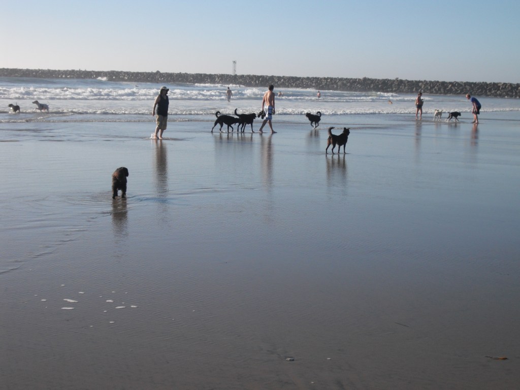
I ought, perhaps, to except the dogs, for they were an important part of our settlement. Some of the first vessels brought dogs out with them, who for convenience, were left ashore, and there multiplied, until they came to be a great people.. While I was on the beach, the average number was about forty, and probably an equal, or greater, number are drowned, or killed in some other way, every year. They are very useful in guarding the beach. Hogs and a few chickens were the rest of the animal tribe, and formed, like the dogs, a common company..


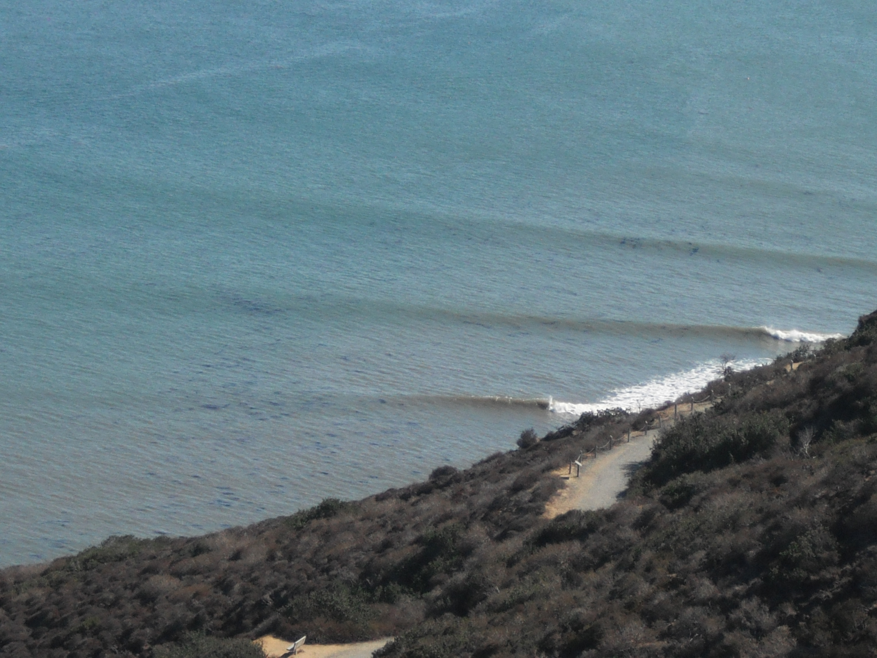
First impressions of San Juan Capistrano area and Dana Point:
Coasting along on a quiet shore of the Pacific, we came to anchor in twenty fathoms water, almost out at sea, as it were, and directly abreast of a steep hill which overhung the water, and was twice as high as our royal masthead. We had heard much of this place from the Lagoda’s crew, who said it was the worst place in California. The shore is rocky, and directly exposed to the southeast, so that vessels are obliged to slip and run for their lives on the first sign of a gale; and late as it was in the season, we got up our slip rope and gear, though we meant to stay only twenty four hours. We pulled the agent ashore and were ordered to wait for him, while he took a circuitous way round the hill to the mission, which was hidden behind it. We were glad of the opportunity to examine this singular place, and hauling the boat up, and making her well fast, took different directions up and down the beach, to explore it. San Juan is the only romantic spot on the coast. The country here for several miles is high tableland, running boldly to the shore, and breaking off in a steep cliff, at the foot of which the waters of the Pacific are constantly dashing. For several miles the water washes the very base of the hill, or breaks upon ledges and fragments of rocks which run out into the sea. Just where we landed was a small cove, or bight, which gave us, at high tide, a few square feet of sand beach between the sea and the bottom of the hill. Directly before us rose the perpendicular height of four or five hundred feet. How we were to get hides down, or goods up, upon the tableland on which the mission was situated was more than we could tell… Beside, there was a grandeur in everything around, which gave a solemnity to the scene, a silence and solitariness which affected every part! Not a human being but ourselves for miles, and no sound heard but the pulsations of the great Pacific!
One or two other carts were coming slowly on from the mission, and the captain told us to begin and throw the hides down. This, then, was the way they were to be got down – thrown down, one at a time, a distance of four hundred feet! This was doing the business on a great scale. Standing on the edge of the hill ,and looking down the perpendicular height.. Down this height we pitched the hides, throwing them as far out into the air as we could; and as they were all large, stiff, and doubled, like the cover of a book, the wind took them, and they swayed and eddied about, plunging and rising in the air, like a kite when it has broken its string. As it was now low tide, there was no danger of their falling into the water; and as fast as they came to ground, the men below picked them up, and taking them on their heads, walked off with them to the boat. It was really a picturesque sight: the great height, the scaling of the hides, and the continual walking to and fro of the men, who looked like mites on the beach. This was the romance of hide droghing! Some of the hides lodged in cavities under the bank and out of our sight, being directly under us; but by pitching other hides in the same direction, we succeeded in dislodging them. Had they remained there, the captain said he should have sent on board for a couple of pairs of long halyards and got someone to go down for them, It was said that one of the crew of an English brig went down in the same way, a few years before. We looked over, and thought it would not be a welcome task, especially for a few paltry hides; but no one knows what he will do until he is called upon; for six month s afterward, I descended the same place by a pair of topgallant-studding-sail halyards to save half a dozen hides which had lodged there.
First entry into the San Francisco Bay:
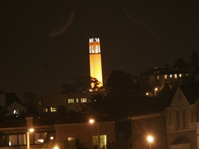
…we made a fair wind for San Francisco. This large bay, which lies in latitude 37, 58’, was discovered by Sir Francis Drake, and by him represented to be (as indeed it is) a magnificent bay, containing several good harbors, great depth of water, and surrounded by a fertile and finely wooded country. About thirty miles from the mouth of the bay, and on the southeast side, is a high point, upon which the presidio is built,. Behind this point is the little harbor, or bight, called Yerba Buena, in which trading vessels anchor, and, near it, the Mission of Dolores. There was no other habitation on this side of the bay, except a shanty of rough boards put up by a man named Richardson, who was doing a little trading between the vessels and the Indians… We passed directly under the high cliff on which the presidio is built, and stood into the middle of the bay, from whence we could see small bays making up into the interior, large and beautifully wooded islands, and the mouths of several small rivers. If California ever becomes a prosperous country, this bay will be the center of its prosperity. The abundance of wood and water; the extreme fertility of its shores, the excellence of its climate, which is as near to being perfect as any in the world; and its facilities of navigation, affording the best anchoring grounds in the whole western coast of America – all fit it for a place of great importance. The tide leaving us, we came to anchor near the mouth of the bay, under a high and beautifully sloping hill, upon which herds of hundreds and hundreds of red deer, and the stag, with his high branching antlers, were bounding about, looking at us for a moment, then starting off, affrighted at the noises which we made for the purpose of seeing the variety of their beautiful attitudes and motions.
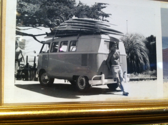
Photo Album – Graphic


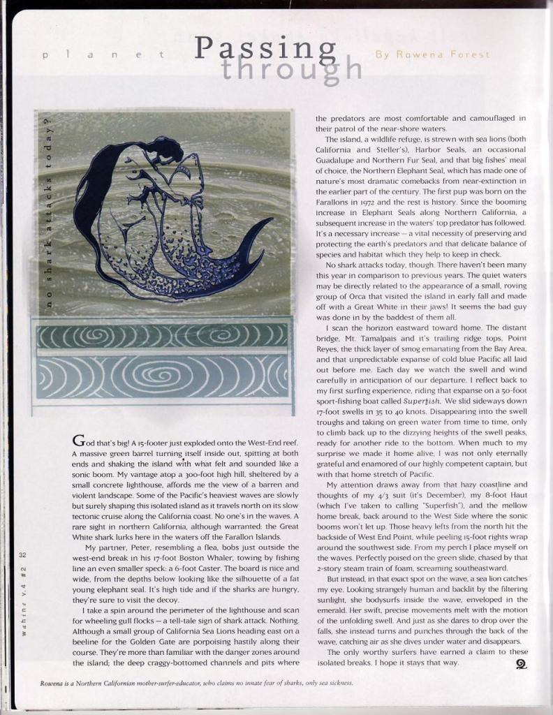
Passing Though – essay in Wahine Magazine
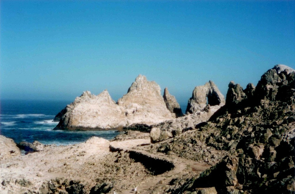
Seasonal Biogeography of the Farallon Islands

This web page was a class assignment, for which I am outlining the seasonal biogeography of the Farallon Islands, based on three major seasonal animal distribution events at the Farallon Islands National Wildlife Refuge
Background:
Farallon Islands National Wildlife Refuge is a small, 7.96 long rocky island chain, which lies 27 miles west of the Golden Gate, at 37° 41’ 56” N, 123° 00’ 12” W
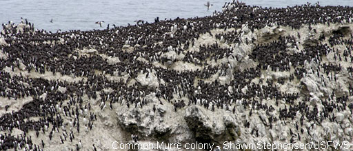
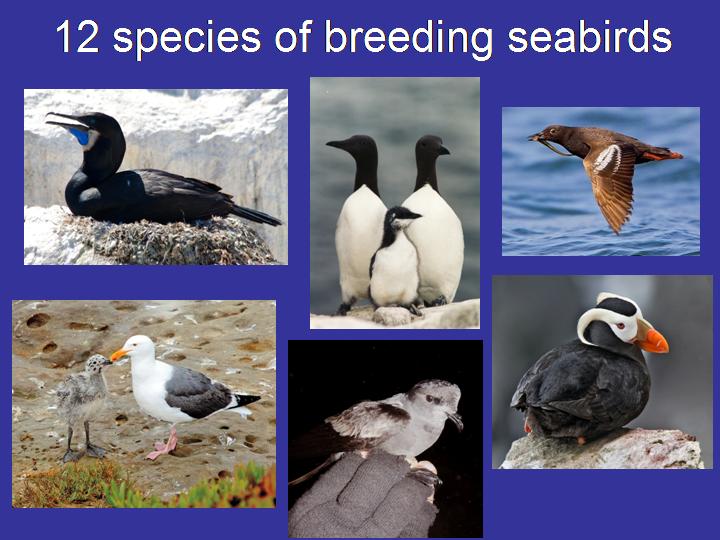
The Farallon Islands host the largest seabird rookery on the west coast of North America, with 12 species of breeding seabirds: Ashy Storm-Petrel, Black Oyster-catcher, Brandt’s Cormorant, Cassin’s Auklet, Common Murre, Double-crested Cormorant, Leach’s Storm-Petrel, Pelagic Cormorant, Pigeon Guillemot, Rhinoceros Auklet, Tufted Puffin, and Western Gull
The Farallones also host large breeding colonies of pinnipeds: Northern Elephant Seal, Northern Fur-Seal, Harbor Seal, California Sea Lion, and Steller’s Sea Lion
Cold, nutrient rich waters of the Gulf of the Farallones, and seasonal upwelling events create an extremely fertile food web and productive ecosystem in the Gulf of the Farallones

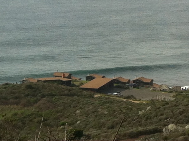
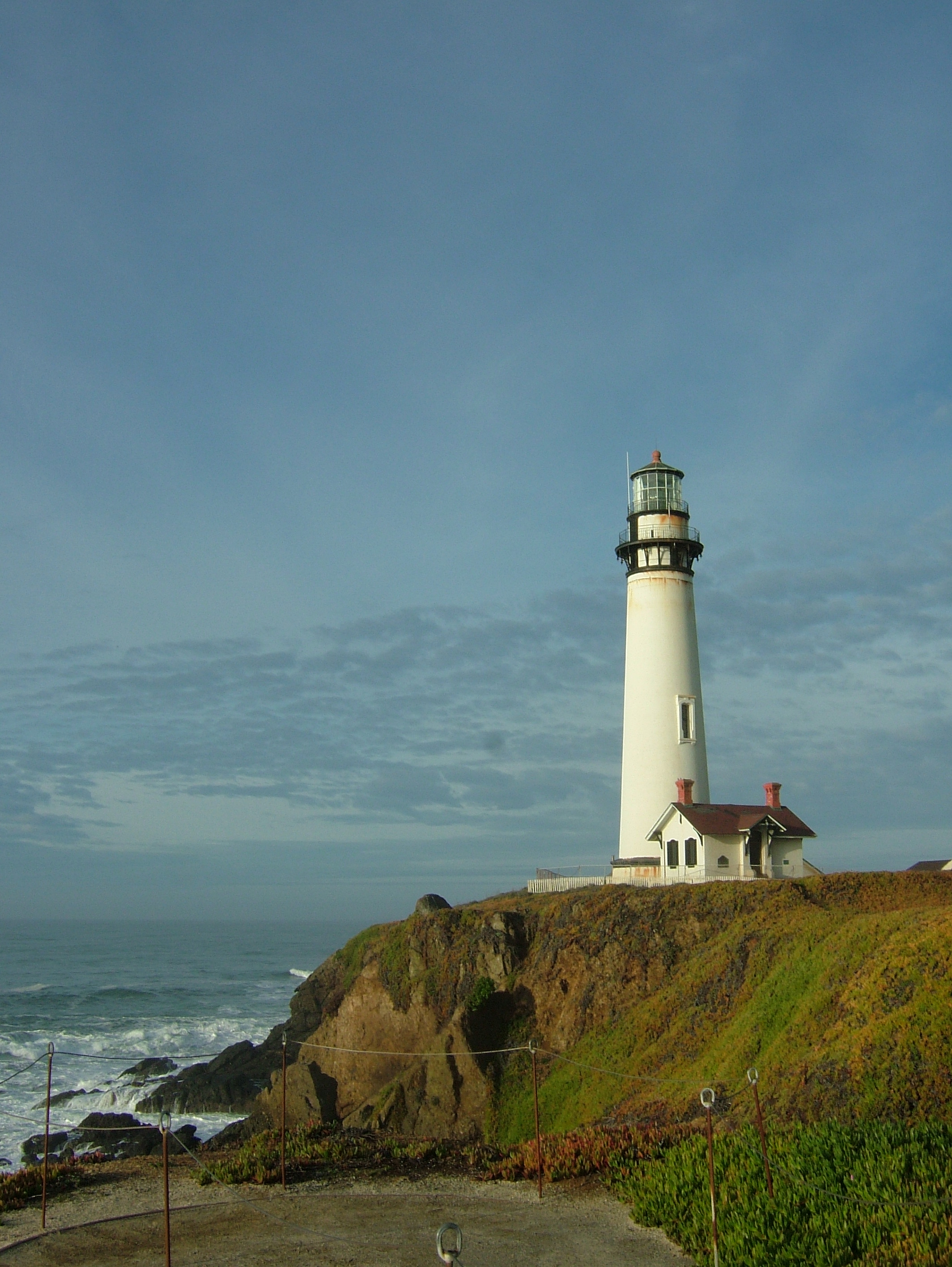
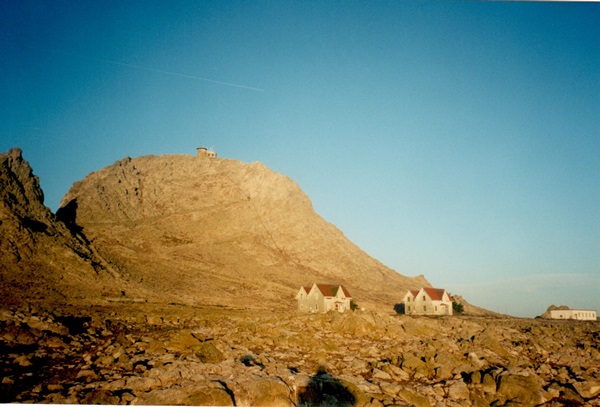
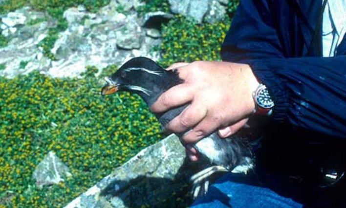
Southeast Farallon Island is the southern-most and largest island of the chain, featuring a U.S. Coast Guard Lighthouse, U.S. Fish and Wildlife infrastructure, and a biological field station run by Point Blue Conservation Science (Formerly Point Reyes Bird Observatory/PRBO). My husband, Peter Bryan Pyle, was the fall biologist for PRBO stationed on the Farallon Islands between 1980 and 2003, with the primary duties of monitoring migrant land birds, monitoring White Sharks, recording all other wildlife activities, collecting of weather and oceanographic data, running the island infrastructure, and working with the US Coast Guard, US Fish and Wildlife Service, and the National Marine Sanctuary program on infrastructure and invasive species projects.
PRBO, has established a 50 year regimen of biological monitoring programs on the Farallon Islands, which follow a distinct seasonal cycle. In the spring through summer intensive study and monitoring of breeding seabirds is conducted; in the fall months monitoring of migrant land birds and White Sharks occurs; and the winter brings the Northern Elephant Seal breeding and pupping monitoring season.
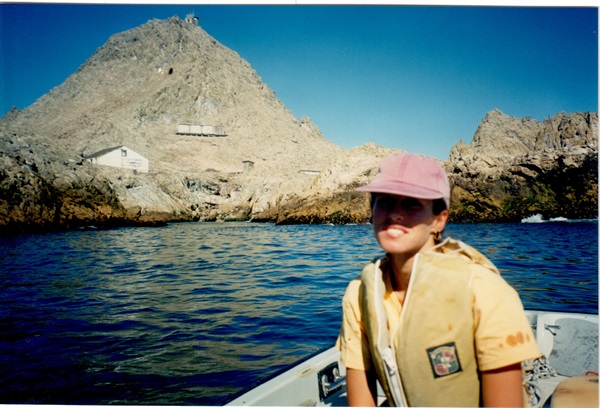
I spent a portion of each fall on the Farallones between 1995 and 2003, and participated in White Shark as well as native and invasive plant monitoring projects. Central to life on the Farallones were long and sometimes harrowing boat trips, harsh weather conditions, rigorous all day field work, nightly communal dinners, followed by a nightly group journal entries of the day’s biological and weather happenings. During fall evenings a fun part of the White Shark monitoring project was to review the raw underwater video footage of White Shark feeding events collected that day. Additionally, I have a very personal connection to the Farallones having grown up watching the pulse of the Farallon lighthouse from my living room window, and had a great-great grandfather who ran his ship aground on Southeast Farallon Island in 1871: one of numerous Gold Rush era shipwrecks on the islands.
Overview of Atmospheric and Marine Conditions at the Gulf of the Farllones:
“Although the Farallones certainly share the weather patterns of the coastal province, there is little doubt that the biogeographic composition and size of the Farallon marine avifauna are influenced by marine rather than terrestrial conditions,” (Seabirds of the Farallon Islands, Ainley et al 1990).
Situated in the Gulf of the Farallones, annual air temperatures at the Farallon Islands mirrors the cold ocean currents surrounding the islands, and only range from approximately 9 to13 degrees C throughout the year (Ainley 1990). Marine advection fog envelopes the islands during much of the summer months, providing summer moisture to terrestrial habitats, and precipitation falls only during the short winter season. The geophysical processes most influential over seasonality and ecology at the Farallon Islands are the presence of the dominant cold California Current, flowing north to south just west of the Farallones, the warmer Davidson counter-current, which occurs in the fall, coastal upwelling processes, El Nino events, and the strengths and positions of the Aleutian Low and North Pacific High pressure systems (Ainley 1990).

As noted in the Seasonality of coastal upwelling off central and northern California: New Insights, Including Temporal and Spatial Variability (Garcia-Reyes, et al 2011), “three seasons are defined to best represent the annual cycle of wind stress along central and northern California. Following the nomenclature used by Largier et al. [1993], but updating the durations, they are defined as: “Storm Season” or winter (December-February), “Upwelling Season” (April-June), and “Relaxation Season” (July-September).”
The strongest northwesterly winds occur from April to June, producing the strongest annual upwelling events, oceanic winds weaken from July through September, and winter brings southerly winds to the Gulf of the Farallones with the passage of cold fronts, (Garcia-Reyes 2011).
Lowest sea surface temperatures at the Gulf of the Farallones are correlated with the strongest northwesterly winds, and warmest sea surface temperatures are correlated with wind relaxation events in the late summer and fall.

Winter on the Farallones:
As winter approaches, the North Pacific High pressure cell move south and east toward the central west coast, northwesterly winds decrease in strength and frequency, and cold fronts, or low pressure systems, move in from the north bringing southerly winds and winter rains to California, (Ainley 1990). With these wind reversals the dominant California Current gives way to the seasonal Davidson Current (or counter current), which now reaches the surface flowing up the coast from south to north.

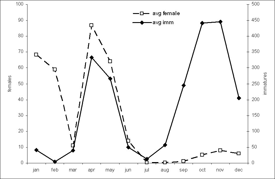
The winter is marked by the dramatic biogeographic seasonal event of the arrival of the Northern Elephant Seal (Mirounga angustirostris). According to Farallon biologist, Peter Bryan Pyle, the first arrivals of elephant seals to the Farallon breeding colonies are the adult males, which show up in November. After 9 months feeding at sea, they are at their peak weight (up to 5,000 pounds), and begin establishing territories. Adult females arrive to the Farallones mid to late December, at their peak weight and carrying full term pregnancies. These females choose a male’s territory (harem to join), and the first pup is usually born right around Christmas.

By February, the nursing females have used up all their physical resources on nourishing their pups, are mated by the dominant male, and then return to sea to feed, leaving/weaning their pups. When most of the adult females have left the Farallones, the adult males leave by the end of February, and the pups remain alone on islands for another three-four weeks until they become hungry enough to take to the waters and learn to survive in the north Pacific by feeding often at great depths.
Female elephant seals begin breeding around four to five years of age, and dominant (alpha) males are eight to ten years old at first breeding. Fights to the death can occur between bull elephant seals establishing and maintaining their harems, (P. Pyle).

Mature elephant seals also visit the Farallones for a short period from mid-June to mid-July to molt, at which time they are completely docile with each other. Between the summer molt and the winter breeding pupping season, Northern Elephant Seals are feeding in the Gulf of Alaska. This twice yearly round trip constitutes the longest known annual migration for any mammal species in the world (Point Blue Conservation Science – Los Farallones blog).
Once exterminated from the Farallon Islands by 19th century American and Russian sealers, the Northern Elephant Seal returned to the Farallon Islands to pup in 1972. Since that time, biologists with the Point Reyes Bird Observatory (PRBO – recently renamed Point Blue) have monitored the breeding colony. As described by Derek Lee in, Population Size and reproductive Success of Northern Elephant Seals on The South Faralon Islands, 2005-2006, “Since 1972 nearly all weaned pups and several immature animals were flipper-tagged every year. PRBO biologists identified returning females by flipper tags, distinguishing marks such as scars, or by dye marks placed on animals during post-breeding molt. After recording tag numbers, PRBO biologists used hair dye (Clairol, Stamford, Connecticut) to mark females temporarily so they could observe animals from a distance. Pups usually were marked with dye 1 or 2 days after birth. PRBO biologists checked mothers and pups daily, weather permitting, to determine parturition and breeding success. All work was carried out according to guidelines of the American Society of Mammalogists.”
Spring-Summer on the Farallon Islands:
In the spring and summer, from about April to June, the northwest winds reach their peak strength, increasing in speed and duration of wind events. The strong northwest winds fuel the process of upwelling along the central California coast, and cause sea surface temperatures at the Farallones to reach annual lows (Ainley 1990). “The beginning of the upwelling season, known as the spring transition, is marked by an increase in the magnitude and persistence of equatorward wind stress, and it is an important factor for the ecosystem, as it marks an increased availability of nutrients and thus the start of the season of high primary productivity,” (Garcia-Reyes et al, 2011).
This season of high marine primary productivity marks the seabird nesting season on the Farallon Islands. The immense numbers of seabirds and size of the breeding colonies on the Farallones is staggering. Once depleted by hunting and relentless egg collection, the seabird populations on the Farallones have still not recovered to their historic numbers, but remain the largest rookery off the west coast of North America. “On this group of rocky islands, situated just 43 km out to sea from San Francisco, is not just the largest concentration of breeding marine birds in the United States outside of Alaska and Hawaii, but it is a diverse avifauna as well.. The overall result of the many reports is a documentation of an avian community over a time span probably unsurpassed in the Western Hemisphere,” (Ainley 1990).
The twelve species of seabirds which nest on the Farallones are the Ashy Storm-Petrel, Black Oyster-catcher, Brandts Cormorant, Cassins Auklet, Common Murre, Double-crested Cormorant, Leach’s Storm-Petrel, Pelagic Cormorant, Pigeon Guillemot, Rhinoceros Auklet, Tufted Puffin, and Western Gull.
These twelve species have been continuously monitored on Southeast Farallon Island by Point Blue (formerly Point Reyes Bird Observatory/PRBO) since 1971, for population size and reproductive success, (Warzybok , 2014). Seabird monitoring data at the Farallones is collected on survival, phenology (timing of breeding), chick growth, environmental conditions, and prey use (diet composition). “These long-term data give us a unique ability to examine trends over multiple time scales and look at variability in the context of long-term patterns and trends,” (Warzybok 2014).


Fall on the Farallon Islands:
In the fall months, three major oceanographic processes affect the marine environment of the Gulf of the Farallones (Pyle et al, 1996): the weakened California Current, the strengthening Davidson counter-current, and weakening coastal upwelling. As defined by Garcia-Reyes et al, 2011, early fall is characterized as the “relaxation season” for northwesterly wind stress (July-September), and transitions to a September through November period of calm winds, wind reversals, and warming sea surface temperatures throughout the fall months.
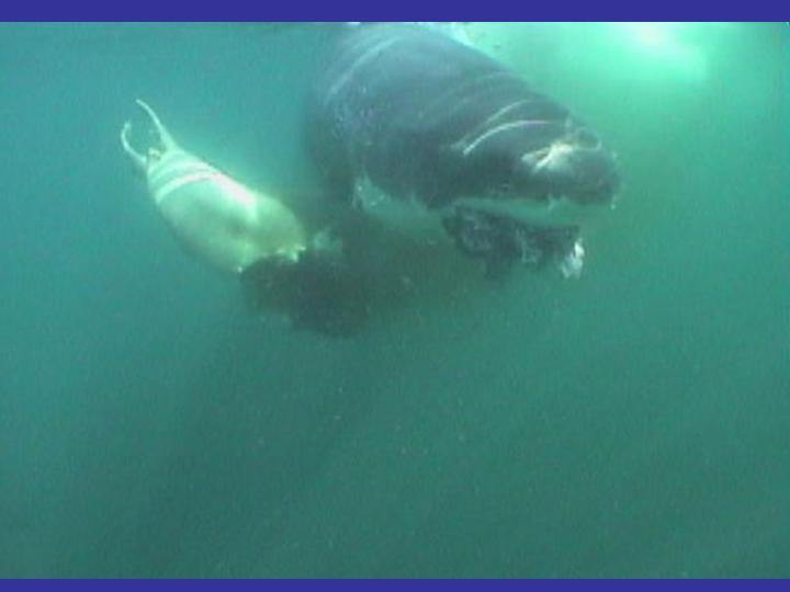
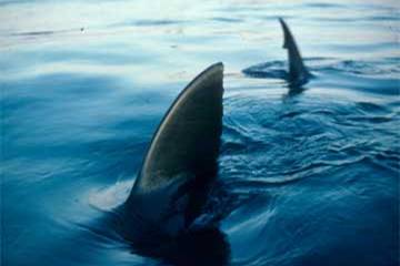
A fascinating seasonal biogeographic occurrence at the Farallon Islands is the migratory return of the Great White Shark surrounding waters in the fall months of September through November. This seasonality is attributed to prey availability of immature Northern Elephant Seals and other pinnipeds in the fall months (Pyle et al 2003).
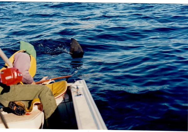
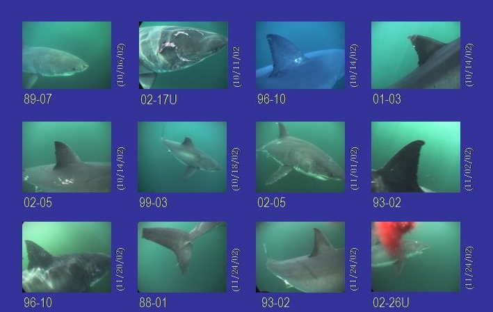
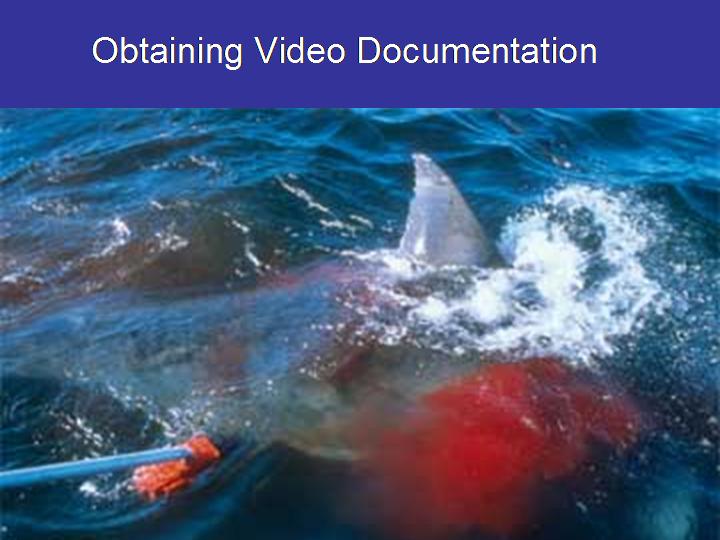
Predation by White Sharks on pinnipeds had been observed by Farallon biologists on island since the early 1970’s, and a methodological White Shark monitoring project was launched in 1987. “From 1987-2000 during daily observation in autumn (1 September to 30 November), we identified and documented individual white sharks using size and unique markings such as scars, mutilated fins, natural pigmentation patterns, and the distribution of notches on the trailing edge of the dorsal fin. From 1987-1992 sharks were documented with still photographs and shore-based video recorders. By 1993 we discovered that white sharks investigated small vessels or decoys particularly during and up to two hours subsequent to feeding events on pinnipeds. This behavior allowed us to employ underwater video recorders mounted on poles to document individual sharks and confim sex,” (Pyle et al, 2003) .
Based on this long term study, biologists found that White Shark attack (predation events) frequency increased with date, number of immature elephant seals present, higher tide, lower water clarity, bigger ocean swell, strong ocean upwelling the day previous to the attack, decreased wind speed, increased sea surface temperature, and decreased moonlight (new moon portion of the lunar cycle), (Pyle et al, 1996). Seasonal populations of White Sharks at the Farallones were estimated at 10-14 individuals at a minimum (Anderson et al 1996) with a possibility of 40 individuals per season at the highest (P. Pyle 2017). “Most White Sharks at the Farallones were found to be transient visitors, with a few short-term residents,” (Anderson 1996).
Other curious and significant findings include the pattern of individual sharks feeding at the same locations on similar dates on successive years (Anderson et al, 1996), leading scientists to surmise that sharks regulate the timing of their extensive, Pacific-wide movements far more precisely than previously perceived. Also discovered through long term monitoring, are temporal sex-specific occurrence patterns among adult white sharks at Southeast Farallon Island, with adult males occurring every year, and females occurring every other year at most. “This sex specific occurrence pattern implies a 2-year reproductive cycle, resulting in a lower reproductive potential than previously thought, which has important implications for the conservation of this species. These results also suggest that female white sharks may travel significant distances in the North Pacific Ocean during a biennial reproductive cycle to give birth, whereas copulation may occur closer to northern CA, allowing males to return annually to SEFI,” (Pyle et al 2003).

References:
Ainley, David, Robert Boekelheide. Seabirds of the Farallon Islands. Palo Alto: Stanford
University Press, 1990.
Ainley, David, T. James Lewis. “The History of the Farallon Island Marine Bird Populations,
1854-1972.” The Condor 76, (1974): 432-446.
Ainley, David, Peter Klimley. Great White Sharks: The Biology of Carcharodon carcharias. San
Diego: Academic Press, 1996.
Anderson, Scot, Taylor Chapple, Salvador Jorgensen, Peter Klimley, Barbara Block. “Long-term
individual identification and site fidelity of White Sarks, Carcharadon carcharias, in
California using dorsal fins.” Marine Biology 158, (2011): 1233-1237.
García-Reyes, M., and J. L. Largier. “Seasonality of coastal upwelling off central and northern
California: New insights, including temporal and spatial variability.” American
Geophysical Union 117, (2012): 1-17.
Karl, Herman, John Chin, Edward Ueber, Peter Stauffer, James Hendley. “Environmental Issues
in the Gulf of the Farallones.” United States Geologic Survey, (2001): 1-78.
Klimley, Peter, Scot Anderson, P. Bryan Pyle, RP Henderson. “Spatiotemporal Patterns of White
Shark (Carcharodon carcharias) Predation at the SouthFarallon Islands, California.”
American Socieity of Ichthyologists and Herpetologists 1992, no. 3 (1992): 680-690.
Lee, Derek. “Population Size and Reproductive Success of Northern Elephant Seals on the South
Farallon Islands 2005-2006.” Journal of Mammalogy 92, no. 3 (2011): 517–526.
Pyle, P. Bryan, Scot Anderson. “A temporal sex specific occurrence pattern among white sharks
at the south farllon islands, CA.” California Fish and Game publication 89, no. 2 (2003): 96-101.
Pyle, P. Bryan, Scot Anderson. “A temporal sex specific occurrence pattern among white sharks
at the south farllon islands, CA.” California Fish and Game publication 89, no. 2 (2003): 96-101.
Pyle, P. Bryan, Peter Klimley, Scot Anderson, Philip Henderson. “Environmental factors
affecting the occurrence and behavior of white sharks at the Farallon Islands, California.”
Academic Press, (1996): 281-291.
Warzybok, Peter, R.W. Berger, R. W. Bradley. “Status of Seabirds on Southeast Farallon Island
During the 2014 Breeding Season.” Unpublished report to the US Fish and Wildlife Service,(2014):1-13.
Ancestral Journey to the Farallon Islands

In the darker hours of night, the tiny pulsing of the distant Farallon Island lighthouse could be seen from my childhood living room windows. I sat backwards on our sofa, facing out to sea with chin resting on my folded arms, leaning forward against the couch back, face close to the cold window, gazing into the black and counting the seconds between the flashes. What we knew about the islands as kids, was only that there were sharks there… and lots of seals. And if you took a boat to the Farallones you would see a shark eating a seal. We also knew that the island was impossibly far away, and only bird watchers went there for some reason. What I didn’t know about the Farallones was that one day I would fall in love with a resident researcher, that I would have the privilege of escaping to the island from the difficulties of my adult life for a week at a time, and that my great, great grandfather – a Danish sailor – once collided with those islands, a shipwreck that would lead to the settlement of he and his family in San Francisco – thus allowing me to rest my chin on the couch back, gazing out the window 100 years later.
The ocean is one of those things in life where the more experience you have with it, and the more familiar you get with it, the more scared, humbled, and cautious you become in its presence. There’s no other way to learn this from the ocean, but the hard way. And if you don’t learn quick you might end up dead, or wanting to move east. The boat trips I took to the Farallon Islands taught me this. Quickly. They are fun stories to tell now, but at the time they were uncomfortable and anxious experiences at best. The only reason I kept coming back for more was because I was in love, and it was the only way to see my boyfriend… and the only way to escape. The Farallones have provided an escape for small waves of adventurous people for over 100 years. Some appreciated the solitude and extremely rugged environment, some profited from the loneliness of the islands, and others hated it. I’m not sure what my great, great grandfather Hans “Henry” Emil felt about the place, but I’m glad he saw it, and I’m glad he survived.
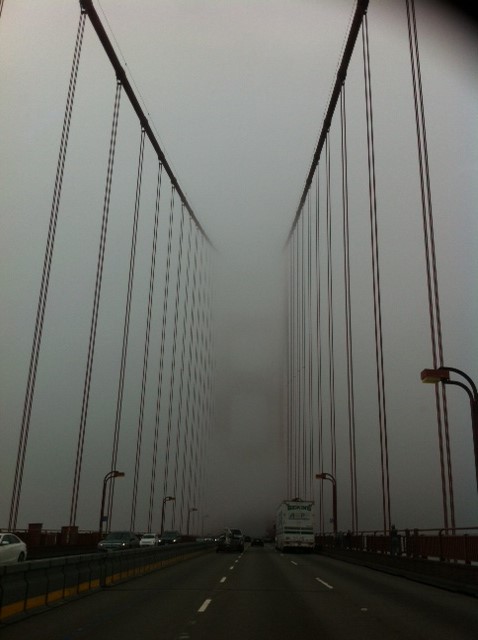
A compromise I reached with the sea, in exchange for regularly tempting its fate in crossing the extremely unpredictable and rough stretch of water between the San Francisco Bay Area and the Farallon Islands, was to pick my days and pick my vessel. The boat of choice was the Superfish, skippered by Mick Menigoz. A large sport boat with strong motors and a level-headed captain. This made for a quick passage generally, but even on the Superfish we had our days. (see my article in Wahine Magazine, “Passing Through”)
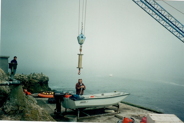
Other challenging trips to the Farallones for me included a ride out on an open 13-foot Boston Whaler with no seats in 15-foot seas, which we met head-on as soon as we made that westward turn from the Bay and headed out under the Golden Gate Bridge. The only thing that saved me from extreme fright on that trip was extreme sea sickness. Once outside the Gate we found that our marine radio didn’t work, leaving us with no method of communications in case of an emergency, or with the island, which was somewhere out beyond the breaking waves in front of us. For four hours we caught air off each swell, only to find the landing boom at the Farallones (necessary for lifting personnel onto the island) had broken that morning and was barely patched together with just enough spit to lift me out of the water and up to salvation on dry land. The two guys that took me out in that tiny, open boat had to turn right around and do it all again for at least a few more hours in rising swells, in order to get back home before dark. Somehow they made it, and it took me a couple of days on the couch to completely recover from the ordeal.

There were other hairy trips: one with an aged, one-eyed skipper and his yacht club, wine-glass-clinking friends. Errors in judgment took us on a “tour” of the island, circling around the most treacherous areas of the Farallones, heading into the wrong end of terrible sea conditions – waves cresting at the side of the cruiser, but somehow never quite breaking over us. A gray whale was nearly struck by the boat on that round-island tour. No one seemed to notice anything except me, and all I could eventually do was sit down and hold on in the lowest spot mid-deck, as the biologists on the island attempted frantically to hail the captain on the radio and tell him to turn back – to no avail.
The stories go on, and mine are by no means the worst. I can’t imagine what my great, great grandfather saw in his many schooner trips around the world – through many seas and seasons. I can’t imagine the emotions one goes through when your ship runs aground, let alone during a devastating shipwreck. I try not to think about it. My curiosity has led me, however, to try to find out the details of this boat he was on, and its encounter with the island. Our family stories of the wreck were by now at least fifth-hand/fifth-generation accounts, with no hard facts. Maybe it never happened, but it was a good story worth investigating.
I began my research in earnest online. I only knew the year, but not the name of the boat, or what position Henry held on-board, other than that he was one of the top mates or steersmen. It would have been about 1871, and a large merchant ship heading-in from the south I assumed. Online I found the California State Lands Commission Shipwreck Database, and a good spreadsheet of all shipwrecks that have occurred near the Golden Gate posted by the Gulf of the Farallones National Marine Sanctuary. All the dates so far were a decade too early or a decade too late. Ships with names like the Bessie Everding, the Beeswing, the Franconia, Lucas, and Noonday were listed as: “foundered”, “stranded”, “lost” or “all hands saved”. Most were wrecked along the north coast’s mammoth rocky reefs and submerged sand bars. A few had met their fate at the Farallon Islands. Nothing matched perfectly. But one, the Annie Sise, was listed as running aground in Marin in 1871– with no other details.
I dove into our copy of The Farallon Islands: Sentinels of the Golden Gate by Peter White, and online I encountered a handful of other intriguing titles, including Shipwrecks at the Golden Gate. From historic ecology research projects I had conducted in the past, I knew the San Francisco Public Library’s main branch had a wonderful history room, so I got off the computer and headed down to The City to do some real digging. The main branch is palatial, and I dropped off my mom in the library’s second floor at the poetry section, and headed on upstairs to the archives. Investigating several different resource angles that day, I was able to determine that the Annie Sise had in fact run aground on the Farallones! It was 1871, and all hands were saved. Also, it was the only wreck on the Farallon Islands that year, so it was a good bet that was his ship. I then spent hours reviewing microfilm of the four newspapers printed in San Francisco during 1871, in hopes of uncovering a record of the incident: The Daily Alta California, The San Francisco Chronicle, The San Francisco Daily Morning Call, and The Daily Evening Bulletin. Finally, in the Daily Alta California I found the following:
September 18th, 1871,
“The Wreck of the Annie Sise”
Captain Howland of the ship Governor Morton, upon his arrival yesterday, reported a ship ashore on the South Farallone Islands. Upon the United States Steamer Wayonda proceeding to the islands, it proved to be the ship Annie Sise, previously reported as having been lost on Point Reyes. The commander of the Wayonda presented the following report:
“Parties on the Farallone Islands gave the following account of the wreck; They saw the ship Annie Sise ashore on the west end reef, South Farallone Islands, on Friday at 6:10pm. She had all sails set, and anchors hanging by shank painters. The ship did not go to pieces until sometime during the night of the 16th. The report having found the ships log and chronometer boxes, but the chronometers were gone. The cabin was well cleared out. Two boats were lashed on deck and two boats gone.”
It was reported in the Daily Alta California on September 17th, regarding the same wreck:
“All hands left the ship in two boats, and reached the bar at 2:00 a.m. yesterday, where they fell in with the schooner John and Samuel, hence for Point New Year, whose master, Captain Borrill, kindly took the crew on board and landed all hands safely in the City, where they arrived at nine o’clock in the morning…”
It turns out that this trip of the merchant ship, Annie Sise, originated in New York, and she sailed around the globe reaching California via Australia along her trade route. I have researched several other resources including the Port of San Francisco records and archives, and the National Archives in hopes of finding the ships log or crew list from this voyage. All of the Port of San Francisco’s passenger-arrival records from 1850 – 1907 were lost in a fire at the Angel Island’s records facility in 1940. If I want to find a crew list for the Annie Sise it will need to turn up some other way, most likely from out of state, and most likely by luck or by chance.. but I haven’t given up. For now, I’m placing my bets Hans Emil was aboard that ship when she ran aground on the Farallones 139 years ago.
Update to Ancestral Journey to the Farallon Islands
As reported previously in Coastal Roots, in Ancestral Journey to the Farallon Islands, we have been searching for the name of the vessel and confirmation of my great-great grandfather, Hans Heiner’s name as crew, and possibly mate, aboard a schooner wrecking on the Farallon Islands, CA in the 1870’s. I had narrowed down the most likely boat to the Annie Sise, which shipwrecked on the Farallon Islands, CA in 1871 – All hands saved and rowing in the life boats toward San Francisco, to be picked up by another ship and brought to port in SF safely. But despite months of research of crew list and ship log journals, I could not find a complete list of names. We now have come across the desired evidence, and can close the chapter on this search: According to the shipping reports in the Melbourne Argus, May, 1871, “Hans Hyner” was Chief Officer of the Annie Sise, and brought her in to port there after the captain had died at sea – just months before wrecking in California.
Photo Album – Historic Marine Labs
Hopkins Marine Station, Pacific Grove


Bolinas Marine Station/College of Marin Marine Biology Lab

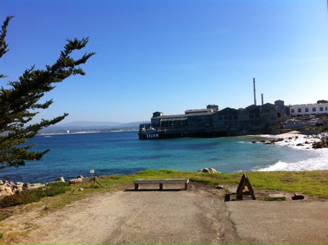
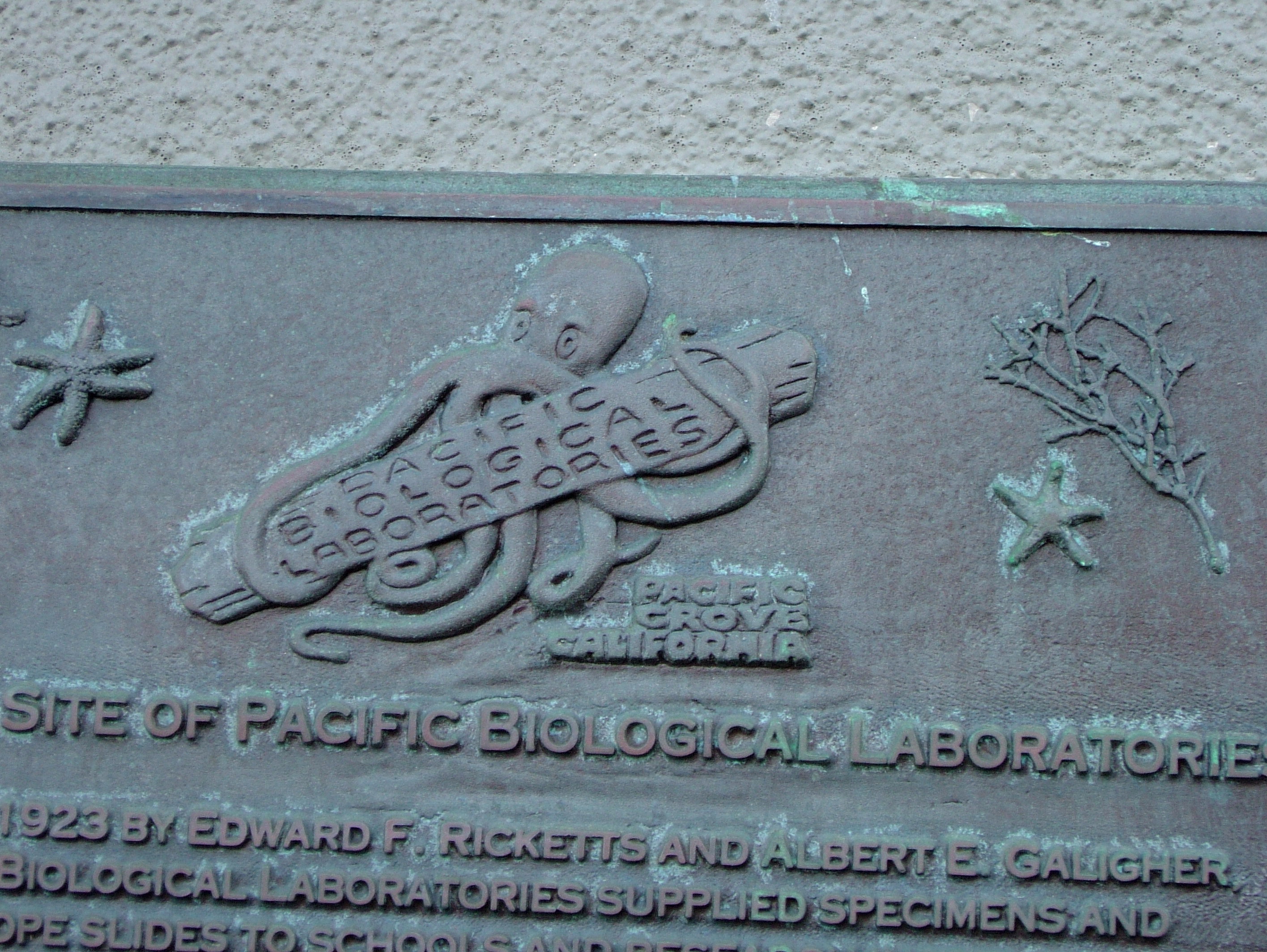
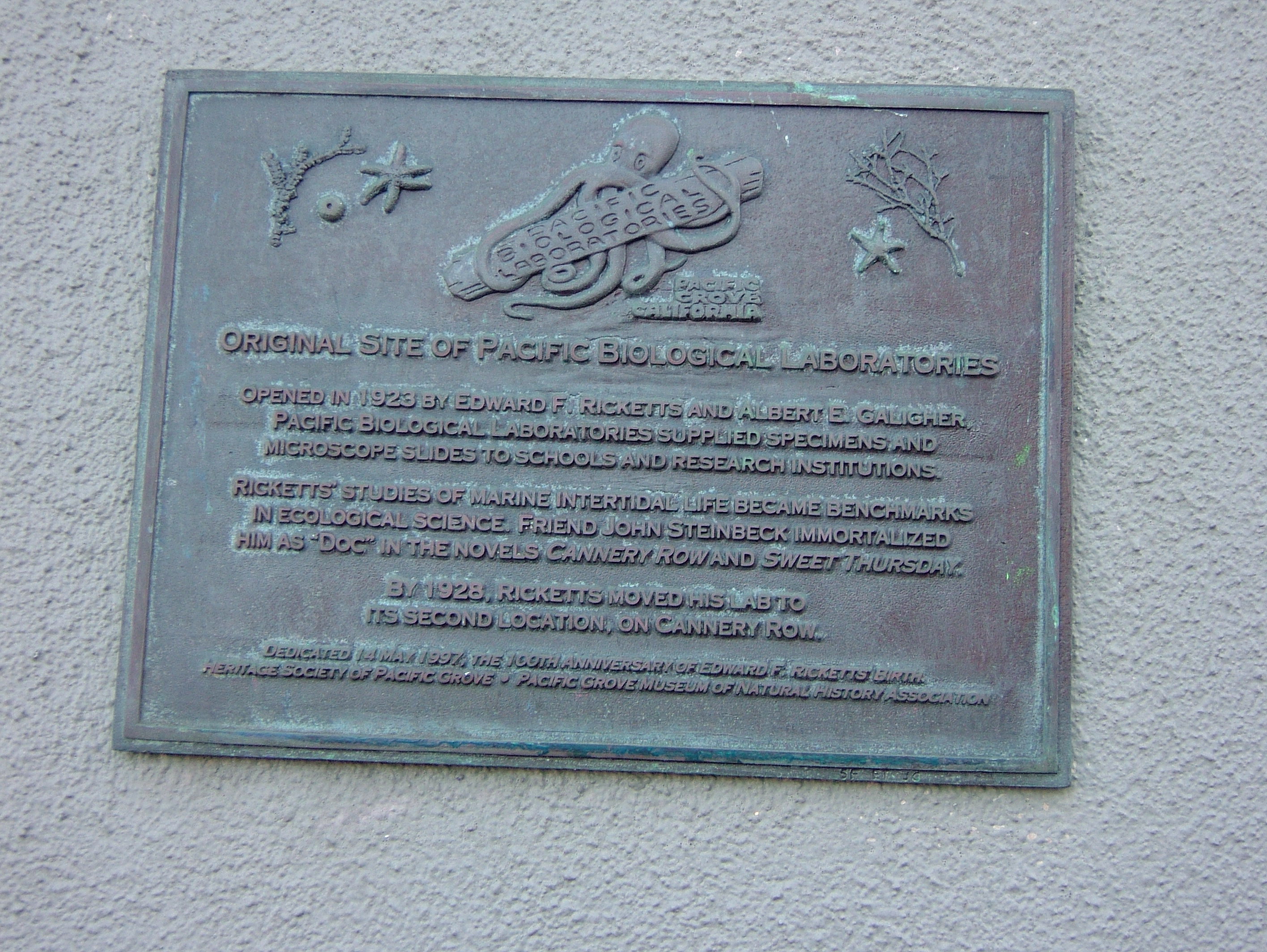
Pacific Biological Laboratories, Monterey
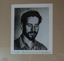


Ed Ricketts’ Pacific Biological Laboratories
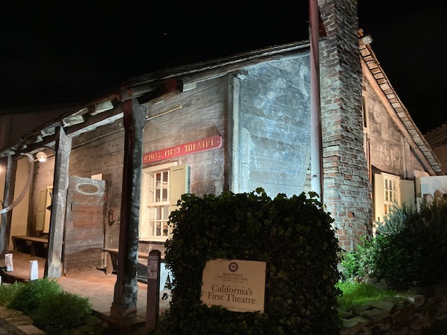
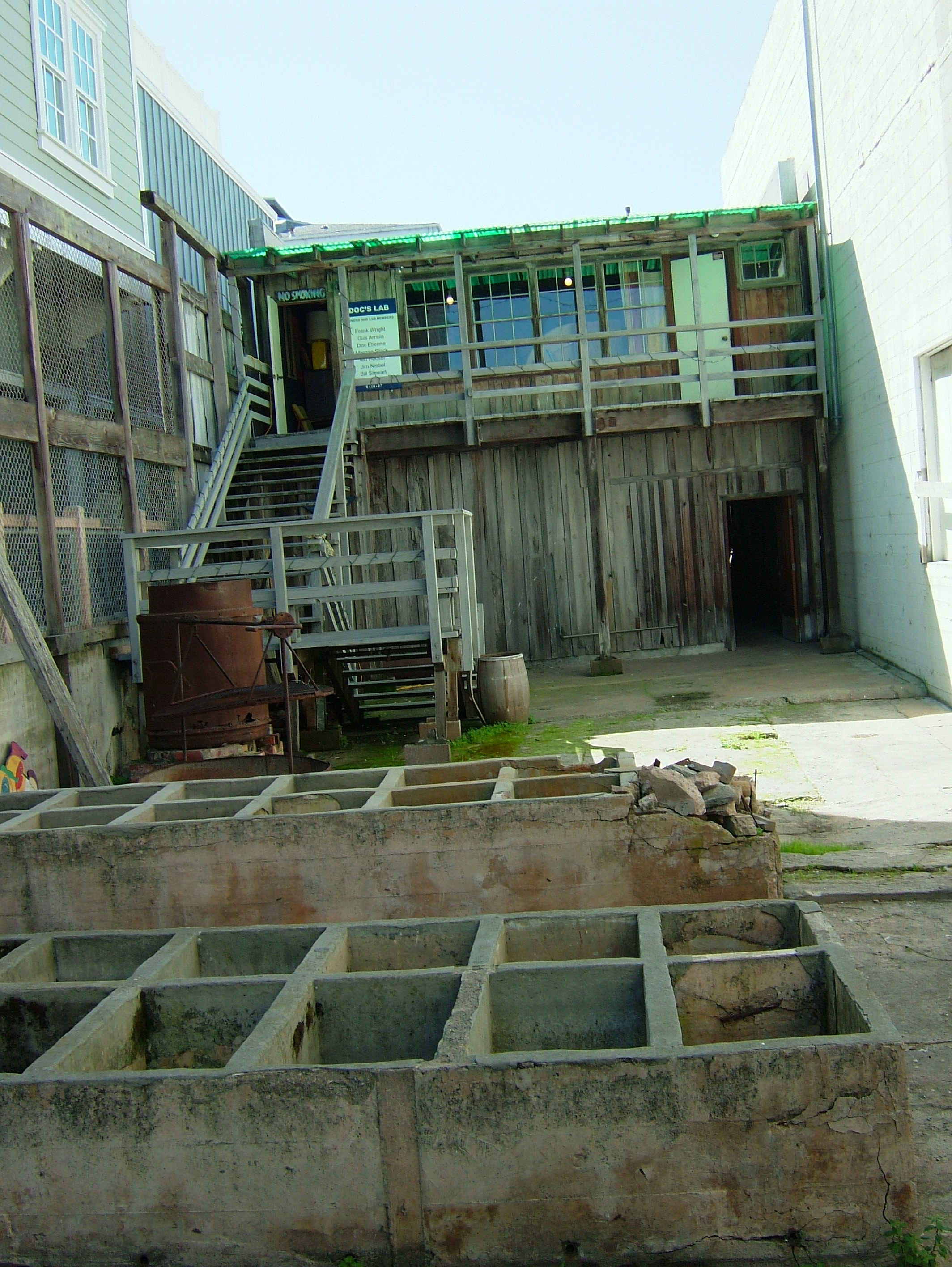
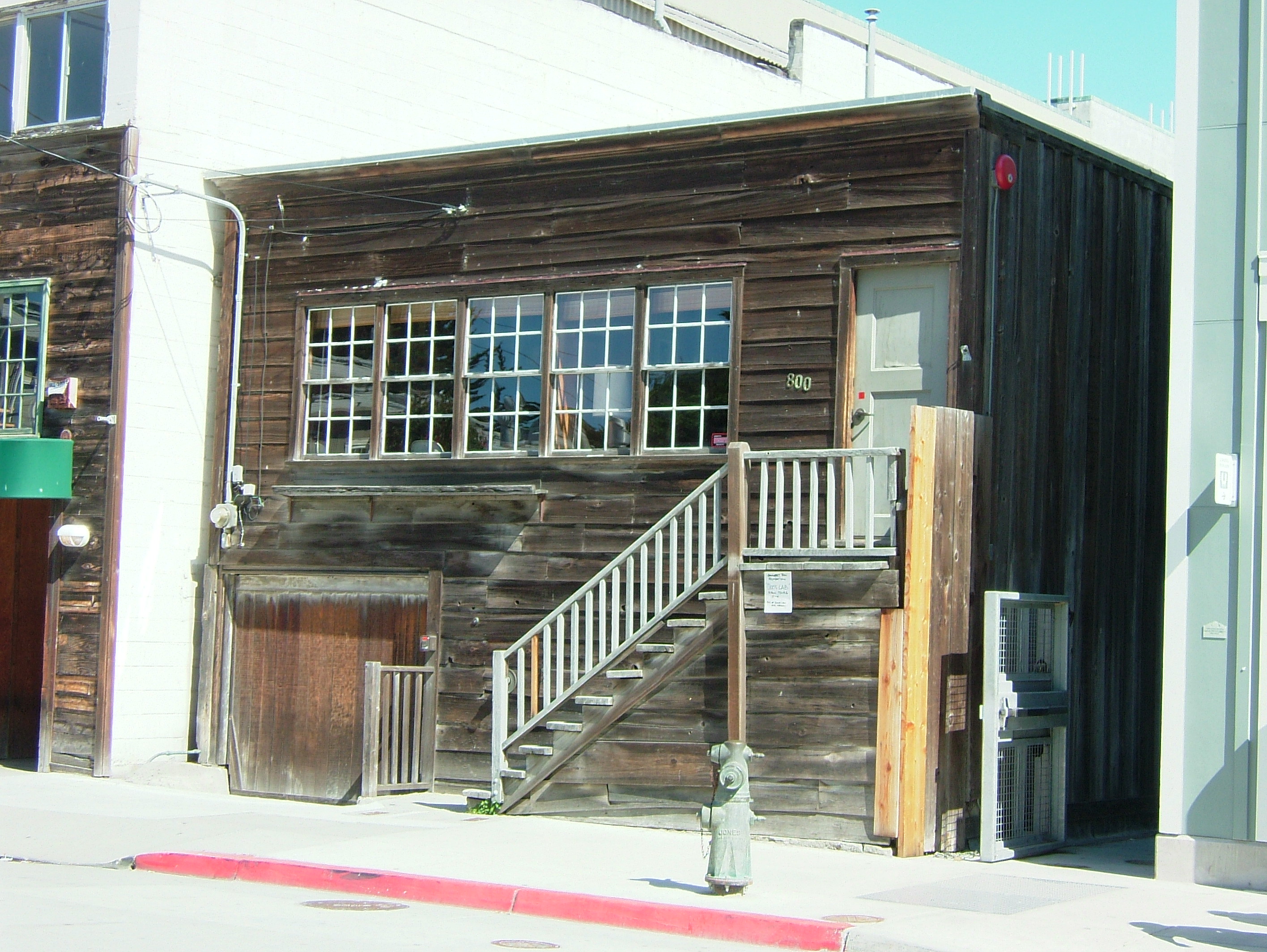
I thought I’d take a simple little trip to Monterey and write a neat little piece on the historic Pacific Biological Laboratories of Ed Ricketts – the place that inspired the creation of the Monterey Bay Aquarium, served as the center piece in John Steinbeck’s classic novel, Cannery Row, and has inspired multiple generations of marine biology lovers and professionals since the 1920’s. Days later I was still in a bittersweet fog.. like I had been thrown back in time myself. The era in which Ed Ricketts lived, where he lived, and how he lived his life holds a significant mystique that cannot be duplicated. What a time it must have been.
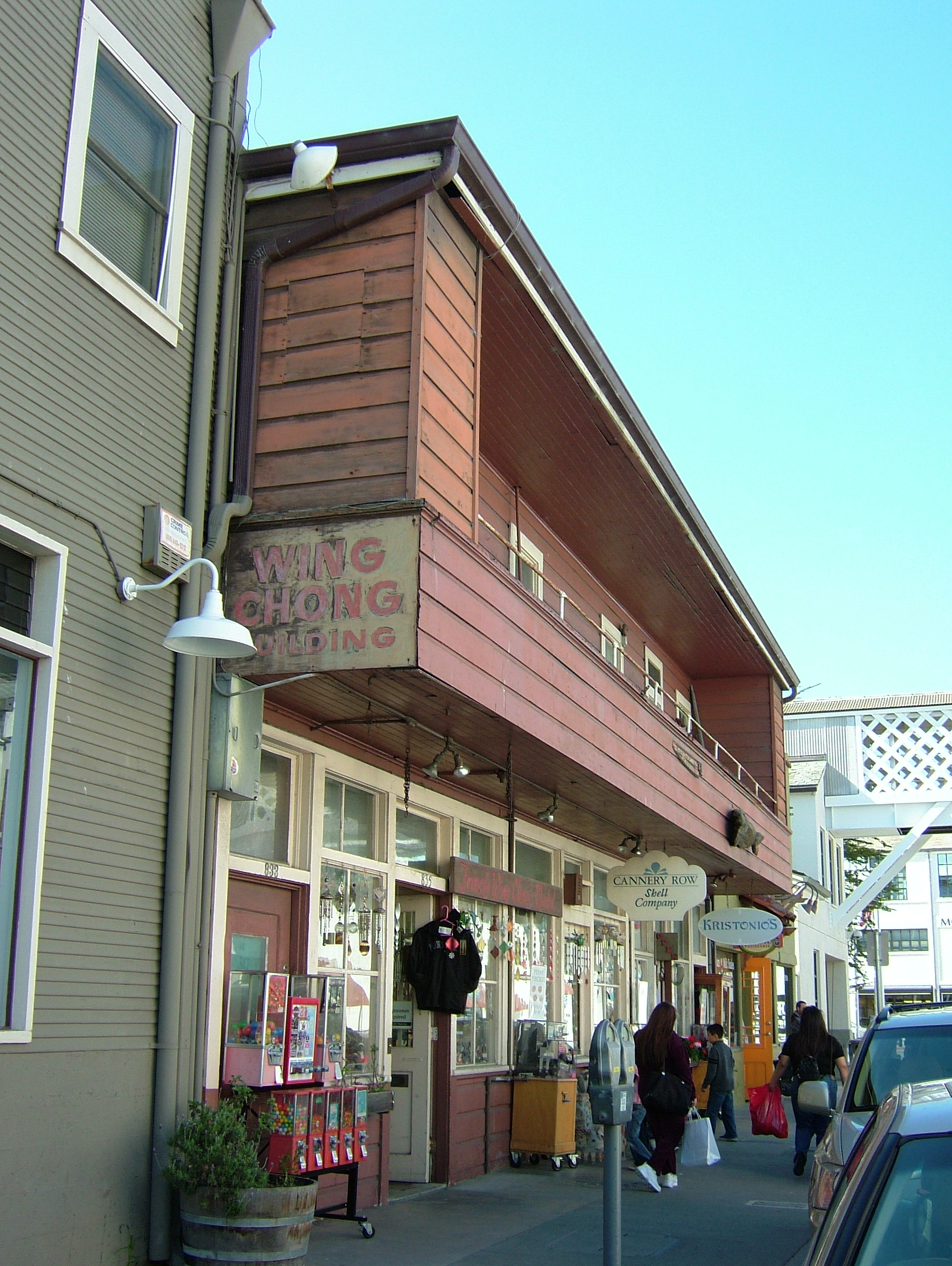
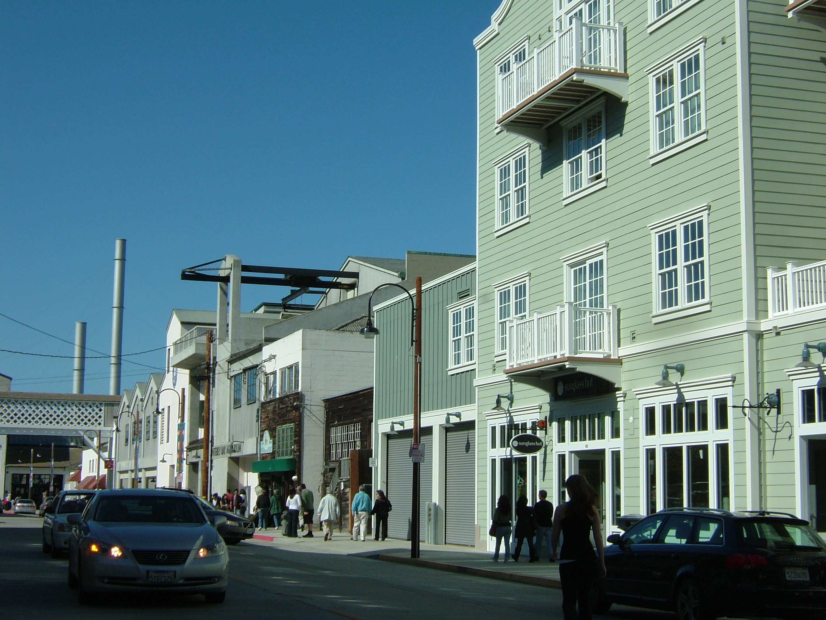
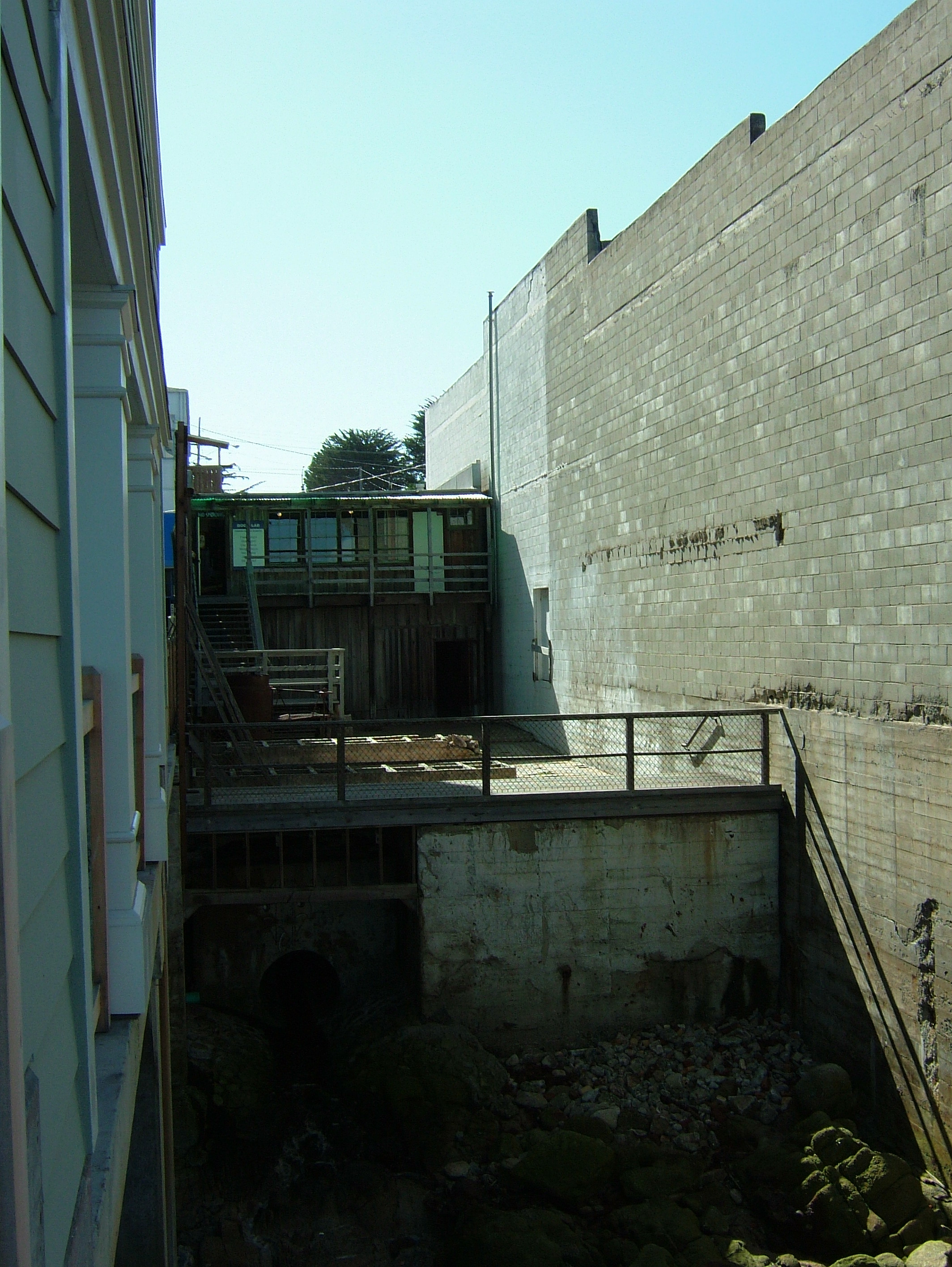
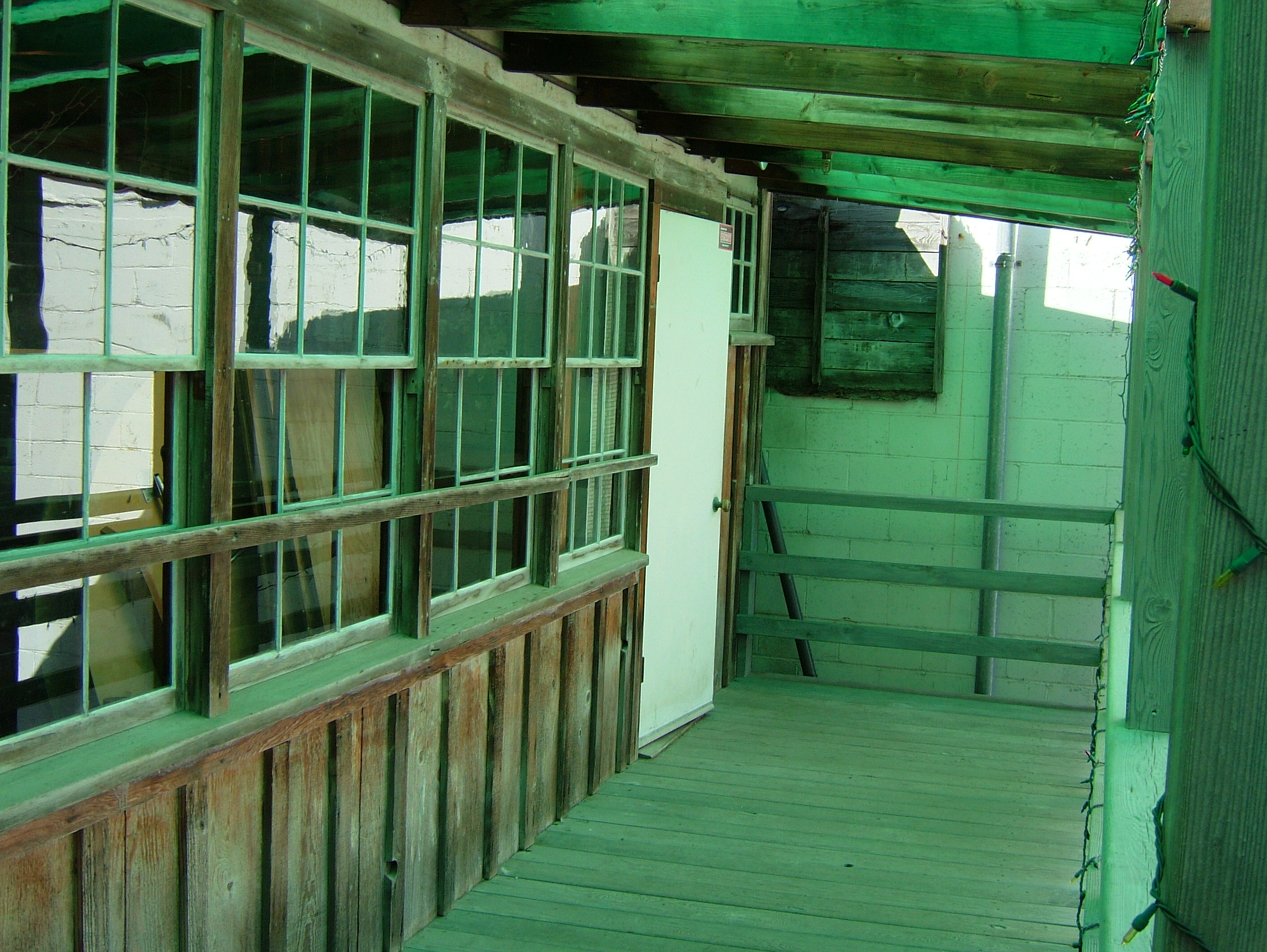
I didn’t expect to find the site of Pacific Biological Laboratories where it is: Front and center on the Cannery Row stage – squished between two massive ex-canneries (one now a luxury hotel) right at the water’s edge and practically adjoining the Monterey Bay Aquarium. I thought I’d find the lab up the hill in the old neighborhoods for some reason… I must have walked by it 10 times over the years in my visits to Monterey for meetings or to go to the aquarium. I parked the truck in the shade for my dog, fed the meter a zillion quarters, and jogged down the ragged east end of Cannery Row toward my destination. I wanted to make sure to catch the next hourly tour of the lab at noon. Open only once or twice a year to the public, in cooperation with the Cannery Row Foundation, Pacific Biological Laboratories is a hot commodity not easily acquired. I’ve been trying to find a way to see it for years, and now I finally will.
I swerve through throngs of tourists meandering Cannery Row on a sunny and crisp Saturday morning. There it is up ahead, in all its dwarfed and rustic beauty. I slow my approach to read a handwritten sign stapled below the stairwell advertising the hourly tours. No one is around so I better hurry in. I start to jog up the creaky wooden stairs toward the old front door, and it hits me. It feels like I’m walking on an exhibit, a fragile antique preserved in time. It shocks me that I’m allowed to do this, and I feel excited and lucky – like I should sneak so I don’t get kicked out. Must have been the sound and feel of that creaky step under my foot, and all at once it feels familiar and like I’m 60 years too late.
For a moment the street is quiet behind me – no one is around. No tourists on the wide sidewalk below, no cars crawling by looking for aquarium parking. The multi-paned windows of Ed Ricketts’ front room are above and to the left of me, weathered and set into the even more weathered dark wooden framing. The call of Western gulls echoes off the waterfront buildings around me. Behind me are the empty lots of weeds and cannery debris, the dirt roads, tree frogs singing in the road puddles, the sandy hills dotted with cabins and shanties, the black cypress and pine covered mountains as backdrop. The door is a few steps above me. There’s motion from the other side of the windows, and the knob begins to turn. Will he step out on to the tiny landing and invite me in? I see Ed clearly looking down at me.
Then the street is back. Not the canneries anymore but hotels, boutiques, and restaurants. There are no weedy lots or dirt roads. I knock tentatively on the door, and am greeted by a small group of friendly, mostly seated older folks who invite me in to sit and have a drink before the next tour gets going.
Most people interested in this stuff know that Ed Ricketts was far more than a biologist. He was a philosopher, a lover of music and art, a voracious reader, an explorer, quiet, kindly and focused, a legendary bohemian, caring friend to many, and frequent party host. His home/lab was a gathering place for like-minded friends and strangers. Joseph Campbell and John Steinbeck kept his company, as well as the local kids, drifters, fishermen, biologists and lady friends.
Ed had a succession of three marine biology labs in the Monterey area. The first opened in 1923 in Pacific Grove, then two at the same location on Cannery Row. The first at the Cannery Row location burnt down in 1936, and Ed never fully recovered financially from the great loss of personal and professional items. He escaped the blaze (which started in and consumed the canneries around him) with his typewriter, a portrait of himself, his pants, and his car. All else lost: art, music, household items, equipment, his specimens which were his livelihood, and his extensive and beloved library.
What was saved from the fire, however, was the manuscript for Between Pacific Tides – which would become the timeless intertidal bible of the west coast, encapsulating Ed’s life work of shoreline exploration along the west coast. The manuscript was saved because it lingered at Stanford University Press as they dragged their heels in publishing a work by an author who had left college early and had no degree to show for his name. But eventually publish it they did, and word has it that it is still the most popular marine textbook produced by Stanford. A true classic.
Ed preserved marine specimens, as well as cat skeletons and frogs for high school and college biology classroom use in schools across the Country. This is how he squeaked out a living through the depression and beyond. Ed’s non-stop collecting and cataloguing of intertidal marine life in California extended to collecting trips in Alaska and Mexico as well. He endeavored to complete catalogues of the intertidal ecosystems of much of the west coast of North America. With the completion of such a body of work, Ed Ricketts would have been known as the undisputed pioneer of western marine biology he so deserved. This work was cut short by his death in 1948 when his car was struck by a train as he crossed the tracks near his home in Monterey.
Although a great help in making his work known to popular audiences, the likeness of Ed Ricketts as “Doc” in Cannery Row was only a “thin veneer of the complicated man Ed Ricketts was”, as one of the knowledgeable and engaging docents on the lab tour put it. Cannery Row, written as a tribute to Ed Ricketts whom Steinbeck held in high reverence, has, as it turned out, overshadowed Ed’s considerable scientific accomplishments.
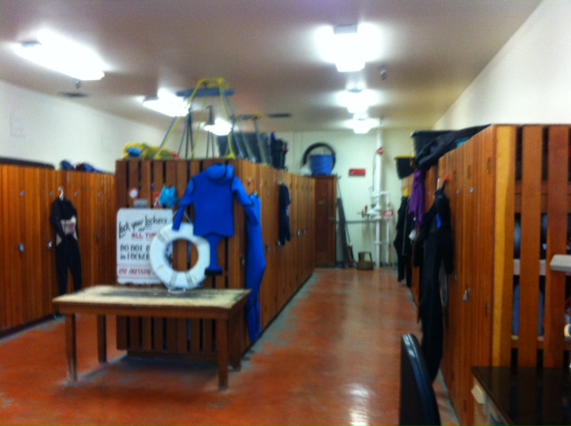
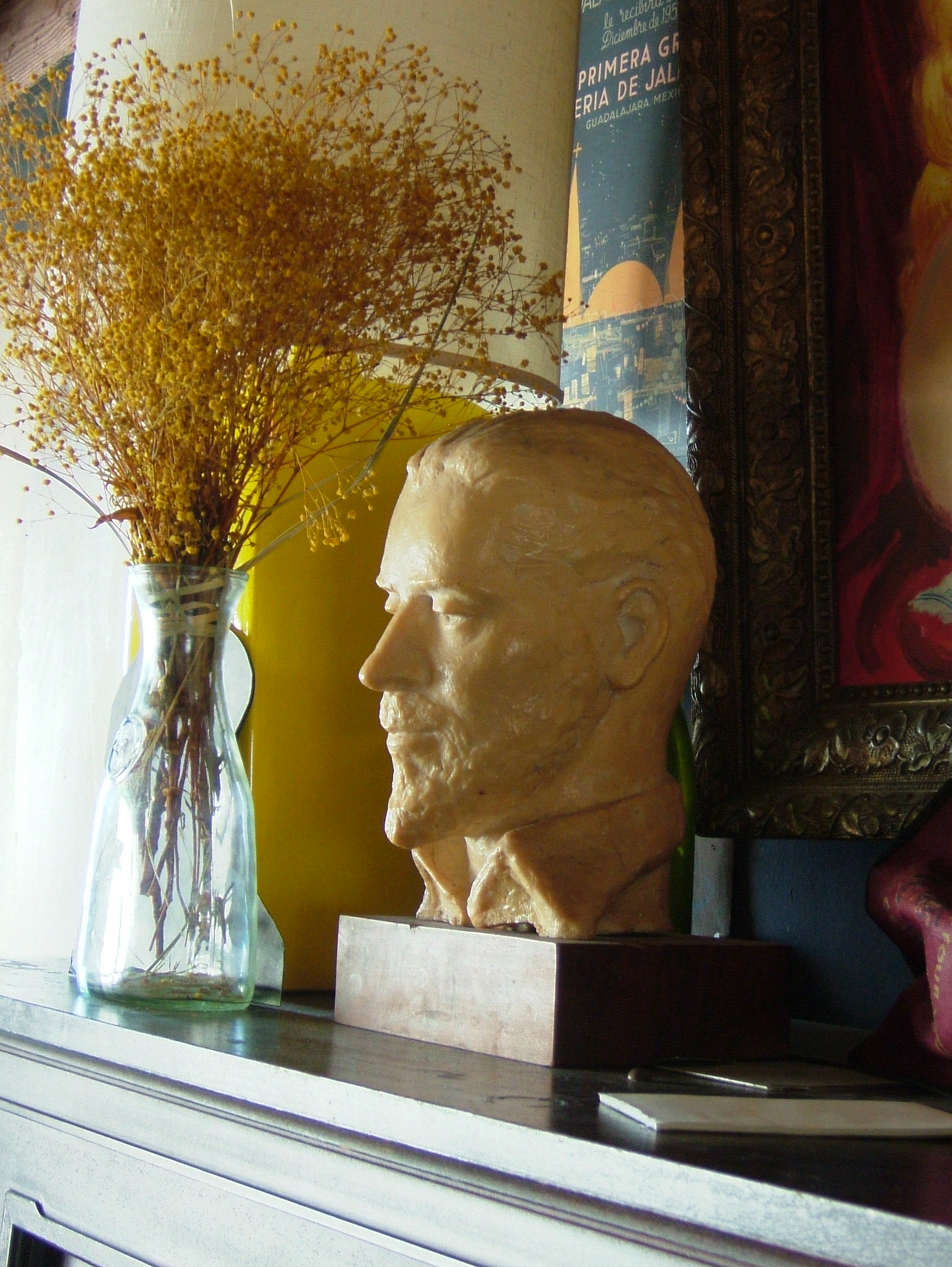
I entered the lab and began to absorb the surroundings. In honor of Ed I took up the offer for a drink, and engaged in red wine for breakfast. I looked around and chatted with the group of colorful local authors, historians and archivists who have made it their passion to research and tell the tale of Ed Ricketts and the real Cannery Row to lucky interested parties such as myself. The place is dark but inviting, and felt somewhat like a small drafty barn with windows. It is barren of hominess and one can see right through the lab from the front sunlit living room strait out the back to Monterey Bay. None of Ed’s furnishings remain, and since his passing the walls dividing the tiny rooms he used in his office/living quarters have been removed to create two main common rooms upstairs.
There have been a few owners of the building since Ed died 1948, but all have cared for the lab in his honor, and preserved it as best they could. Since the 1950’s the lab has been owned by a group of businessmen and artists who formed a “gentlemen’s club”, which meets regularly at the site mostly for social events. What remains in the building are artifacts of this club: books, an old record player, a bar built in the back room, a piano, artwork, and some reproductions of portraits of Ed Ricketts on the walls. One notable artifact of the men’s club is a collage in the front room decorating the entire western wall comprised of photos of jazz musicians, sexy actresses of the day such as Sophia Loren, a young Fidel Castro, local characters of Monterey and the men’s club, and prints of modern art.
Beneath this wall once sat Ed Ricketts bed, and his library shelves. The patched hole low in the wall where Ed’s potbelly woodstove once stood close to his bed, remains. On this western wall Ed had hung a paper timeline on which he invited anyone to list historic facts of significance in the arts, sciences, philosophy, and civilization throughout time which they had learned. No one knows what became of that paper timeline or much else of Ed’s belongings after he died. Understandably, friends and family took bits and pieces of Ed to remember him by until nothing was left here – Only the skeleton of his concrete specimen tank system out back, some extra large ceramic mason jars in the lab below, and the floors we stood on. If those floors could talk.
Some of Ed’s marine specimens are reported to be at various museums and academic institutions around the San Francisco Bay Area. The Gentlemen’s club has deeded the building to the City of Monterey, and when the last of the few remaining members of the club move-on, the city will take up full ownership of this great place. It remains to be seen what the plan is for the building: One hope is for a renovation to restore the lab as it once was when Ed Ricketts worked and lived there – a replica open to the public to preserve his memory and legacy.
I easily return there to the bustling lab of the 20’s, 30’s, and 40’s, and the streets and the life of Monterey’s working waterfront. Watching Ed work and talk and host. Similarities in my own life bring me there. I grew up in a place, time, and community like Cannery Row.. there was even an old marine lab that inspired a community of kids, students, and philosophers. But nothing really compares to Ricketts’ lab and Cannery Row in old Monterey.
Recommended Reading:
Renaissance Man of Cannery Row – The Life and Letters of Edward F. Ricketts, edited by Katharine Rodger
Between Pacific Tides – Edward F. Ricketts and Jack Calvin
Beyond the Outer Shores – Eric Enno Tamm
The Log from the Sea of Cortez – John Steinbeck
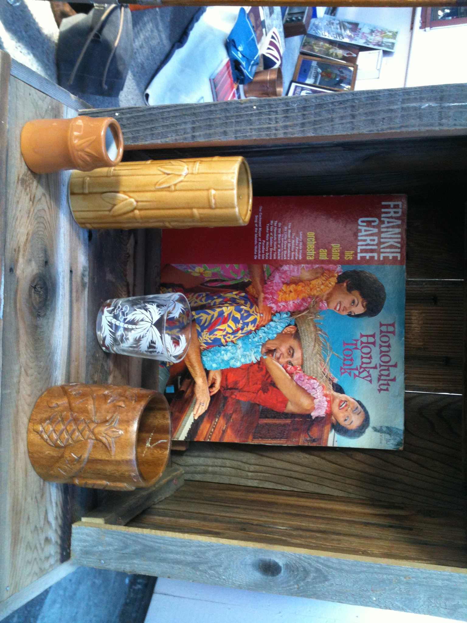
Photo Album – Marine Life
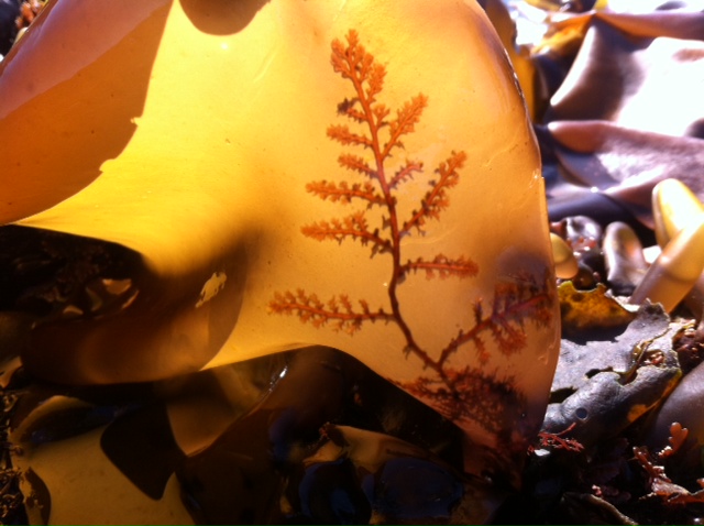

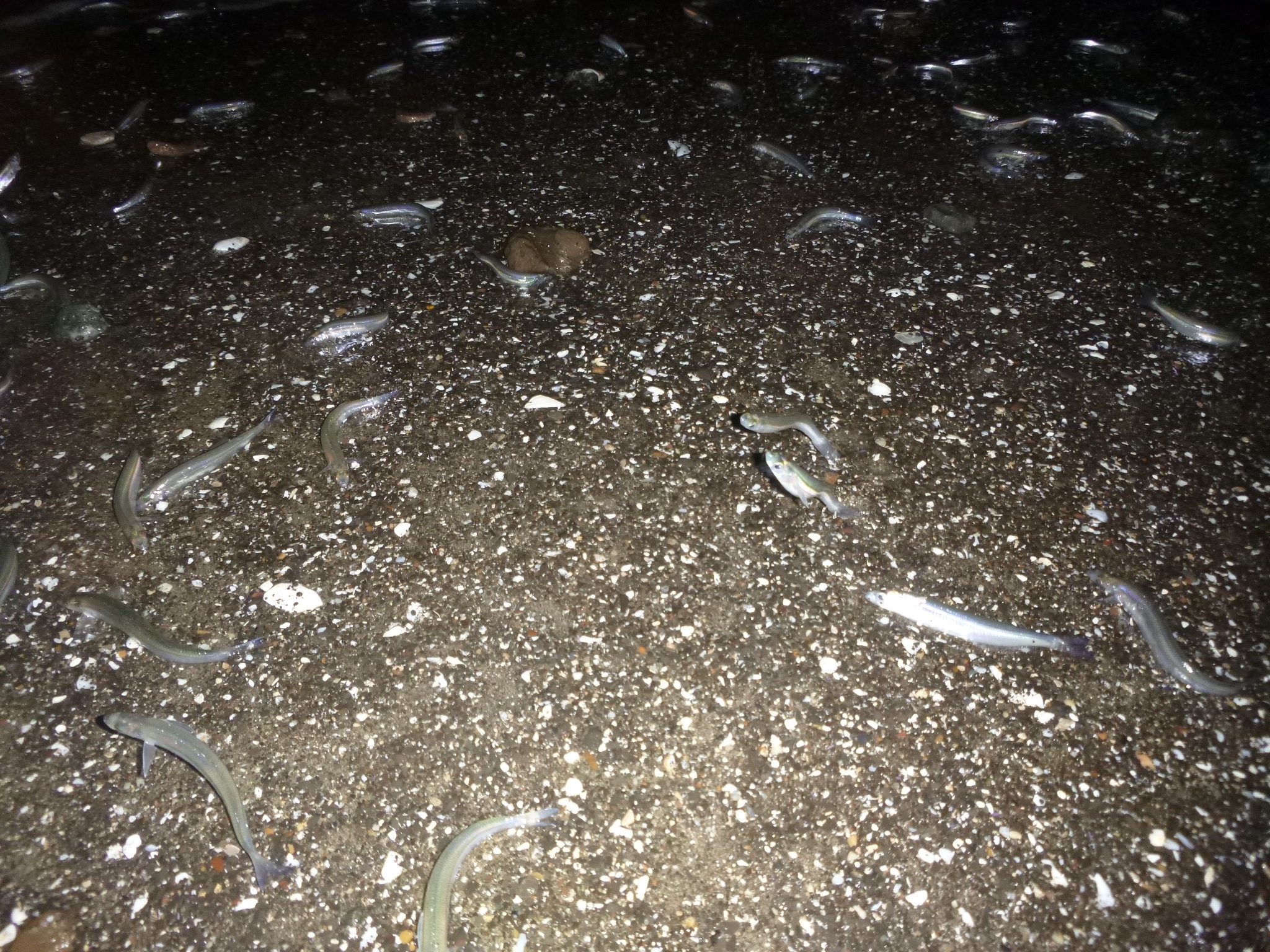


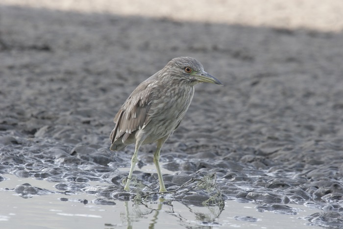
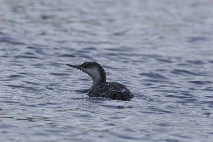


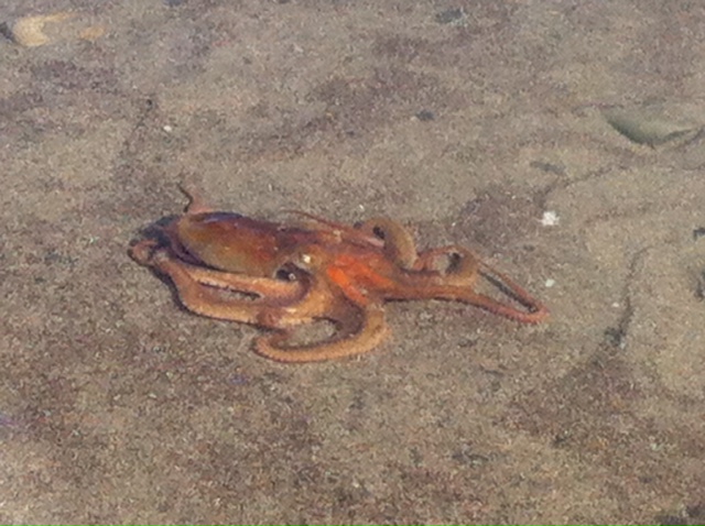


wordpress template won’t let me put captions on this gallery.. A bunch of random marine life mostly from central CA coast, Gulf of the Farallones, Bolinas Lagoon, etc. Including a scooting Red octopus, new moon Grunion run on Bolinas Beach, Guadalupe fur seal, Night heron, etc
Bolinas Marine Lab

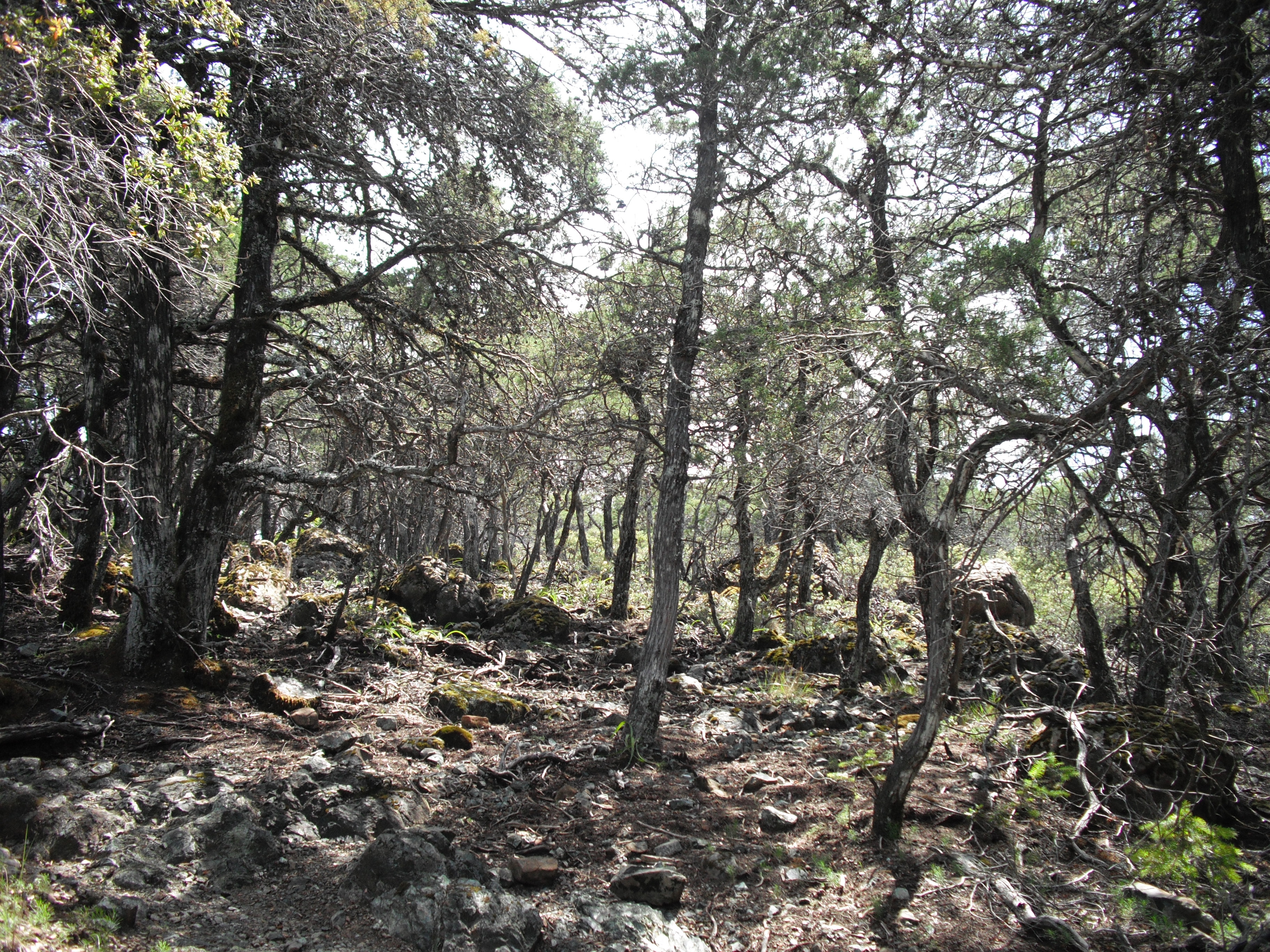
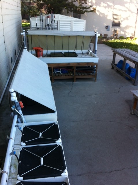
To those with the ocean bug, marine biology labs are more than just classrooms and workshops – they are treasure chests, enticing in their mystique, exciting and abounding with odd possibilities. The sounds of the pumps and rushing water, the humming tanks, the elaborate work stations and sinks, the posters on the walls of exaggerated and colorful marine life you could only imagine seeing in the flesh, the cool air, salty smells and wet floors, the artifacts of the beach rack and old seaside dump sites decorating the window sills and high shelves. There are many fine marine labs along the California coast, several affiliated with prestigious academic institutions such as the UC Davis Bodega Marine Lab, The Romberg Tiburon Center affiliated with San Francisco State University, and the UC Santa Cruz Long Marine Lab. Here I will be focusing on two smaller labs – both of extreme historic significance, unique character and mystique, and both served to influence and change the lives of many kids, students, and visitors in similar magic ways.
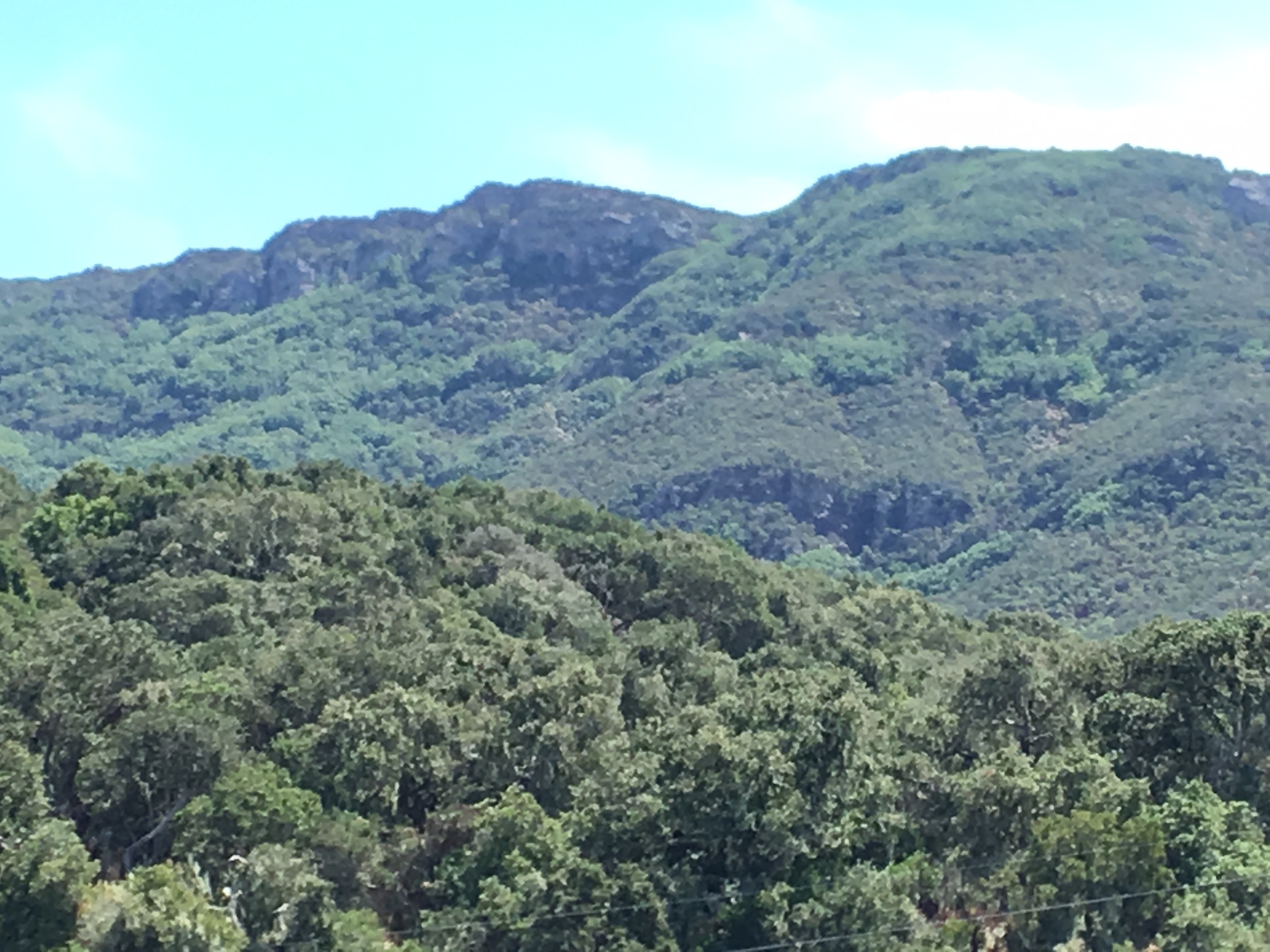
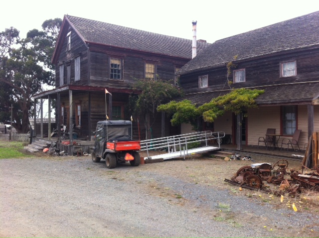
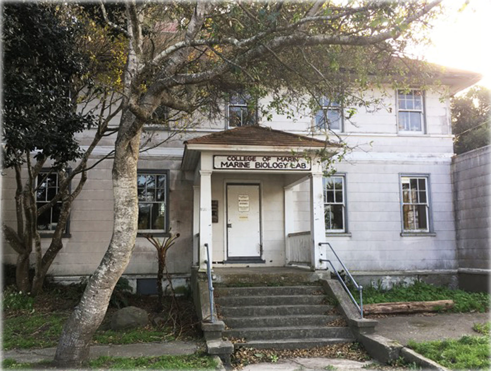
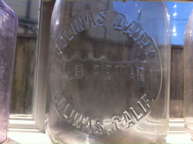
When I was a kid growing up in Bolinas in the 1970’s there was a marine lab on the waterfront filled with all of the above. A large antique and official looking building – something unusual in this small coastal agrarian and hippy town – The College of Marin’s Bolinas Marine Lab lured us in as kids time and again. There always seemed to be someone knowledgeable and cool around the lab to let us in, show us the bubbling tanks and specimen jars, and allow us to generally run around and explore the lab and yard. The waters of the Bolinas Lagoon lapped under the dock across the street, kingfishers cried from the overhanging oak trees on the close hill above and behind the buildings, someone would skate by to discuss a fossil found on the beach, or joke about the surf on their way to the neighboring surf shop to repair a dinged board. We’d run in with fossil sand dollars, sea glass, “sightings” of imagined biota in the wide rushing lagoon channel or off the beach down the street. I thought every kid had a marine lab in their town to run around in.. it was natural and something we always looked forward to. Well, as it turns out this was not the norm for childhood experiences, and we were lucky – as have been the hundreds of college students, staff and visitors to this great facility.
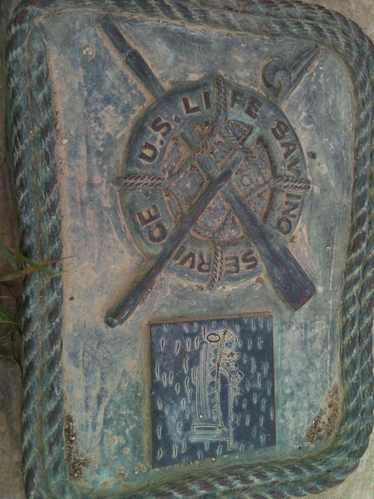
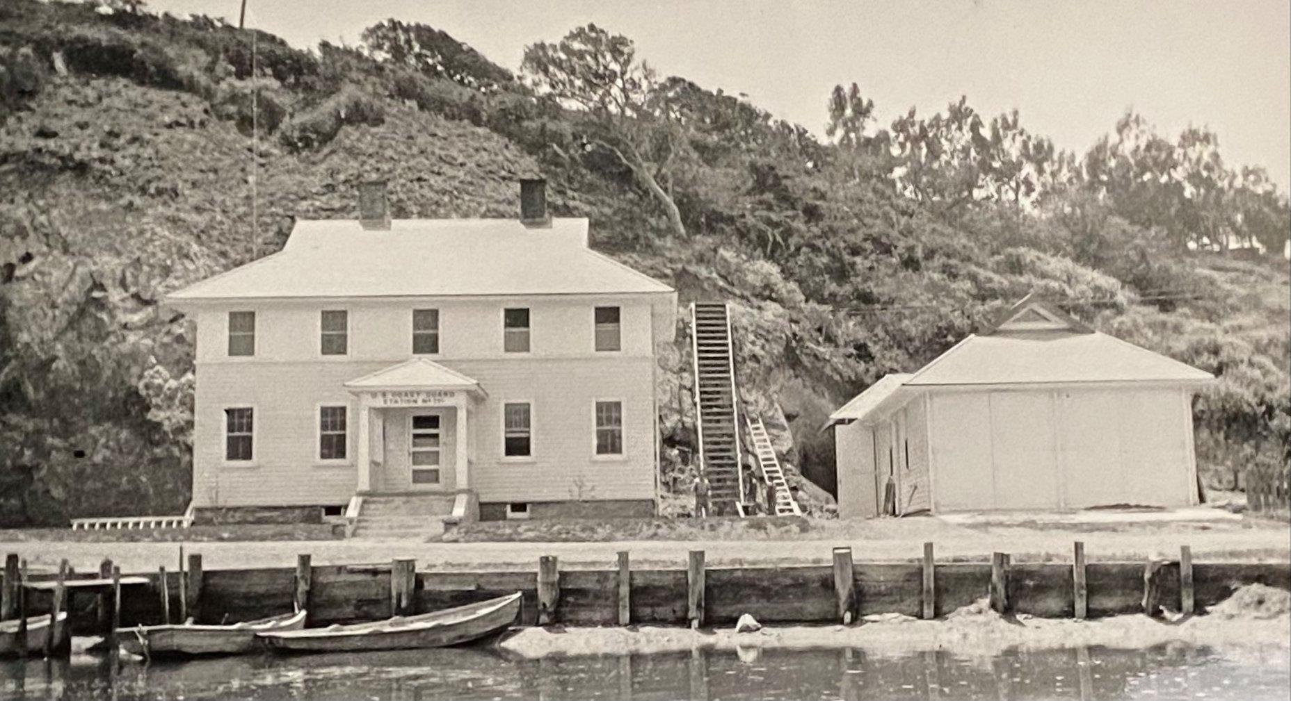
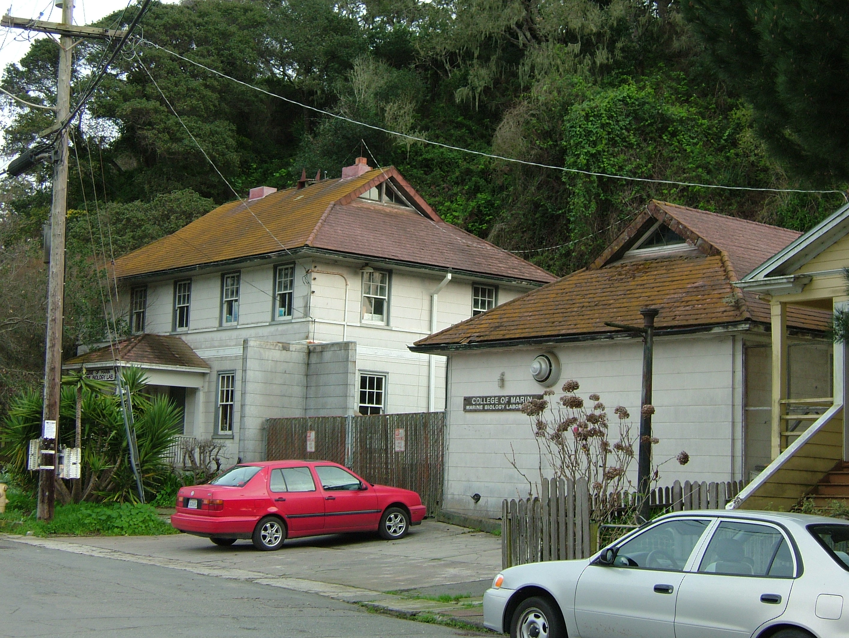
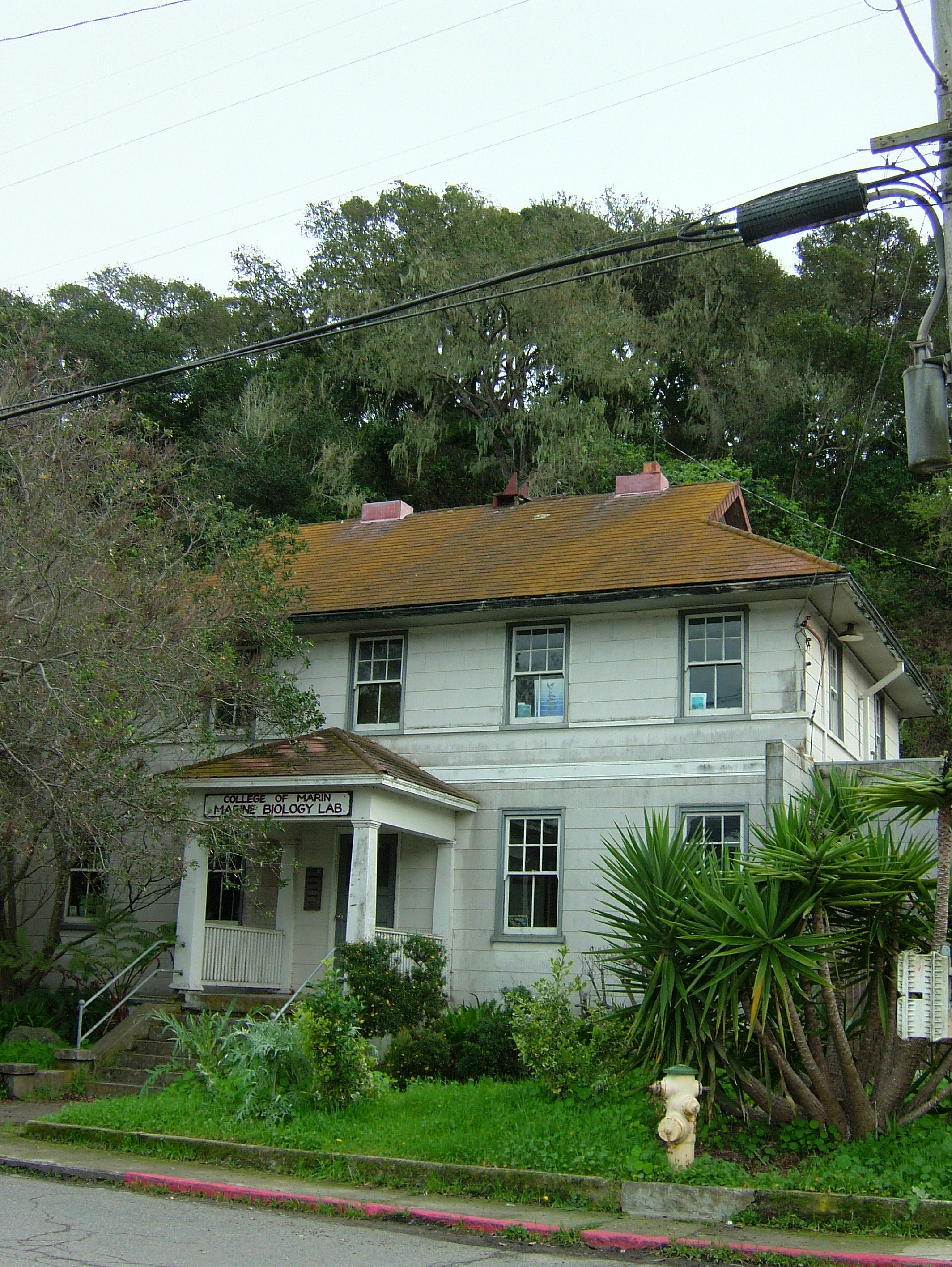
The buildings that house the Bolinas Marine Lab and offices were built alongside a sheltered harbor near the mouth of the Bolinas Lagoon in 1914, as the Bolinas Bay Lifeboat Station. The lifeboat men of that era rank near the top for holding one of the all-time most dangerous marine jobs: Assigned with rowing large open sea-worthy skiffs out to particularly treacherous locations known for shipwrecks, in order to save as many lives possible amidst the chaos and dangers of sinking or grounded vessels. Duxbury reef was one of these sites, with a long list of lost ships and passengers to its name – including its namesake. The Lifeboat Station had two lookout towers on the neighboring hills in town, where they monitored for ship groundings on the mammoth Duxbury Reef, with its most prominent reef feature running north/south approximately, and over a mile out into the ocean from Bolinas Point.
The Lifesaving Service morphed into the U.S. Coast Guard over time, and when the Coast Guard left the town of Bolinas in the 1950’s, the old lifeboat station was turned over to the Marin Junior College in an inter-governmental transfer. The college soon converted it to a marine biology lab and education center, and it thrived as such for over thirty years. Recently viewed as expensive to maintain and a liability to public safety by the college, the historic buildings have fallen into disrepair and neglect.
There are only a handful of the historic lifesaving stations left in the U.S., and the Bolinas facility is one of them. Ralph Shanks, Maritime Historian, identifies the Bolinas Marine Lab facilities as “One of the most historically significant maritime buildings on the American coast”. The significance of these buildings is such that they easily could qualify for national or state historic site status.
In the past this facility had so touched the lives of several College of Marin staff, that some personally took it upon themselves to keep the lab and facilities up and running for students – inspiring a new generation of marine biologists and conservationists. The fight to maintain and use the facilities hadbecome too great for any individual or handful of staff to keep up with alone. Under Measure C – the College of Marin Facilities and Modernization Program, consultants were hired to assess the safety of the lab and buildings and the cost of modernization. The findings and assessment were daunting, if overblown. Where as real concerns for structural integrity and environmental hazards in such old building are warranted, these could be more realistically remedied than the natural disaster issues sited, such as possible un-detected earthquake fault lines under the buildings, and fears of loss and damage in the event of a tsunami. Many people including College of Marin staff, students past and present, and community members rallied in the face of the real threat that College of Marin would sell the historic buildings to private interests. These concerned groups succeeded in saving the lab as an educational institution for future generations of marine students. Unfortunately the buildings were demolished in 2021 due to overwhelming structural issues, but a new lab will be built in its place.
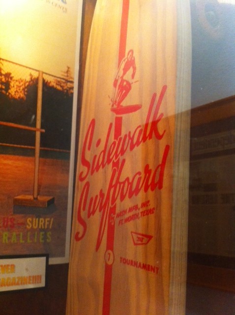
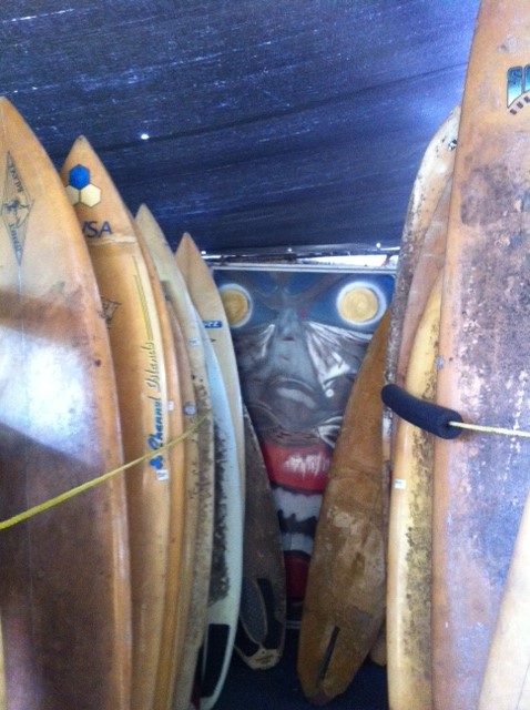
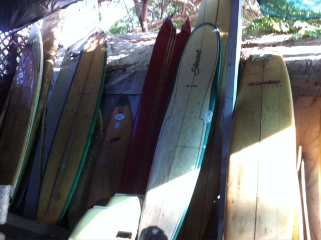
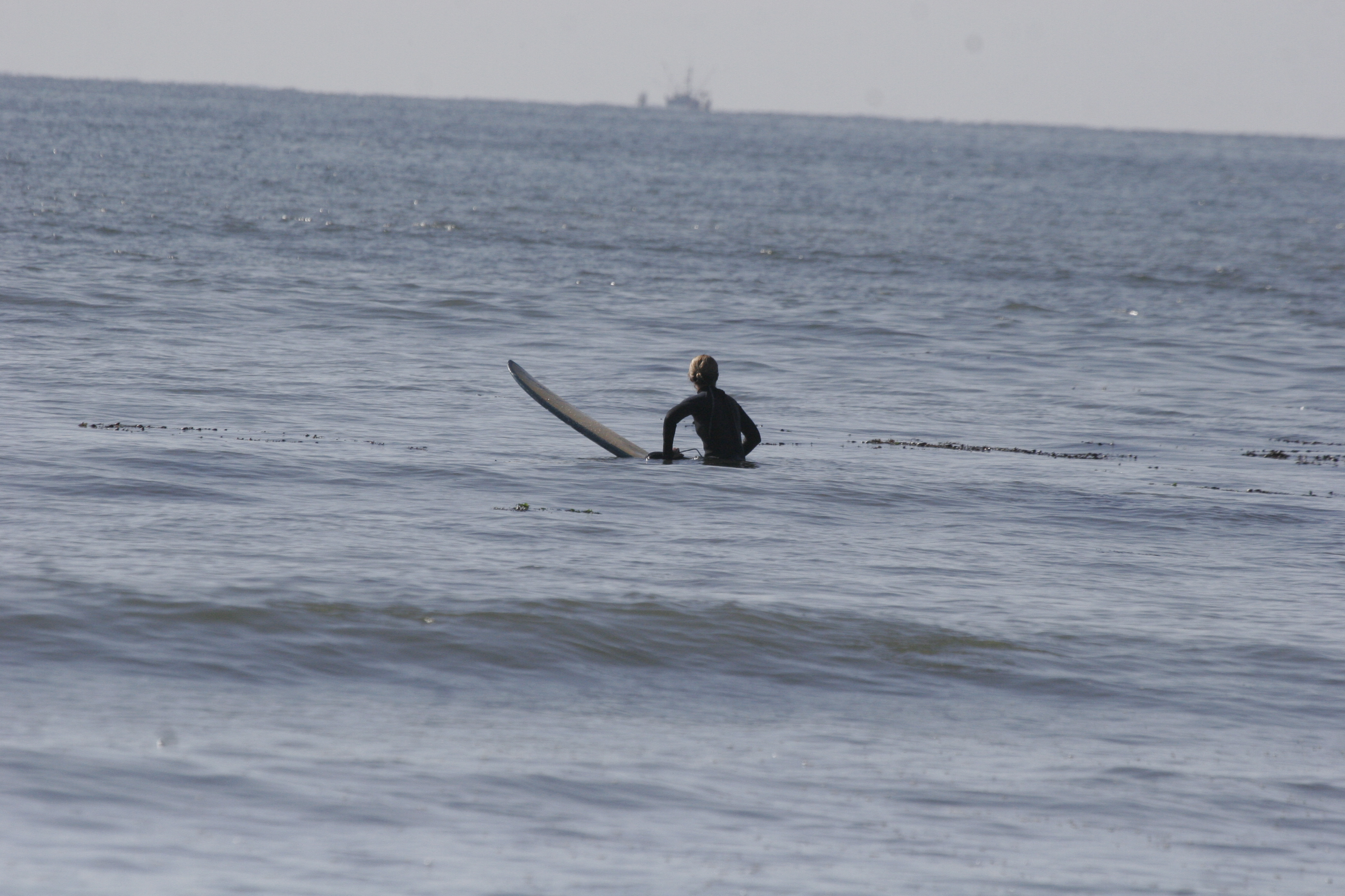
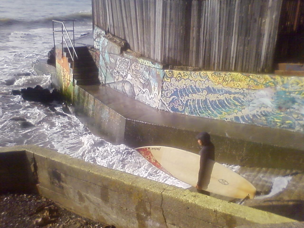
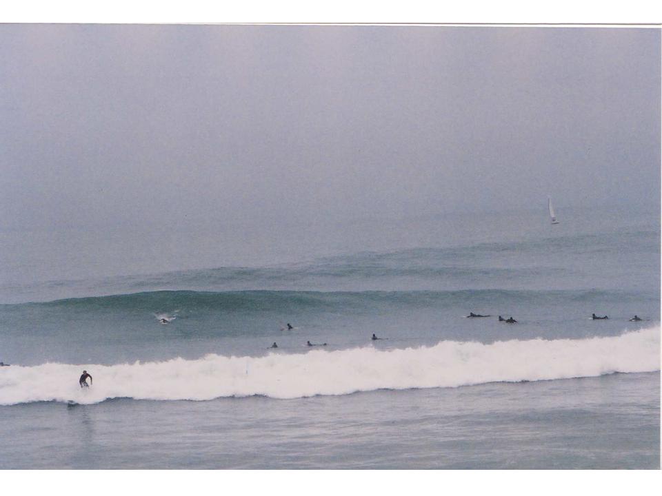
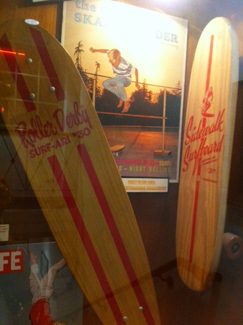
Photo Album – Surf


Discovering a New Species of Seabird in the Pacific
Peter Bryan Pyle
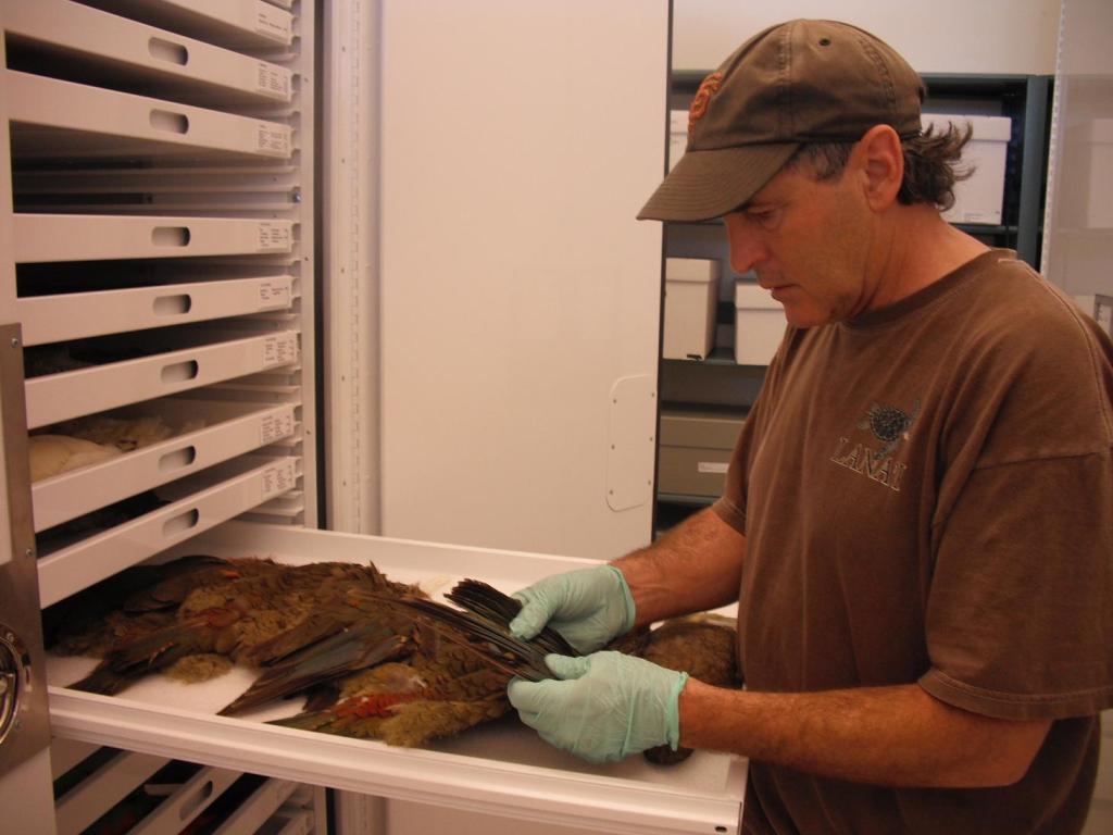

I had thought my best chance of discovering a new species of bird came and went during the late 1970s and early 1980s, when I worked on the Hawaii Forest Bird Survey. During this survey we slogged our way to very remote cloud forests that had never been adequately surveyed for birds. Less than a decade previous a surprising and distinct new species had been found on Maui, the Po’ouli, and our coverage of the tract where the Po’ouli was found, along with many similar unexplored tracts throughout Hawaii, was far more thorough than had ever occurred. During the survey we found some surprising new range extensions and a few species thought perhaps to be gone (and which probably are gone now) but, alas, no new species, despite intense due diligence. It appeared that the last frontiers for discovering new bird species were the very remote forests of South America and Southeast Asia, with discovery involving large and time-consuming expeditions. My career was taking me in other directions so it seemed I had lost my opportunity to discover a new bird.
One direction I took was the study of bird molt, and this required hours and hours of focused work in museum collections, examining 10’s of 1000’s of bird specimens. Most would consider this very tedious work, but I reveled in the discovery of any new tidbit about molt not previously known. The audience that shares my enthusiasm for these tidbits is next to non-existent, however, not quite the same as that enthused by a new species or, even, rumored rediscovery of one that was thought extinct (see Ivory-billed Woodpecker). Like pelagic trips to observe birds at sea, some days in the collections are better than others, and I was lucky to have a good day in August 2004 at the U.S. National Museum (USNM) in Washington, D.C.
Steve Howell and I were there for a week catching up on numerous projects of interest, including molt in water birds such as gulls and alcids and, for me, examination of some specimens that had been collected in Hawaii. I was helping my father with a monograph on the birds of the Hawaiian Islands, now on line, and one of my goals was to try to identify the subspecies of all migrant birds that had been recorded in the islands.
In February 1963 a small shearwater was collected on Midway Atoll in the Northwestern Hawaiian Islands, identified as a Little Shearwater, given USNM specimen # 492974, and put in a dark drawer where it was left alone for over 40 years. There are five subspecies of Little Shearwaters that breed in cold regions of the south Pacific, and although the Midway specimen had, in 1968, been tentatively identified as the nominate (first described) subspecies from Norfolk Island, I wanted to confirm this against subsequent published information and to take some digital images of it for the monograph. But after a moment or two comparing it with other specimens of Little Shearwater at the museum, I was convinced that it was not the nominate subspecies of Little Shearwater and in fact was not even a Little Shearwater. But what was it?
Some of the specimen’s features were more like Audubon’s than Little Shearwater but it was too small for any of the Audubon’s Shearwater subspecies, and in fact appeared to be smaller than any other shearwater species. The closest contender was Boyd’s Shearwater, which breeds in the Azore Islands of the north Atlantic and also has characteristics in between Little and Audubon’s, so much so that ornithologists had considered a subspecies of each about half the time. The specimen did not quite fit Boyd’s either, however, and it would be very unusual to have a north Atlantic species occur on Midway. I suspected then that it might be an un-described subspecies or species, but knew that it would take more than just measurements and photographs of it to confirm this.
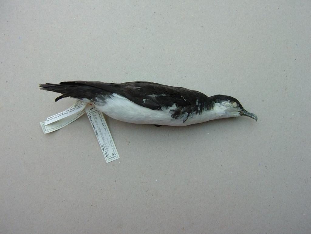
I ran all of this by Steve and USNM researcher Storrs Olson, who was studying small shearwaters including Boyd’s at the time, and Storrs suggested I examine its DNA to see if this could help place it. Thanks to Rob Fleischer and Andreanna Welch we eventually were able to compare DNA from the specimen with that of most other small shearwaters and indeed it proved to be more closely related to Newell’s Shearwater of Hawaii than Little or Boyd’s shearwaters and therefore was, in fact, a new species of bird. So I ended up getting my new species “the easy way” as those slogging the forests of South America might say, to which I respond that they should try spending 1000’s of hours in museum collections and see how easy it really is!
I got the opportunity to name the new species after my grandfather, Edwin Horace Bryan, and so it becomes “Bryan’s Sheawater (Puffinus bryani).” The big questions now are where does it breed and how can we conserve it? Another Bryan’s Shearwater was found calling in a rock crevice on Sand Island, Midway Atoll, in December 1991 and tape recorded. These Bryan’s Shearwaters may have been “prospectors” to Midway from other colonies, like the individual Short-tailed Albatrosses that visit Midway from colonies off Japan. It is also possible that Bryan’s Shearwaters bred undetected on Midway before rats were introduced there during World War II. Based on the timing of the records the species appears to breed in winter, and bird surveys there prior to the war were concentrated during spring and summer, so it could have been missed. Through the use of play-back recordings and decoys the U.S. Fish and Wildlife coaxed a pair of prospecting Short-tailed Albatrosses to nest and successfully fledge a chick on Midway for the first time during 2010-2011. And so the search now is on, to find where Bryan’s Shearwaters breed and, perhaps, to use recording of the 1991 bird to coax some back to Midway, to start a new colony now that the rats have been removed.
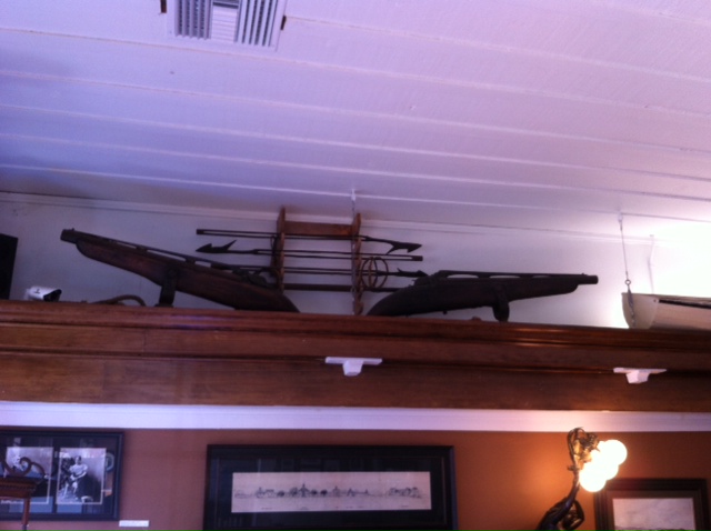
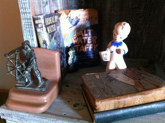
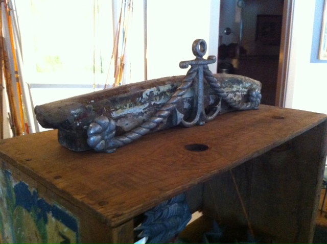
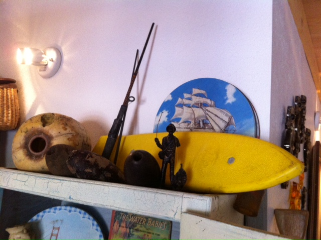
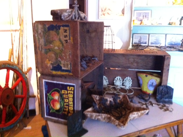
Photo Album – Vintage

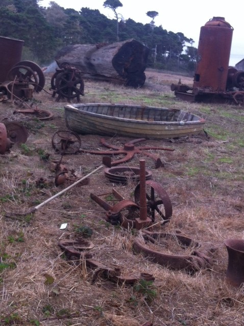


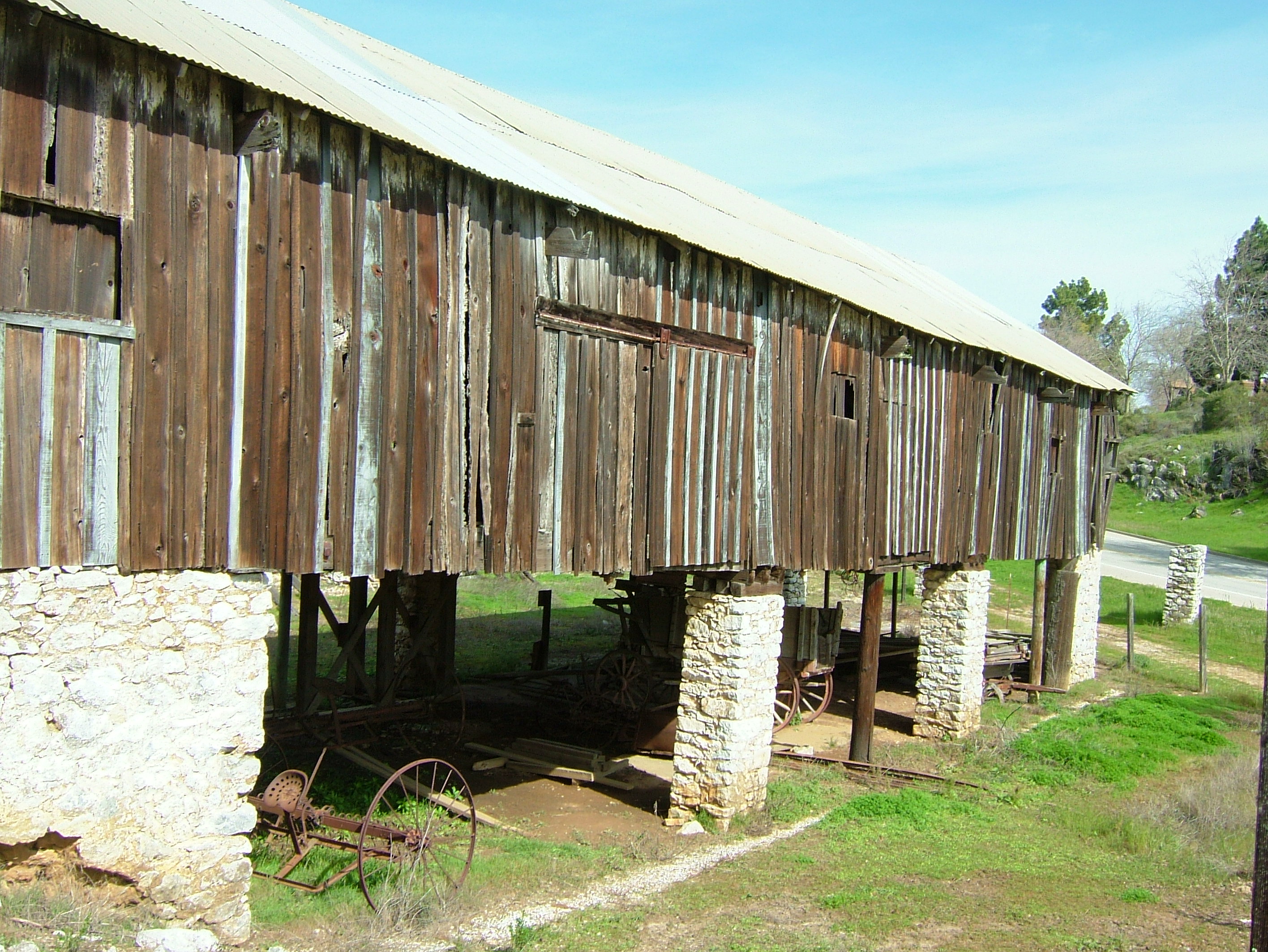
California’s Shore Whaling Stations – Excerpts from the National Archives
History of the Shore Whaling Station
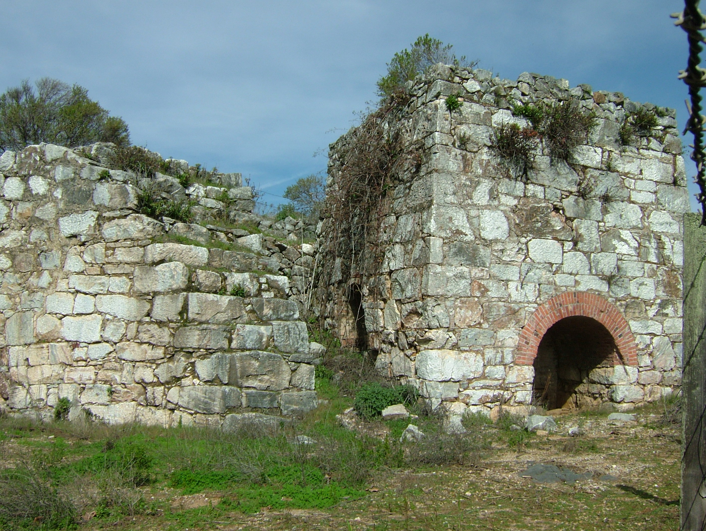
Shore whaling in California began at Monterey Bay around 1851, and proved to be so profitable that soon after whaling stations were established all along the Californian coast. During the second half of the 19th century whaling stations were established at Crescent City, Bolinas Bay, Halfmoon Bay, Pigeon Point (known then as Whale Point), Santa Cruz, Monterey Bay, Carmel Bay, San Simeon, Port San Luis (known then as Port Harford), Point Conception, Portuguese Bend, Dead Man’s Island and San Diego Bay. Although conventional ship whaling continued off the California coast at the same time as shore whaling, there was little competition.
Whaling ships confined their operations to the easier and more valuable right and sperm whales, while the shore whalers caught mostly gray and humpback whales. Industry and households depended on whale products for which there was no substitute. Whale oil was used for lighting and lubrication until 1860 when kerosene and petroleum started to gain popularity. The pure clean oil from sperm whales was a superior source of lighting and the finest candles were made from the whale’s wax-like spermaceti. Light and flexible, baleen – the bristle-fringed plates found in the jaws of baleen whales – had many uses in objects which today would be made out of plastic. No part of the whale was wasted in the modern whaling process.
Teams of flensers started from the head and stripped the blubber and then hacked it into manageable blocks. Pressurised steam digesters separated the oil from the liquid product which was dried, ground into powder and sold as whale meal for animal feed. In the 19th century, great iron cauldrons called trypots were used at sea and on shore for the stinking, greasy job of boiling down whale blubber. Pairs of trypots surrounded by bricks were called the tryworks. The blubber was heated and stirred until the precious oil separated out. It was then ladled into large copper coolers and later poured into casks for storage and shipment.
Whaling stations existed at the following points on the California coast. Others were on the Lower California coast, most of which, if not all, marketed their products in San Francisco: Crescent City, Bolinas Bay, Halfmoon Bay, Pigeon Point, Santa Cruz, Monterey Bay (2. stations), Carmel Bay, Point Sur, San Simeon, Port Harford (or San Luis Obispo), Cojo Viego (Point Conception), Goleta, Portuguese Bend (San Pedro), Dead Man’s Island (San Pedro), San Diego Bay (2 stations).
Mr. C. H. Townsend wrote in 1886 (Bull. United States Fish Commission): “of the eleven whaling stations mentioned by Scammon as established along the coast ten or twelve years ago, only five remain; those at Monterey, San Simeon, San Luis Obispo, Point Conception, and San Diego.”
There is considerable discrepancy as to when the different stations were started and abandoned, arising no doubt from loose organization. A station might be abandoned and so reported, but might start again either as the same company or another, or possibly a few fishermen with scarcely any organization would get together to try their fortunes at whaling. Some of the companies were composed of men who were fishermen or farmers a part of the year and whalemen the rest. Some organization, however, was necessary, for the property of a whaling company amounted to a thousand dollars or so, and shares had to be arranged.
The dates given must not be too seriously relied upon. Many of them were obtained from old men who based their recollections on relative incidents and personal experiences. For instance, at Pescadero the oldest inhabitants agreed on the years from 1862 to 1865 as the time of the beginning of whaling at Pigeon Point, until one old gentleman recalled very positively, and related in highly embellished English, how he had sold a yoke of oxen to Captain Bennett in 1865 “and the station had at that time been running exactly three years.”
Bolinas Bay Station
This was not included in the list of stations of either Scammon or Goode, though in some respects it was more important than any other. Probably the industry did not warrant such an ambitious scale as this company operated on and it did not last long. The company, according to the Daily Alta California, San Francisco, November 13, 1857, was capitalized at $100,000, and was known as the Bolinas Bomb-lance Whaling Association. It had a commodious dock and try works, and a steam engine for hoisting and oil refining purposes. In some respects the operations of this company resembled those of the more modern whaling stations than they did those of the stations of its own time. It had a fleet of small vessels that cruised about taking whales and flensing them alongside the ships. About biweekly the ships would land their cargo of blubber at the dock, where the oil was tryed out and refined. The account stated that the company contemplated the purchase of a steamer to tow their vessels over the bar.
Japan Tsunami hits the Central California Coast


Below is a report written the morning after Japan suffered a 9.0 earthquake in March of 2011, and on the day the tsunami waves hit California. Please also find below an intriguing article explaining the effect on the earth’s tectonic plates and the earth’s axis from this enormous earthquake.
There’s a Reason Tsunami is a Japanese Word
I happened to catch the live reports from Japan last night just after the massive earthquake hit and the tsunami’s began rolling in.. No sleep for me. On my mind were friends and family on Midway and in Hawaii, and most of all I couldn’t shake the surreal visions of tsunami waves and devastation in Japan. Our hearts and thoughts are with Japan tonight.
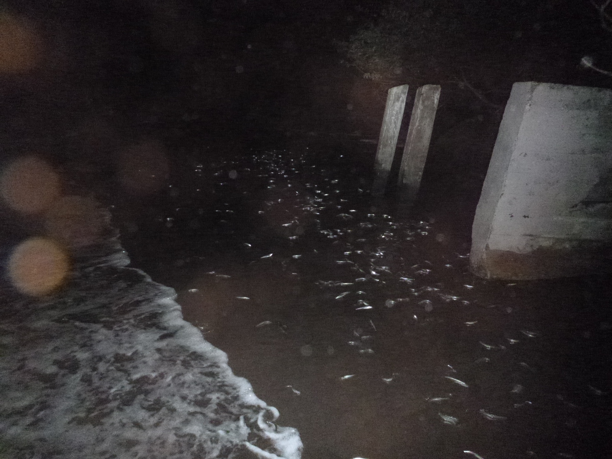
So – it was up early for me, check-in with Hawaii, then hit the road for semi high ground at the Marin coast. The sea change was subtle at first, but by 9:00 a.m., March 11, 2011 had become the eeriest day of my life. In an instant the good-sized surf fell quiet and calm, and the ocean’s retreat revealed so much rock and sea floor further and further out that it sent shivers up my spine, and exclamations from the onlookers around me. The ncoming surge and swells that followed soon churned and rumbled-in, flooding Stinson Beach, Bolinas Beach and the Bolinas Lagoon completely. This pattern continued for every half hour until I left the scene at noon.
Cormorants sat confused on the beach, and at one point a large Leopard shark was swept in and dumped on the retreating sands of the beach below, thrashing and rolling until a surge brought relief to the fish about 20 minutes later. We later heard that mild surges were clearly detectable up and down the coast of California through the night of the 11th, and into the next day – for at least a 24 hour period!
Reports of harbor and shoreline damage up and down the California coast keeps trickling- in from locations such as Crescent City, Fort Bragg/Noyo Harbor, Berkeley Marina, Santa Cruz Harbor, Morro Bay, and Catalina Harbor. We have MUCH to learn regarding the science of tsunamis, and much to learn from Japan’s unparalleled preparedness and response to earthquakes.

Japan’s earthquake shifted balance of the planet – Liz Goodwin – Mon Mar 14, 2011
Last week’s devastating earthquake and tsunami in Japan has actually moved the island closer to the United States and shifted the planet’s axis.
The quake caused a rift 15 miles below the sea floor that stretched 186 miles long and 93 miles wide, according to the AP. The areas closest to the epicenter of the quake jumped a full 13 feet closer to the United States, geophysicist Ross Stein at the United States Geological Survey told The New York Times.
The world’s fifth-largest, 8.8 magnitude quake was caused when the Pacific tectonic plate dove under the North American plate, which shifted Eastern Japan towards North America by about 13 feet (see NASA’s before and after photos at right). The quake also shifted the earth’s axis by 6.5 inches, shortened the day by 1.6 microseconds, and sank Japan downward by about two feet. As Japan’s eastern coastline sunk, the tsunami’s waves rolled in.
Why did the quake shorten the day? The earth’s mass shifted towards the center, spurring the planet to spin a bit faster. Last year’s massive 8.8 magnitude earthquake in Chile also shortened the day, but by an even smaller fraction of a second. The 2004 Sumatra quake knocked a whopping 6.8 micro-seconds off the day.
After the country’s 1995 earthquake, Japan placed high-tech sensors around the country to observe even the slightest movements, which is why scientists are able to calculate the quake’s impact down to the inch. “This is overwhelmingly the best-recorded great earthquake ever,” Lucy Jones, chief scientist for the Multi-Hazards project at the U.S. Geological Survey, told the Los Angeles Times.
The tsunami’s waves necessitated life-saving evacuations as far away as Chile. Fisherman off the coast of Mexico reported a banner fishing day Friday, and speculated that the tsunami knocked sealife in their direction.
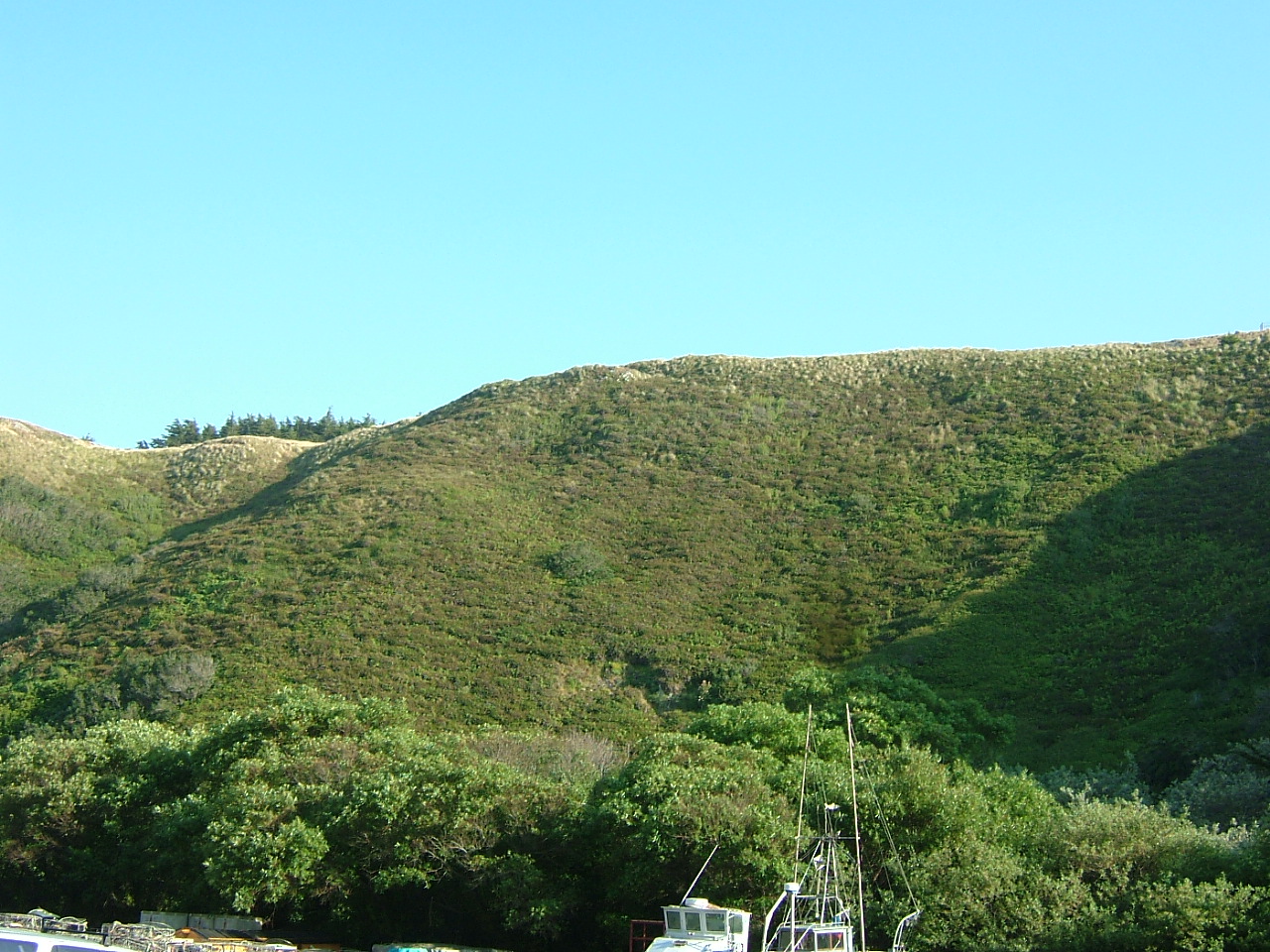
Photo Album – North Coast Journey


A Conversation with Peter Banks – California Archeologist

This is the first formal discussion I’ve had with my uncle, Peter Banks, regarding his extensive work as an archeologist in California and abroad in the 1960’s through the 1980’s. His adventures, profession, and character have always been a subject of pride for our family, and the objects of much conversation and storytelling over the years. Peter is a great traveler and bohemian – and a loving, colorful, and inspiring father figure to my three older siblings. He left behind a small town upbringing in the Hudson River Valley of upstate New York for a degree in geology at Cornell University, followed by a zig-zag pilgrimage west, bouncing between the States and Europe and North Africa and Mexico – shedding one profession along the way, and finding adventure, a new inspiration, and finally a family as he headed west and finally settled in California.
As a student of archeology Peter dove into the world of the Neanderthal and other prehistoric humans, living in the field and working extensively on cave, rock shelter and ancient village sites across Europe and into Egypt. In California he learned the field and became intimate with the varied terrain of its early inhabitants. He eventually founded a well respected archeological firm in Berkeley, and became an expert in the shellmound sites of the San Francisco Bay Area
I graduated from Cornell in 1960 with a degree in geology, and headed west, because there really wasn’t any action for geology work for a new-comer back east. I ended up working on oil fields in rural Wyoming, analyzing the substrate that came up in the wells as they were drilling down. It was a hard lifestyle – Wyoming in the winter, and a long journey from where we were staying in a tiny town, out to the fields. I was sort of thrown into it, and didn’t feel like I knew what I was doing. I didn’t last long at those jobs, and I went on to eventually work for the USGS in the summer in Wyoming and Colorado mapping and analyzing Tertiary geologic formations for uranium content. As we were doing these surveys, I became more interested in the upper layers we were looking at, in the Pleistocene layers where there were often remains of early human activity: stone flakes, evidence of fire, etc. That was much more interesting to me than analyzing the lower layers for geologic evidence.
So, I decided to chuck geology and to become an archeologist. I went to New York City and took a series of temp jobs to save money for my big-time trip to Europe where I could do field work on Neanderthal and Cro-Magnon sites. I bought a ticket on the cheap-o Icelandic Air – featuring a prop plane that took several stops to hop its way over to my final destination of France. It wasn’t until I actually arrived in Paris that I realized I had no money, nowhere to stay, and no way to communicate. So I floundered around in France for a while then went to England, volunteered with the British Museum on an Early Man site, made a few more contacts, bought a bicycle, and rode it to my next job in the south of France. It took me about a week, and I showed up at the job site of Combe Grenal with my bike and a knapsack. Professor Francois Bordes generously welcomed me into his small crew. We all lived/camped on his property in the small village of Carsac, and he arranged for all of our meals to be provided for us at a nearby restaurant in town with wonderful French country cooking. Combe Grenal was a very important site with pre-Neanderthal and Neanderthal deposits. During one of the long, post-prandial afternoons I was sleepily digesting my wonderful lunch and was jolted awake when I found a pre-Neanderthal hand axe. Combe Grenal is still considered a classic Paleolithic site and Life magazine came to the site and wrote an article about our work there. Professor Bordes arranged to take the crew on a tour of the famous prehistoric cave painting site of Lascaux, but just before the day of our tour it was discovered that a fungus resulting from the change in the cave’s atmosphere due to the large numbers of human visitors was starting to destroy the paintings, so the site was closed to all visitors just days before we could get there.
I next had the good fortune to head to work in Egypt for six months spanning 1964-1965. I worked along the upper Nile River Valley before much of it was lost, inundated by the newly created Aswan Dam. Many crews were working up and down the Valley surveying and removing any archeological sites that would soon be lost below the water line. Teams worked on all eras, and we met people surveying early Christian, Medieval, prehistoric, and Dynastic sites. We were surveying for any prehistoric sites and found many open air sites and several cave sites. The most interesting sites were out in the open, fully exposed, in areas where the desert winds had blown away all the soil and what was left was a pavement of artifacts. You could pick up a prehistoric tool and find close by the core it had been struck from. We did extensive surveying and mapped the artifacts before the flooding. In the construction of the Aswan Dam the entire territory of the Nubian people in Egypt was inundated and lost, as well as prehistoric, Egyptian Dynastic and many later sites.
In the next few years I worked on several archeological digs and surveys across France and Yugoslavia, including the famous Cro-Magnon rock shelter in Les Eyzies in France, an early Neolithic village site in Macedonia, and middle to late Paleolithic open air sites in central and southern France.
I also started anthropology and archeology classes at San Francisco State during the winter months, and began volunteering on digs, and becoming familiar with field sites in the Bay Area. I then moved on to jobs on digs throughout California as well as Nevada and Arizona, including a Clovis site — one of the earliest human cultures in North America — with mammoth remains that had the distinctive Clovis points still embedded in them. The excavations were directed by Dr. Vance Haynes, who was a proponent of the theory that big game in North America was primarily wiped out by these Clovis hunters. National Geographic came to the site to photograph our work and wrote up an article on it.
I returned to California to work on a site in the Sierra foothills but instead caught a nasty case of the archeologist’s occupational disease — Valley Fever, and had to take six months off to recuperate. I holed up in a bungalow in Bolinas next to my sister’s house. In the mid-1960’s, I could easily live on the $200.00 a month Workmen’s Comp stipend I got, including covering my $40.00 a month rent to live in a cabin by the beach! Earlier on in my travels I had also injured my back, which turned out to be a blessing in disguise: I had stopped in the Midwest to visit my sister, and my back went out. Her husband, Milt, was a medical intern and took me in for a diagnosis. I was told I had a slipped disc in my spine and needed several months of bed rest. This turned out to be a piece of luck, since while I was down and out the Vietnam War draft board caught up with me and asked me to show up for a physical. Milt got his doctor friend to provide me with an excuse, and the army re-categorized me as 1-Y, or temporarily unqualified. The Vietnamese War was just starting to heat up, and we had begun to send military personnel over as “observers”. If I had been drafted I would have been prime cannon fodder. I learned my lesson from this near miss, though, and stopped telling the draft board where I was. They tried several more times to get me in the next few years, but I had either moved to another state, or was overseas on digs.
When I came back to California, planning to attend UC Davis, and also was offered a year-long job in Puebla, Mexico working on prehistoric sites, which sounded like more fun, so off I went. There I worked for a German professor I met in Egypt, and we excavated an early Classic site. Pottery was prevalent at these sites, and I learned a bit about working with pottery — a great tool to establish chronologies, trade patterns and functionality.
Once I was finally back in California, I did more field work, including a job in Indian Valley, a beautiful oak woodland valley in the north Coast Range west of Covelo. It was so full of birds I couldn’t believe it: including such northern California woodpeckers as Lewis’s, Pileated, Acorn…This got me turned-on to birding. Here I also met Sari Fredrickson, a beautiful, young field archeologist who would become my wife, who also is the daughter of Dave Fredrickson – a well known professor of California archeology at Sonoma State. Unfortunately, this was also a dam recovery project, and that lovely valley is now under water.
Sari and I settled in Berkeley. A local archeologist who I also worked with in Egypt named Bob Orlins and I formed California Archeology Consultants. We focused on sites around the greater Bay Area, and particularly investigated the Indian shellmounds of San Francisco Bay. We often referenced the maps made by pioneering Bay Area archeologist N.C. Nelson in the early 1900’s, as he surveyed indigenous sites around the Bay by horseback, including the famous and immense Emeryville and Candlestick Point shellmounds. Our firm did alright, especially during the huge development boom in the East Bay in the 1970’s, but as development slowed, so did the requirement for archeological site surveys, and business really slowed for us.
During those years we acted as consultants, conducted site surveys, and directed digs. A large amount of our work was in the East Bay, but one really interesting job was conducting a survey of prehistoric sites in the Mission Bay area of San Francisco. For this we used N. C. Nelson’s field notes and superimposed historic maps of the San Francisco peninsula onto modern City maps. We drilled down through the concrete, and recovered the soil from the drill bit to note if we hit archeological deposits or bay mud. By this method, we were able to locate a number of shellmounds – including the big one near the stadium at Candlestick Point. During our survey years we were also able to re-locate the Stege Mounds, which are a famous grouping of shellmounds along a historic slough near the Richmond-Albany border, originally mapped by N.C. Nelson.
Some sites have been lost, including sites we surveyed, due to erosion and development. But my hope is that our work will serve to preserve most or all of the sites that we found, described and mapped. The good thing is that development has slowed, and there are strict laws in place which help prevent further destruction of archeological sites. The exciting thing is that there is enough known now about the shellmounds and other habitation sites of the Bay Area – especially Berkeley – Richmond – Contra Costa – that a good use pattern analysis could be performed. This is something I had hoped to do, but didn’t get around to it before my career moved-on.
CZ: What did you learn from the shellmounds of the Bay Area?
PB: The most important fact is that they are still there, underneath pavement, backyards and parks. Although the tops of these shellmounds have been leveled off, the lower deposits are still intact — at least that proved to be the case in all those that we investigated. The manner in which the shell mounds have survived — with older and middle deposits still intact and more recent deposits in the upper levels destroyed — can lead to the odd result that we can learn more about the early periods of human habitation in the Bay Area than in the later periods and historic contact times.
I also learned that the Bay was not a barrier to people trading and mixing. It was not a barrier to relationships — for example, marriage between tribes in Marin County and the East Bay seem to have been as common as marriage between adjacent East Bay tribes. In most periods, there was not a lot of overt inter-tribal strife, and relationships between groups were generally good. Language did not appear to be a barrier.
A Conversation with Mike Heiner – California Maritime Historian


Mike is a great historic storyteller. Our interview conversation jumped and diverged into little known and curious, if not far-out, historic facts and legends of the central California coast and beyond – all meticulously researched over the years and locked-down by the steel trap mind of my brother, Mike. Mike is also a performer. He’s not afraid to be in front of an audience storytelling, singing, acting, and most often joking. He likes to make people laugh. Mike was a rambunctious child – intelligent and spirited. Often challenging authority, and running with a pack of like-minded bad boys in our small coastal hometown of Bolinas. Some of the stories of those days I don’t want repeated to my teenaged children.. Those stories are now mostly hilarious, but back then it probably wasn’t so funny for Mike, but he came out of it with stories to tell and a keen knowledge of local natural history. Mike has been a docent-extraordinaire for The Bay Model in Sausalito (a football-field sized hydrologic engineering tool and exhibit of the Army Corpse of Engineers); for the historic sailing vessel, Californian, in the San Francisco Bay; the dry-docked steam schooner, Wapama, in Sausalito; and the Point Bonita Lighthouse at the Marin Headlands of the Golden Gate.
CZ: As a kid, how did you first get interested in all things nautical and marine, and what were some of your early influences?
MH: I got involved by growing up in Bolinas right on the ocean – we lived right down the street from the beach. You grow up looking at dead seals, shells, whales going by – you can’t help it. Then after high school I got into scuba diving and sailing. But as far as early influences go, The Bolinas Marine Lab was a big one. The staff I remember at the lab were Gordon Chan, a teacher there, and Craig Hansen. Those guys were around a lot. They would hang out and talk to us kids when we came in. I remember bringing in fossils to show them, and they would talk about how the mesa (the residential area on the marine terrace in town) used to be the sea floor, and other local geological facts. I was really into hearing about the shipwrecks that had happened at Bolinas and on Duxbury Reef. The lab was in the old lifeboat station boathouse, and the main building had half-assed classrooms, administrative rooms, and a pretty good library. I remember the lab was crammed with aquariums, microscopes, water pipes going every which way.
Jacque Cousteau was of course a big early influence for me – I wanted to be a marine biologist – and watching the old surfing films of sun and sea around the world. It was like “hey – I want to go there!”
CZ: What about the 1971 oil spill that hit Bolinas?
MH: The oil spill was one big party as a kid! I was eleven years old. I remember the smell of kerosene in the air – you could smell it from home. For the first week of the spill school was closed so everyone could be on the beach helping to clean up the oil and help stranded animals. Of course it took much longer than a week to deal with, and a lot of the oil ended up sinking. Ranchers from the Tomales area brought shit loads of hay to soak up the oil along all the shores. Then the oil-soaked hay would be stacked up on the beach and massive bon-fires lit. My friends and I would jump through some of those fires – total stupid pre-teen boy stuff. Lucky we didn’t trip. At night there were bright lights lighting up the whole beach. I’d sneak down in the middle of the night – it was a big adventure – dark side of the moon.
My uncle Peter Banks was a big influence for my interest in local nature and history as a kid. (An archeologist whose focus was Californian Indians – Peter lived with the family for many years in Bolinas when we were kids). Peter would take us out and around a lot. We’d go explore this big Indian midden site that got churned up after the Park Service removed old greenhouse buildings from the site in the 1960’s. There were all kinds of spear points, obsidian knives, and abalone shells up the wazoo. Peter told us about how the Miwok Indians got abalone from the reef below and processed them up at this site on the bluff. From there I got really interested in local Indian place names and history. We’d build driftwood shacks with Peter on RCA beach and camp there. Peter would find sneakers washed up on the beach and he’d be happy he found his next pair of shoes. They didn’t match, but sort of fit each time. We’d find rations in cans that were still sealed that had washed up a lot from ships, and we’d cook and eat them out there on the beach. My friends and I would camp out there too and make fires.
When I was older I took a scuba diving course in Monterey and was into that for a while. Most of my dives were in Monterey. I dove for abalone up north.
CZ: Tell me about your background and interest in boats and boat work.
MH: After high school I thought “oh shit, I have to get a job”.. I had to make money and figure out what I wanted to do. I moved onto a houseboat in Sausalito and started doing bright work on wooden sailboats. There was this harbor in town called Pelican Harbor that used to be all wooden boats. I started working there and word spread that I was around and available. I learned as I went and got better and better at it. There was this marine supply store in Sausalito that isn’t there anymore, and the staff was really nice – they’d give me advice on varnish and brushes to use. Some of the boats I worked on were hauled out, most in the water. I charged $200.00 a boat, so I think I made about $2.00 an hour! I had an ad out in the sailing magazine Latitude 38 for my bright work.
I got into sailing in beer can races and some ocean races: to the Farallon Islands and around the lightship/bucket buoy outside the Golden Gate. I started giving tours at the Bay Model in Sausalito and saw an ad for docents to work aboard the Californian (historic tall ship) on her SF Bay cruises. The ad called for someone who could sail, was familiar with local history, and could sing shanties – In addition to nautical and navigational knowledge I had always sung in a performing chorus, so it fit really well. I had a lot of fun doing those cruises.
CZ: How would you describe the waterfront of Sausalito, and what have you seen change there for better or worse?
MH: Sausalito used to be a working harbor town, and it took years to transition into a tourist town. It has that extreme tourist reputation, but it’s not entirely true. There are some expensive areas and some aren’t at all – there’s a combo of rich and poor. The funky docks used to be Gate 5, Issaquah, Yellow Dock. Now it’s only really Gate 5 that’s still funky. There are a lot less anchor-outs than there used to be. In my opinion it was becoming a bit of a slum, and the pollution issue was getting gross. There should be room for everyone and not just the rich, but I don’t think that was a rich vs. poor fight – it was truly a sewage issue that needed to be dealt with. A lot of the people out there were going over the side of their boat – I mean that’s not cool.
There were periods of time that the Sausalito waterfront was really funky – after World War II in particular when the Marin Ships industry closed down abruptly, leaving behind vacant ship building facilities and infrastructure. Artists moved into the waterfront in put-together houseboats, and one of the large ship buildings in particular became an artist’s collective and still is – the ICB Building. Another is run by the Army Corpse of Engineers and is the Bay Model Building.


CZ: Tell me about Marin Ships
MH: Marin Ships was the shipyards constructed overnight in Sausalito to build Liberty Ships for World War II cargo transport. It was developed along the more remote north western end of town. Hills were blasted and bay lands filled-in to make the shipyards. It looks really different now than it did historically because of this mass construction. Huge Quonset-hut style buildings were put up in a hurry, docks and piers were built, a track and haul-out system was created. Crews, mostly women and blacks, worked 24/7 building ships there to send overseas for the war effort. An entire ship was constructed in a month or less, and sent out the Golden Gate. The whole thing lasted from 1942-1945, and then was abandoned.
When I was a volunteer at the Bay Model, the Sausalito Historic Society put up money to build a Marin Ships exhibit on the premises. The first exhibit builders didn’t work out, so I was asked to meet with the head of the Historic Society, and they offered me the job after hearing what I thought needed to be done on the exhibit. I worked on it until completion in collaboration with the architect who was down the street at the ICB building, and members of the Historic Society, as well as ex Marin Ships workers as guides for how the displays should go. They would stop by with ideas or alterations to be made and we went along that way. I built all the display cases, designed their placement, and made decisions as to what artifacts should go where. I also built the theatre which is part of the exhibit. It was a fun job. I’m proud I was a part of it.
CZ: I heard a rumor you lived aboard the dry-docked Wapama for a while. Please describe this boat and your experiences there:
MH: The Wapama was a historic logging steam schooner built in 1915 in Oregon that ran along the west coast delivering mail and supplies to the north coast, and returning with timber. It basically was what the flat-bed logging trucks are now before there were good roads to Mendocino. Logs were loaded onto these steamers by lumber shoots at various stops along the north coast. These boats were built fast, and they only usually lasted 10 or 20 years because they were worked to death. The Wapama is the last one left. It was purchased by the California State Parks to preserve it, and it ended up at Hyde Street Pier in San Francisco on display with the other historic vessels. Over time it began to bow and would have eventually sunk, so it was put on a barge and first brought to Oakland for a while before the Army Corpse agreed to house it up on the pier in Sausalito next to the Bay Model.
When I was working at the Bay Model as a tour leader there was a period of time I was staying at the Marin Headlands youth hostel a bunch, and needed a place to live. The supervisor at the Bay Model offered for me to live on the Wapama, which was great. There were a couple of other guys living on it from the restoration crew I think. They were characters – one guy was a Hawaiian named Kawika with no front teeth, and a gnarly tattoo from his time in Vietnam. No one was using the captain’s quarters, so I moved in there. It was a trip living on that boat. It was huge with cavernous holds below decks. It was made entirely of Douglas fir – huge timbers for support beams. You had to climb up these big staircases to get between decks. It was a great time living there and walking to work at the Bay Model, downtown for sushi, sitting back for a beer alone in the wheel house enjoying prime views of the Bay. It had a smell that’s hard to explain that only old – really old – wooden boats have. The only bad thing was the Sausalito Ferry graveyard crew next to the pier making noise in the middle of the night.
I led tours on the Wapama for a long time. You could turn on the engines, which were massive, to show everyone how they worked. Every year there was a big party called the Steam Schooner Meet aboard the Wapama, with sea shanty contests, beer and wine.. it was great. It got really hard to upkeep the boat for the Park Service, so I think the Wapama is back at Point Richmond last I heard.
CZ: What was your first encounter at the Point Bonita Lighthouse, and what inspired you to get involved there?
MH: The military transfer and clean-up of the Marin Headlands and Point Bonita facilities to the Park Service had occurred, and I heard they were starting a lighthouse volunteer program. I’ve always been into lighthouses and navigational systems, and I was in the first wave of volunteers trained to give the tours. There was a really great crew of knowledgeable rangers to train the volunteers then. I’ve been there for 22 years, and I have always mainly led the monthly full moon hikes at Point Bonita. A couple of us early docents had so much energy and fun with our tours that we developed a following. Sometimes the weather and visibility is bad on the tour but that’s more fun, because we tell more stories and interact individually with the participants better. People sometimes question my crazy references and stories, and I tell them look it up if you don’t believe me! The Wild West was here. It was insane, dangerous and crazy 24/7 around San Francisco and the coast – it was f***ing nuts. For instance the mystique of sea shanties, which are usually tales of the brutality of early sailing life and getting your ass kicked. Or the romantic notion of the Barbary Coast – give me a break! It was opium dens and whore houses. People were regularly mugged, raped, and beaten-up. “Shanghai-ing” started in San Francisco due to the high number of crewmembers abandoning the harsh life of the sea for the gold fields of the Sierras. Ship companies would pay bars and sometimes the police to drug or beat a person, and kidnap them onto a ship setting sail for the open seas as crew. Shanghai in China was a common port of call for ships leaving San Francisco then.. It could have been called Honolulu’d or Manila’d I guess!
Mike is a major hiker, and this was his response when I asked him what some of his favorite coastal hikes and sites were: leaving by foot from his house in Sausalito, walking across the Golden Gate Bridge, along Crissy Field and the SF waterfront to Hyde Street or Aquatic Park – sometimes further – through the Presidio, back over the bridge, into the Marin Headlands, down into Mill Valley and back to Sausalito. He also still loves hiking the more remote areas of the north coast he explored as a child with Uncle Peter and friends.
Photo Album – Fishing
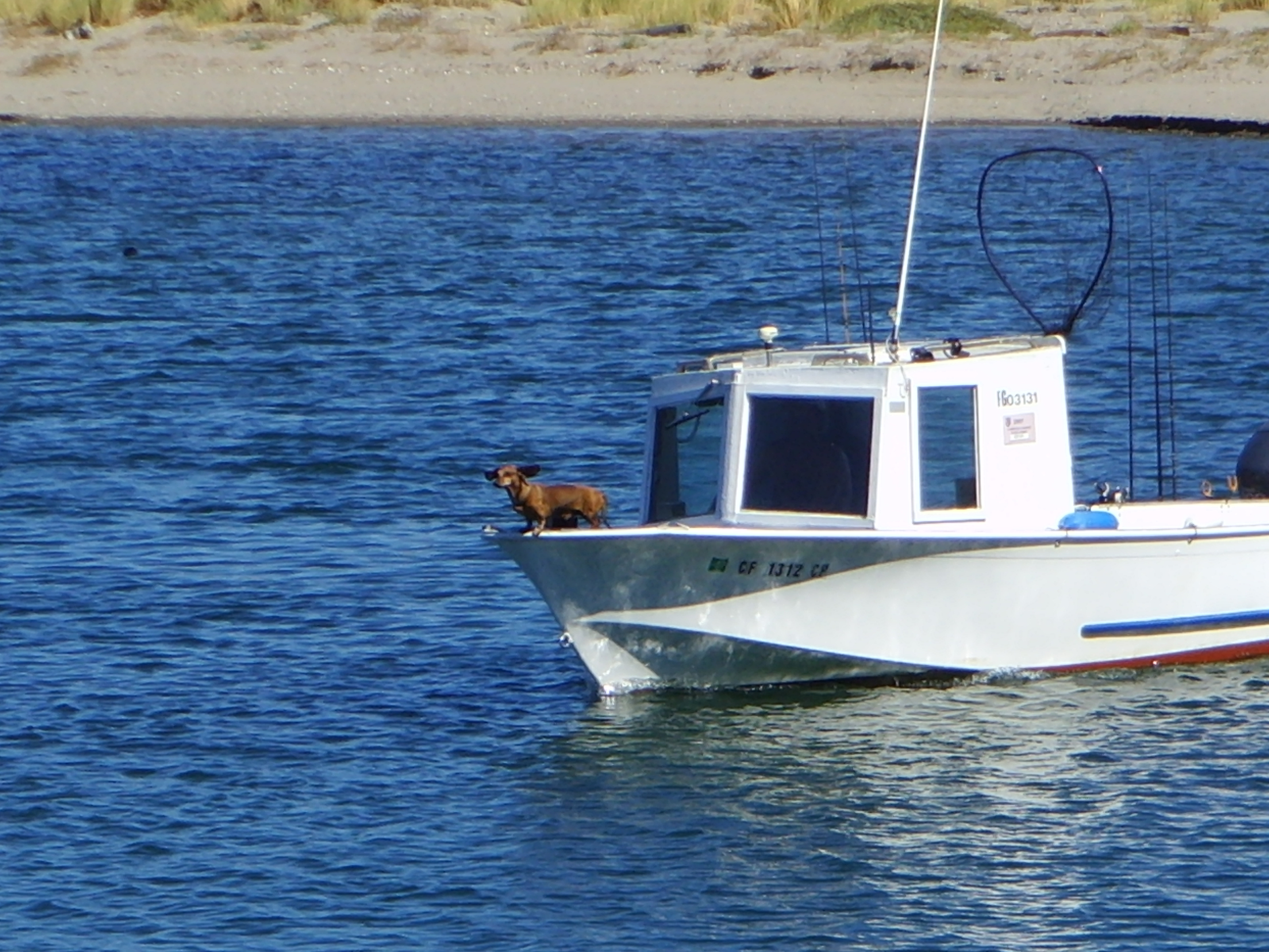


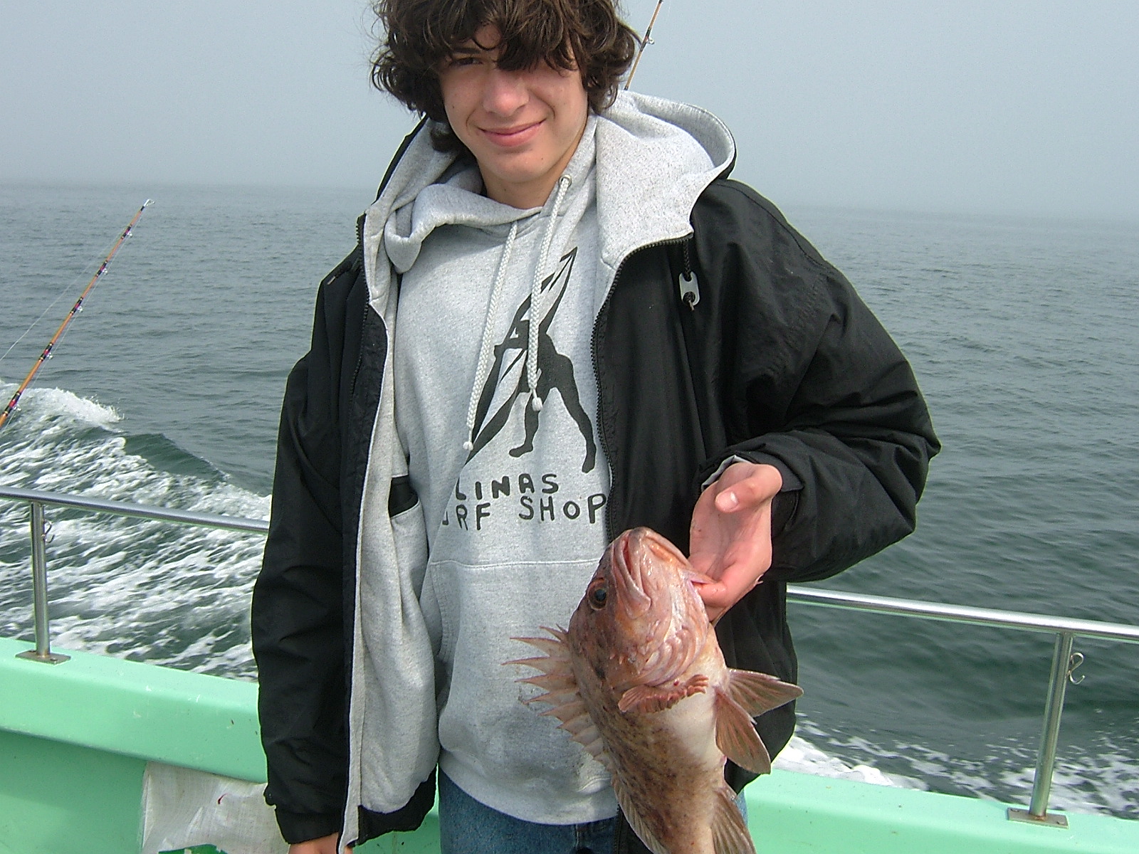
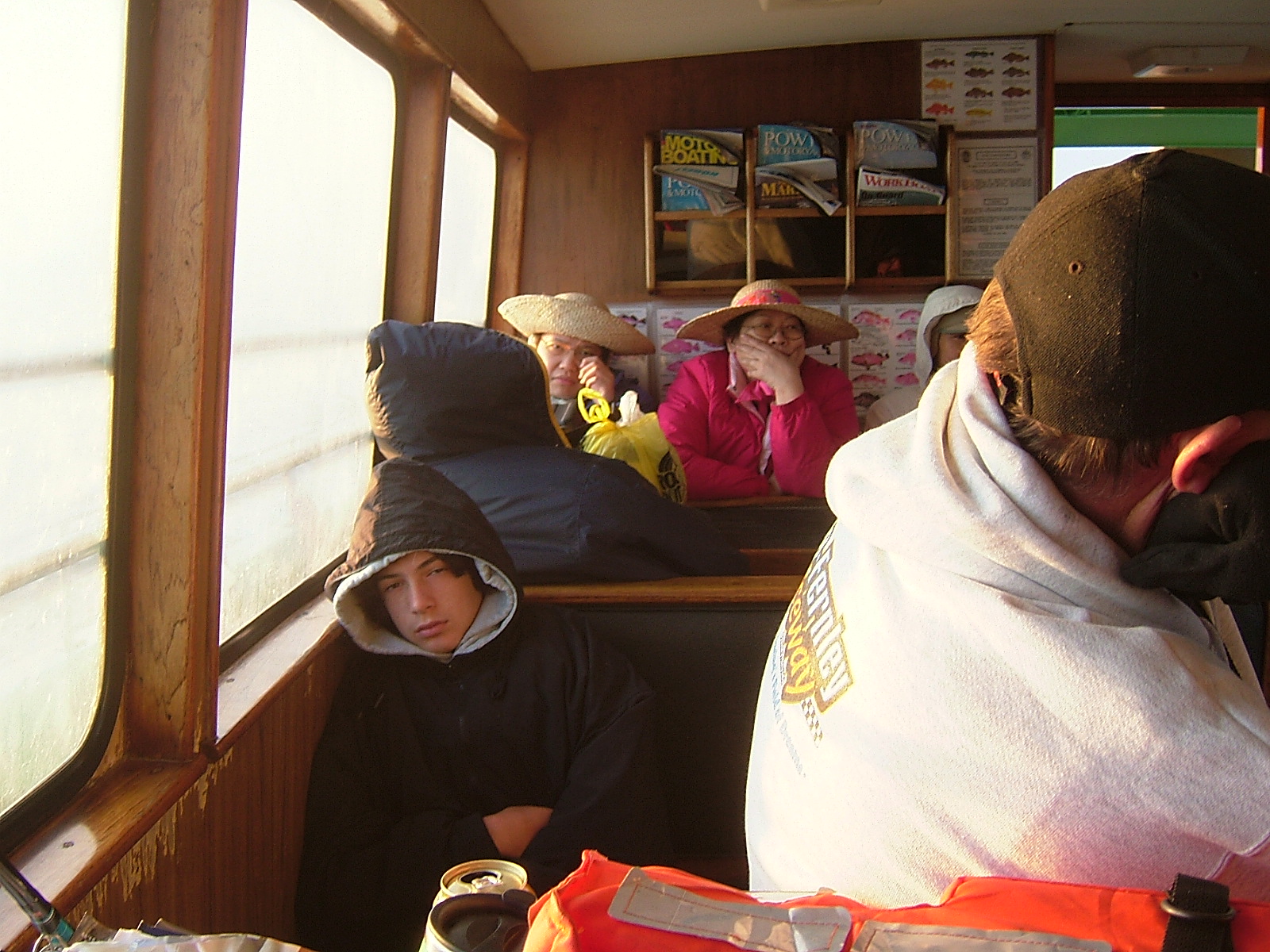

A Conversation with Peter B Pyle – Ornithologist and Marine Biologist
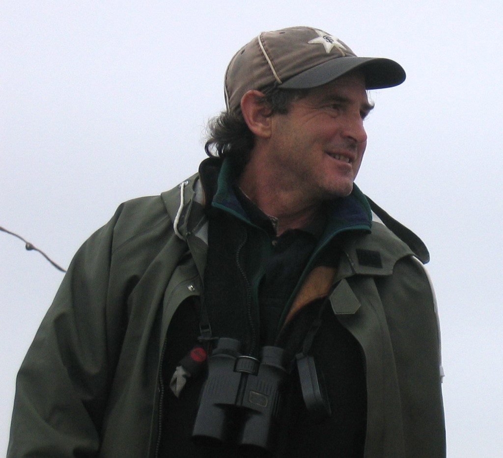
In his own words: Peter wrote responses to my interview prompts:
I first arrived in Bolinas on the afternoon of December 31st, 1979, so I can say I’ve been there since the 70’s. I was to start an internship at PRBO’s Palomarin Field Station near the end of Mesa Road but when I got there nobody was home and the building was locked. I knew nobody in the area so I stayed by myself in my old toyota pick-up camper in the parking lot that night. I distinctly recall getting up the next morning, looking over the coastal scrub to the tranquil and blue Pacific Ocean, and thinking that a new decade and era was dawning for me. Almost 30 years later I’m still around and own a house in Bolinas. When I return to that parking lot I’m saddened by the fact that Douglas Firs have completely consumed the coastal scrub and you can no-longer see the ocean from the place I arose that first morning of the 1980s.
I became part of the PRBO family during the 1980s, back when the organization still had a family feel. I got involved in various projects and began to lead trips for them to Mexico and Central America. It was on one of these trips in the early 1980s, to Palenque and Veracruz, in which I met Corinne Ryan and Judge Dick Simms, who had come on my tour along with 8-10 other PRBO affiliates. We had a great time, and toward the end of the trip Corinne asked me if I would like to care-take her summer home on Wharf Road along Bolinas Lagoon. Known as “The Barge” it was an old coal transporter that was parked along the road in the early 1900s and was put up on pillars and converted into a house during the 1950s. I stayed in a small room at the back of the garage and was responsible for looking over the place and making sure that occasional renters were accommodated and cleaned up after. Outside my bedroom window stood the entire lagoon, and I immediately started keeping track of everything I could see, including the number of bird species seen from the property. I was where I was supposed to be.
My work was still taking me into the field for extended periods, and in 1987 I was to be gone for a four-month stretch on a scientific cruise to the equatorial Pacific and to the Farallones. So I asked Keith Hansen if he would come down from Fresno to care-take the Barge for me. By the time I’d returned Corinne had invited Keith to stay as well, and he has since established his well-known wildlife gallery in Bolinas and is still care-taking the Barge with his wife Patricia. We overlapped there for another 7 years or so, during which time we had built the yard-list to over 270 species, at the time one of the largest totals for a yard-list in the country. We had many memorable moments during that period.
One year a young and scraggly male Western Gull landed on the deck. He was so pathetic that we named him “Stud”, and started giving him leftovers to help him survive. For two to three years he was a regular fixture on the deck of the Barge, and several times we needed to rescue him from various predicaments: at least three times we had to catch him and pull fish-hooks or lodged starfish out of his mouth. Typical of gulls, Stud began to push the boundaries in search of food, and one day we caught him in the kitchen scrounging around and making a mess. Attempts to reprimand Stud for such actions were to no avail, and he continued to enter the house. One day we left the door open all day by mistake and Stud found his way to the upstairs living room and could not figure out how to get back out. He freaked out and through the course of the day had bashed against the windows and covered the expensive furniture and carpets with blood and excrement. Poor Keith was the one to discover Stud, and after booting him out spent 2-3 days getting the house back in shape before the next renters arrived. It was not long after this that I saw Stud over on the tip of Seadrift, wet, bedraggled, and with a drooping wing, apparently broken. A large winter surge entered the lagoon, flooding the spit and took poor struggling Stud up into the lagoon on the rising tide. This was the last we saw of Stud, but we were able to at least give him a few years of borrowed time, for better or for worse.

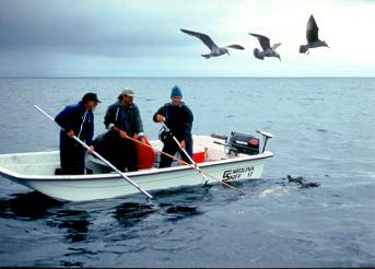
The Farallon Islands is a magical place for a biologist. We have three distinct seasons defined primarily by ecological events. The longest and most intense season occurs in March-August and is characterized by the seabird nesting season and a lot of northwestern winds. Over 300,000 seabirds of 12 or 13 species converge their each year, and their success varies tremendously, depending on oceanographic factors – El Niño, coastal upwelling, etc. A focus now will seeing how things change as ocean warming takes place over the next decades. Studies on the seabirds out there collect a lot of information on the things they are eating, which helps us manage our fisheries and other ocean resources. The fall season, September-November, was my favorite due to the generally calmer and more variable weather and the emphasis on observing and recording details on everything that occurs around the island. Over 415 species of birds have been recorded there, incredible for a tiny rock with three trees, and many of these are far-flung vagrants that we discovered in fall. We also closely monitor the comings and goings of seals and sea lions, cetaceans, bats, butterflies, insects, plants, and of course the white sharks in fall. Winter season, December-February, is when the Elephant Seals come in to breed. In 24 years working there I spent most of my time in fall but also covered five or six breeding seasons and have been there at all times of year to cover for other biologists.
Every day I would get up before 6 am to sniff the weather and call in our observations to the Coast Guard and, whether rain, wind, or shine, I and the other biologists would be completely focused on the tasks at hand until bed time. When not out looking around, there were generators and boat motors to service, data to analyze, and reports and papers to write. It was impossible to plan out a day – you just had a big list and would chip away at things between constant interruptions for biological events or generator or other mechanical breakdowns. The Fish and Wildlife Service worked hard to upgrade the electrical and water-catchment systems during my time out there, so it got easier for us biologists, but I sort of began to miss the old days when challenges would keep us on our toes. I liked to foster a team approach while there, where everyone chipped in evenly to get things done. We all rotated kitchen duty days, in which one person would wash all dishes and cook dinner. Each night after dinner we would convene and summarize the day’s events in the Farallon Journal, an amazing chronology of every day out there since PRBO established the station in April 1968. We did have a TV but it was exiled to the Coast Guard House and few out there had time or interest to watch it regularly. My daily TV dose was limited to five minutes at 6:23 every evening when the weather-satellite photo would come on. Evening activities when time and energy allowed consisted of battling the mice, which over-ran the island each fall, and re-telling the many convincing ghost encounters, especially during foggy and windy periods. After a long foggy day at the computer we’d sometimes have mouse-trap wars, where we turned off all the lights and randomly threw loaded mousetraps, hoping to hit another participant. Sometimes the traps would just go off in mid air, and we knew we’d hit the ghost and we were in for a restless night.
When I first started out there in the early 1980s, besides our thrice-daily calls of weather to the Coast Guard, we would call in a grocery list to PRBO and set up the weekend boat run once a week on Thursday, and that was it as far as communication with the mainland went. There was trust in those days that we would take care of ourselves and get the job done at hand. Save for mail call once per week or two, everyone on the island could focus on our well-defined world without distractions from outside sources. I liked that. Gradually, however, communication was sort of forced upon us by an outside world, eager to find out what was going on and, in some cases, to exert more control over or take more credit for what we did. A radio-phone was installed, then a primitive email system, then a direct, open-line radio patch to the PRBO office in Bolinas, then a satellite cel phone, and now full internet service.
I suppose these additions reflect the times and the wants of a younger generation of biologists used to being connected at all times. It wasn’t for me, though. On the other hand, I had no problem talking to the captains of the fishing, whale-watching, and other boats around the island on the marine radio, as they shared that corner of the world with us, along with all of its elements. Most mornings when I was there I chatted with a fisherman named San Bruno in the morning after my 6-a.m. call to the Coast Guard, and gave him a more detailed analysis on the immediate weather and what I thought might happen that day and that week. San Bruno was blind and lived up on the mount where he could communicate via radio to fisherman from Monterey to Fort Bragg and beyond. The fishing community so enjoyed (and at times relied on) our morning call that they would stop by and drop off a sack of Dungeness Crabs for us each Thanksgiving. Those were some of the best meals I’ve ever had, in many cases with a violent ocean as a backdrop, accompanying the first winter storm of the season.
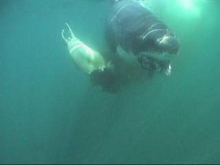

I enjoyed monitoring the boating community and providing a safety valve for them at times. A sailboat came in once and radioed a request for some diesel fuel to negotiate the Golden Gate. I was happy to go give them a few gallons and it turned out I was the first person the crew had seen in something like six weeks. They had limped in off the ocean from some far-flung place in the Pacific. Another time there was a knock at the door when I got up to take the 6-a.m. weather. Two Vietnamese fishermen in their pajamas! I followed them around to Fisherman’s Cove on the north side of the island where their boat was upside-down and smashing up against the rocks. The weather had turned unexpectedly that night and their boat had come untied from the mooring in the cove. Huddled behind an outcropping near the boat was an old man in an orange bathrobe. We call it Pajama Point now. They wanted us to save their boat but there was nothing we could do as the storm was rapidly gaining intensity. So we brought them in the house (where the old man curled up and fell asleep atop our kitchen table) called the Coast Guard to come out and take them home. Then there was the guy in the water, in the middle of shark season! He’d come out fishing all the way from Sacramento and his boat had been caught by a sneaker wave off Great Arch, the absolute gnarliest and sharkiest place around the island, and had sunk. We had seen a shark attack on a seal right at that spot the day before and I was certain I’d have a mess on my hand by the time I got there in our whaler but his karma must have been good that day, as we were able to get him ashore, warm him up, and call the rescue helo to come fetch him. There are other success stories: our towing boats to moorings, in some cases preventing their drifting into the surf and rocks, or providing first aid, water, and battery recharges. And others not so successful, like the family of five who disappeared in 1982 (we found their boat on the rocks) and the various tragedies that have occurred during the round-the-Farallones regattas, e.g., in March 1999, and (especially) April 1982.
I like taking an ecosystem approach and so all studies are relevant to each other. You can’t understand the birds without studying what they eat, you can’t study what they eat without knowing about oceanographic processes, these oceanographic processes in turn affect how the marine mammals are doing, which indirectly affect the birds, etc. I tried to view all of these interactions through the eyes of the subjects themselves, and perhaps this was easiest with the Western Gull, since they are such intelligent birds. Based on the work of Larry Spear we had a very intense study where we followed about 500 banded birds through the breeding season each year – where they nested and who they nested with, how many eggs they laid and chicks they hatched and fledged. We got to know each of these gulls, and to recognize each one’s distinct personality. The 3 and 4 year-olds that had not yet bred (the equivalent to human teenagers) would hang out together in clubs, acting dumb and inexperienced, the males sometimes practicing copulation but standing backwards on the backs of females, eyes wide open with fear. Working with gulls, you really understood how they and humans are all of the same cloth, and how studying animals can help us understand ourselves.
With such a study we had to take a patient approach, but every year I was there we seemed to take a few steps forward. In the early 1980s we documented attacks on seals from the island, and noted how the killing of four white sharks by a fisherman in the fall of 1982 impacted the number of attacks we observed. In those days everyone was still gripped by the movie Jaws, which gave us a very unrealistic sense about what white sharks are all about. Thus, when a shark came up to the whaler as I was doing a landing one day in 1985, I was terrified, raced into 3′ of water next to the island, and still did not feel safe. But we gradually worked up the gumption to study attacks up close and were able to document a lot of interesting things. It was the only study of its kind – on un-baited sharks in their natural environment – and we used this opportunity to instigate their protection in California (the bill was passed in 1994) and publish about 20 papers in the scientific literature. Among other things we documented that some of our sharks migrate all the way to Hawaii when not at the Farallones, something that struck home with me since I have been doing the same thing for so many years.
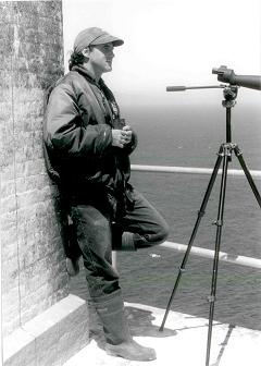
In 1993 a film team that was sponsored by the BBC and National Geographic Society came out to do a special on the sharks and our project. Up until that point we had been careful to keep a low profile about during our research, knowing that attention would only spell eventual doom to the project, if not the sharks. The documentary came out in 1995 and was very popular, winning an Emmy or two. It focused on the natural history and was accompanied by triumphant music, as opposed to the stale old heart-beat mantra of Jaws, to better give the audience an heraldic sense about the sharks. But as we predicted it riveted attention on the sharks out there, and began a parade of thrill-seekers, countless other film and media parties looking for an edge (and out-take footage that they could sell), cage divers, administrators, fund-raisers, etc. I look back at the decade between 1986 and 1995 as the best part of the shark project, as our time was relatively undisturbed and filled with discovery about the sharks.
I’m proud of the shark protection bill, regulations we got passed on the shark-diving industry, and what we contributed to science, but I’m most proud about our role in helping shape peoples attitude about sharks, away from the fear and loathing promoted by Jaws and toward one of respect and understanding. Without the white sharks our waters would be over-run by seals and sea lions, which would deplete our fishery resources, and further instigate a whole chain of effects that would not be good for the marine environment or ourselves. Through our writing and other venues I think a lot of folks, especially kids, now think that sharks are cool and belong out there off our coasts.
Photo Album – California Trip