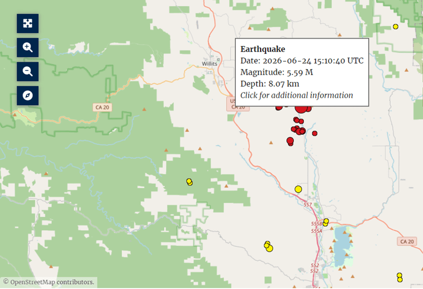
I’m not normally an earthquake chaser, but the 5.6 earthquake in rural central Mendocino County this morning, June 24, 2026, shook close to home and coincidentally occurred within a tectonic setting that I have been intensively researching for a few months now. It also happens to be the largest earthquake recorded within the Maacama Fracture Zone.
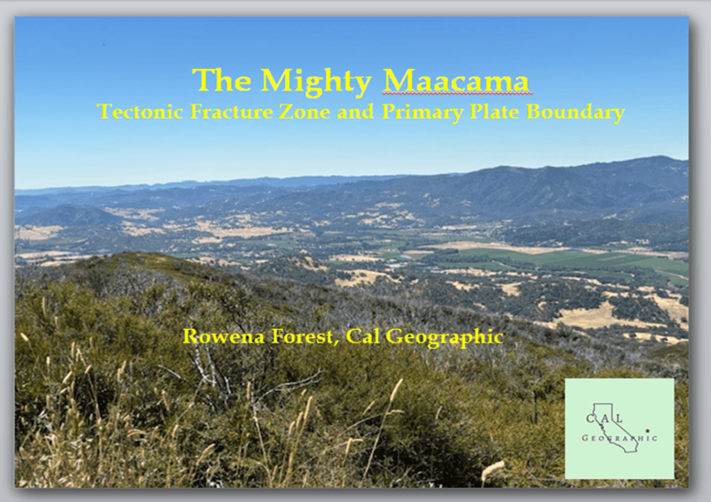
My recent research and writing has been laser focused on the complex and intriguing setting of the Maacama fracture zone in Sonoma and Mendocino Counties, and this morning I was in the final edits of a presentation on the mighty Maacama that I will be giving this summer in Ukiah when the earthquake hit.
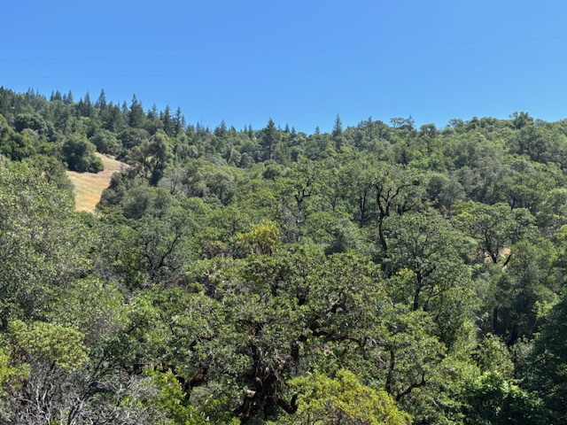
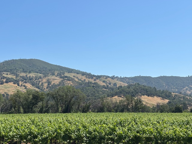
Four days ago three of us were in the upper reaches of the UC Hopland Research Center on the slopes of Red Mountain, not far from the epicenter of today’s quake, surveying and photographing the Maacama’s tectonic features across that landscape.
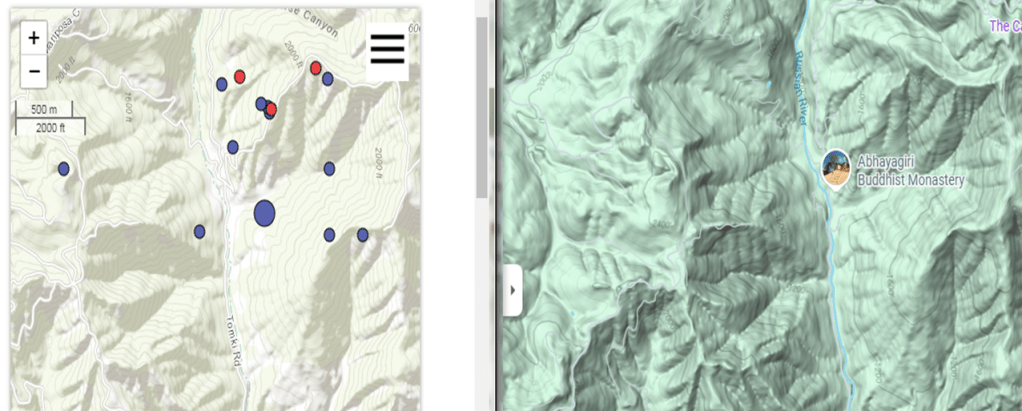
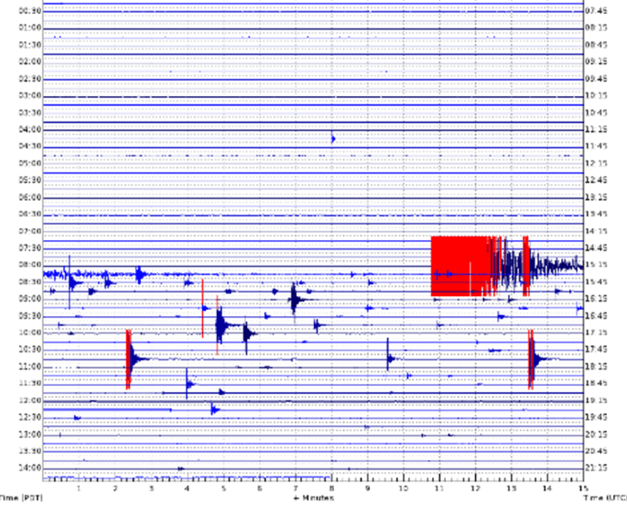
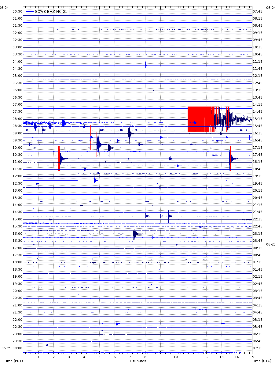
The main shock of this morning’s earthquake appears to have occurred on a fault strand of the Maacama fracture zone within Redwood Valley, up Tomki Road. Unfortunately, the epicenter was within a rural residential area, and directly adjacent to/within feet of the Abhayagiri Buddhist Monastery in upper Redwood Valley. Within the first six hours following the magnitude 5.6 earthquake, there have been at least 35 aftershocks over magnitude 1.3.
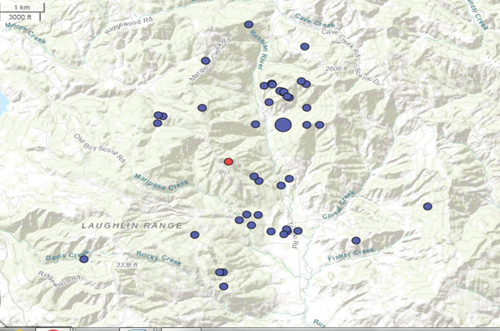
The Maacama Fracture Zone is just that, a splintered fracture network of fault strands branching out at angles and semi-parallel to the mainstem of the transverse Maacama fault. The Maacama is so fractured that the vast majority of fault strands associated with it have yet to be identified, and clusters or swarms of earthquakes along the fracture zone can be so numerous that they form what is known as a mesh, or a fault mesh.
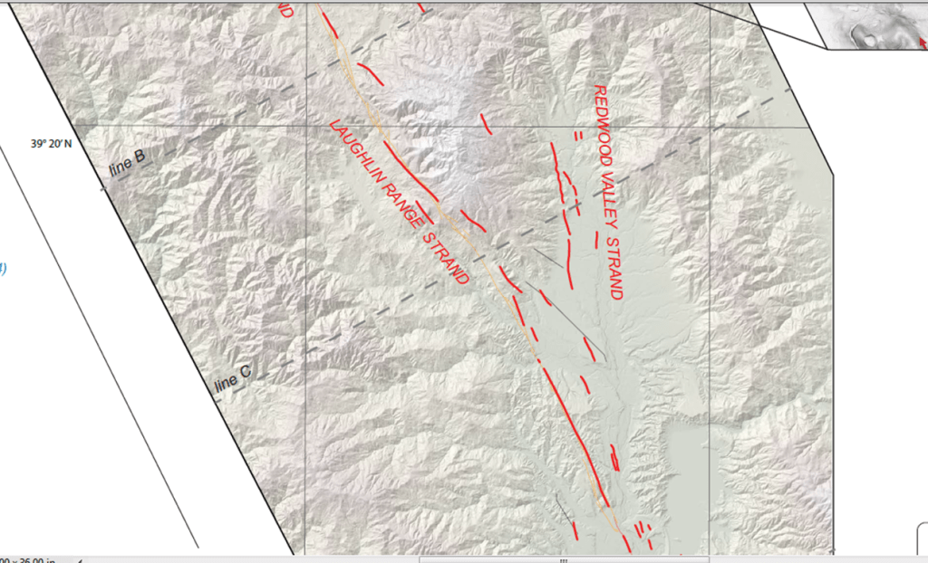
Recent studies of the northern Maacama’s tectonic geomorphology revealed several new and active fault strands splintering up through Redwood Valley. The June 24th, 2026 5.6 earthquake and aftershocks occurred just north of these newly identified strands, which will instigate the identification of yet more fault strands extending up Redwood Valley and within the Maacama fracture zone.
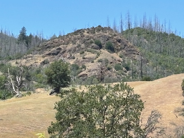
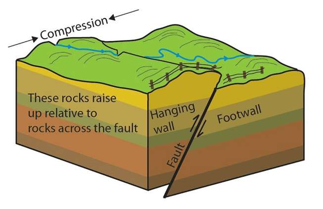
The Maacama fracture zone is a major player in the greater transverse San Andreas fault system, and is believed to be the primary plate boundary between the North American and Pacific Plates in northern California. The oblique transverse mechanics of the San Andreas system and plate boundary involves a lot of collision, resulting in uplift as the plates rub and grind into and past each other. This compression, or transpression, in turn constructs compressional landforms on the tectonic landscape such as linear pressure ridges and much larger compressional ridgelines within active fold and thrust belts.
Within this tectonic environment the compressional interactions also cause numerous thrust faults to form due to the convergent squeezing and cracking of the landscape. Thrust faults are primary contributors to the formation and uplift of the steepest slopes and ridgelines throughout Mendocino and the north Coast Ranges. The splinter faults within the Redwood Valley region, including the fault responsible for the 5.6 June 24 earthquake, may include thrust faults.
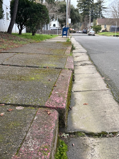
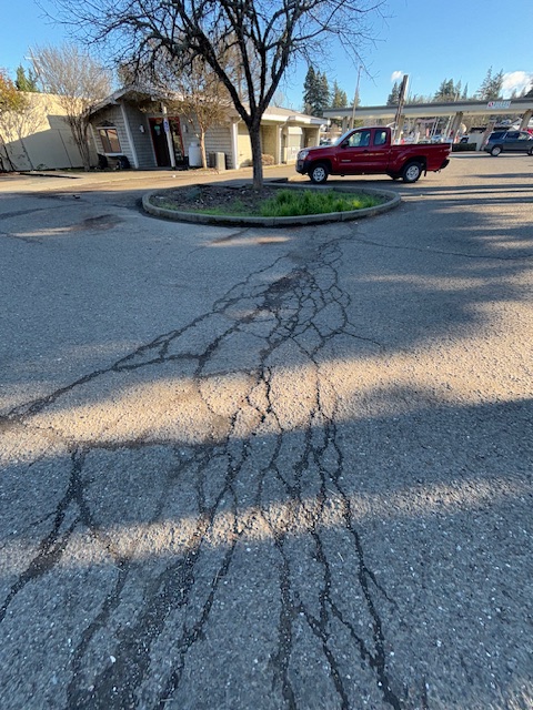
Much of the displacement along the Maacama fault system is the result of a-seismic fault creep (one study estimates fault creep occurs along 80% of the Maacama), which is described as continual a-seismic movement along a fault zone that can occur in spurts or as steady motion over the course of hours or over many days. And unlike the seismic slippage of an earthquake, a-seismic creep is generally undetectable without instrumentation as it occurs.
The effects of fault creep are usually only visible within urban or built environments, such as areas of pavement and infrastructure that can be disrupted by the steady ground displacement of creep. This makes downtown Willits one of the few hot spots to view fault creep along the Maacama, with the focused mainstem of the Maacama fault slicing through town at an angle from the southeast to the northwest.
The good thing about fault creep is that it is believed to relieve seismic energy along fault lines, which lowers the chances of larger earthquake events. So the 5.6 Redwood Valley quake may be somewhat of a rare event.
Hearing from those that were closer to the epicenter of today’s earthquake in central Mendocino County, it sounds like the shaking was abrupt and disruptive, and not overly prolonged. This could indicate the speed/acceleration of the earthquake as well as the geologic environment it occurred within.
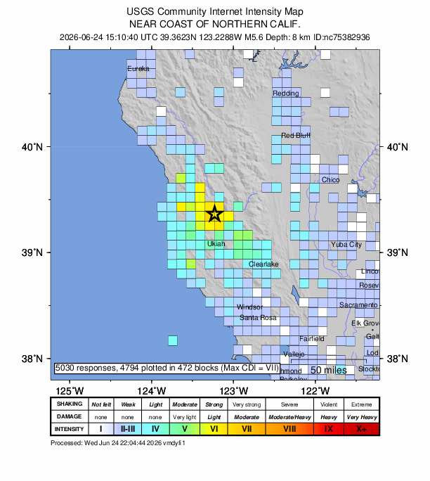
Magnitude is the total energy released by an earthquake, not how the earthquake energy was released. Intensity of an earthquake is how an earthquake is felt, and that is different than the magnitude. Intensity depends on how the energy is released. The energy of an earthquake can be released in different ways, and a very shaky earthquake may have emanated from harder bedrock with a faster acceleration at release, regardless of the magnitude of the earthquake.
The location of the Redwood Valley earthquake is within the geologic Central Belt of the Franciscan Formation, which features harder bedrocks such as older, moderately metamorphosed Franciscan assemblages and peridotites, as well as softer units of serpentinites and sedimentary deposits from the mélange formations. Here is a link to the Cal Geographic Notes on Basic Earthquake Behavior.
*If you are going to use or reference any part of this article, project concept, or any of our work at Cal Geographic or by Rowena Forest, please properly cite the article, website, and work, and give full credit of our authorship and research – Duplication is not permitted – See our Copyright and Trademark Statement here *
References:
Forest, R. 2026. “The Mighty Maacama: Tectonic Fracture Zone and Primary Plate Boundary.” CalGeographic.com, article and presentation
Forest, R. 2024. “Fault Creep on the Maacama.” CalGeographic.com
Forest, R. 2024. “The Mendocino Triple Junction: Tectonics, Evolution, and Structure.” CalGeographic.com
Furlong, K. P., et al. 2024. “Formation and evolution of the Pacific‐North American (San Andreas) plate boundary: Constraints from the crustal architecture of northern California.” Tectonics 43:1-23
Shakibay, S.N. et al. 2019. “Widespread fault creep in the northern San Francisco Bay Area revealed by multistation cluster detection of repeating earthquakes.” Geophysical Research Letters 46:6425–6434
Shelly, D. R., et al. 2023. “Fracture-mesh faulting in the swarm-like 2020 Maacama sequence revealed by high-precision earthquake detection, location, and focal mechanisms.”Geophysical Research Letters 50
Swiatlowski, J. L., et al. 2016. “Fault creep observed on the Maacama and Rodgers Creek faults, northern California using PS-InSAR.” Poster Presentation at 2016 SCEC Annual Meeting.
Trexler, C., et al. 2021. “Active deformation along multiple strands of the northern Maacama fault, Mendocino County, California from lidar-derived topographic data.” USGS
UC Berkeley Seismology Lab Earthquake Map
USGS California Volcano Observatory Earthquake Map
GCWB Seismic Monitoring Site, Northern California Seismic Network
Discover more from Cal Geographic
Subscribe to get the latest posts sent to your email.
